 Click on image to enlarge (98K).
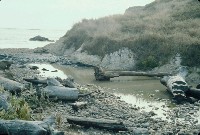
This photo shows the mouth of Moat Creek and the effects of an ATT drilling mud spill on July 30, 1992. Note the sheet of geotextile fabric or plastic spread across the sand to keep drilling muds from entering the ocean. Click on InfoLinks to find out more about the spill and its effects. Photo by Pat Higgins.
 Click on image to enlarge (99K).
Close up of bentonite clay drilling muds caked in cobbles in the lagoon of Moat Creek. While the drilling mud is mostly inert elements like barium, it smothers benthic flora and fauna. Click on InfoLinks to find out more about the spill and its effects. Photo by Pat Higgins.
 Click on image to enlarge (113K).
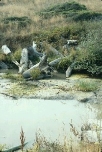
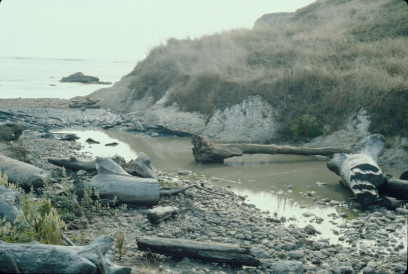
This picture shows large wood in the Moat Creek lagoon with water clarity notably impacted by the spill and drilling mud covering the bar in the middle of the water body in late July 1992. Click on InfoLinks to find out more about the spill and its effects. Photo by Pat Higgins.
 Click on image to enlarge (91K).
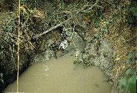
Close up of Moat Creek with drilling muds not far upstream of Highway 1. Click on InfoLinks to find out more about the spill and its effects. Photo by Pat Higgins.
 Click on image to enlarge (157K).
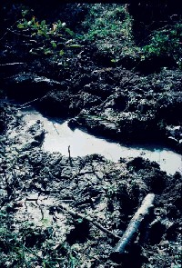
This photo shows the channel of Moat Creek in its middle reaches with the drilling mud spill. Click on InfoLinks to find out more about the spill and its effects. Photo by Pat Higgins.
 Click on image to enlarge (98K).
This photo is evidence that the drilling mud spill in Moat Creek actually filled the channel and over-topped the banks, as demonstrated by the caked drilling muds in the foreground.Click on InfoLinks to find out more about the spill and its effects. Photo by Pat Higgins.
 Click on image to enlarge (115K).
Contract workers for ATT are shown here vacuuming drilling muds from the channel of Moat Creek. Click on InfoLinks to find out more about the spill and its effects. Photo by Pat Higgins.
 Click on image to enlarge (67K). Click here to display a larger version (164K).
This is a hose leading up from Moat Creek through which drilling muds were transported after being sucked from the stream bottom. Click on InfoLinks to find out more about the spill and its effects. Photo by Pat Higgins.
To learn more about this topic click Info Links
To view additional information (data source, aquisition date etc.) about this page, click Metadata

 Click on image to enlarge (98K).
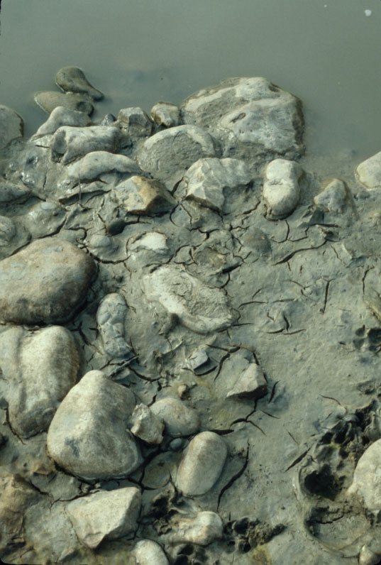 Click on image to enlarge (99K).
 Click on image to enlarge (113K).
 Click on image to enlarge (91K).
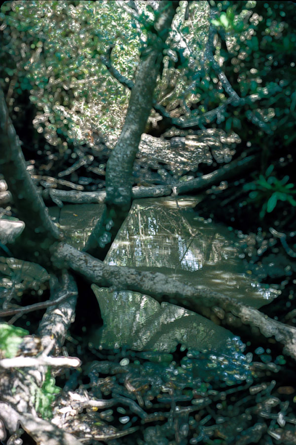 Click on image to enlarge (157K).
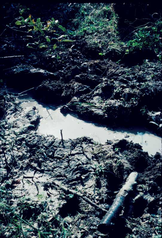 Click on image to enlarge (98K).
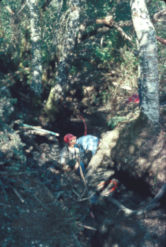 Click on image to enlarge (115K).
 Click on image to enlarge (67K). Click here to display a larger version (164K).
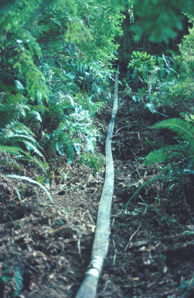