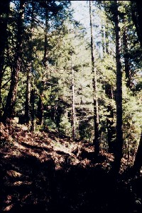
 Click on image to enlarge (40K). Click here to display a larger version (171K).
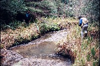
This photo shows geologist Danny Hagans taking field notes in Schooner Gulch to assess the condition of the channel while Brian Thurman of the Moat Creek Management Agency looks on. Hagans found that Iverson Basalt formations underlay Schooner Gulch, which supplies hard rock that contributes coarse aggregate for spawning. November 1993. Photo by Pat Higgins.
 Click on image to enlarge (111K).
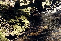
This picture shows the mainstem of lower Schooner Gulch forming undercut banks beneath roots of riparian trees. The moss covering the roots suggests that there has not been major bedload movement, inordinate flood peaks or excess sediment being deposited on terraces in many years. November 1993. Photo by Pat Higgins.
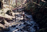
 Click on image to enlarge (121K).
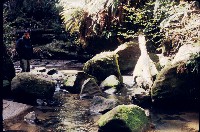
Brian Thurman, resident of the Schooner Gulch watershed (on left) and geologist Danny Hagans (right) move upstream past a small pool on the mainstem of Schooner Gulch. Note that there are ample gravels for steelhead spawning. November 1993. Photo by Pat Higgins.
 Click on image to enlarge (130K).
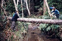
Brian Thurman leans against a large log spanning Schooner Gulch. Note that the stream bed here is predominantly gravel. Bank vegetation suggests no recent torrents or scouring flows. November 1993. Photo by Pat Higgins.
 Click on image to enlarge (150K).
The large blocks of bedrock in this reach of Schooner Gulch are actually where the creek passes through a sandstone formation. November 1993. Photo by Pat Higgins.
 Click on image to enlarge (90K).
This is a view of the canopy over the mainstem Schooner Gulch where selective logging with a skyline cable system has been used. Full shade on Schooner Gulch was maintained at this site and sufficient over-story to provide a cool microclimate over the stream. November 1993. Photo by Pat Higgins.
 Click on image to enlarge (144K).
Fish biologist Pat Higgins stands in the channel of the mainstem of Schooner Gulch in November 1993. This area is another with Iverson Basalt Formation underlaying it as evidenced by the boulders and cobbles which cover much of the stream bed. Photo by Brian Thurman.
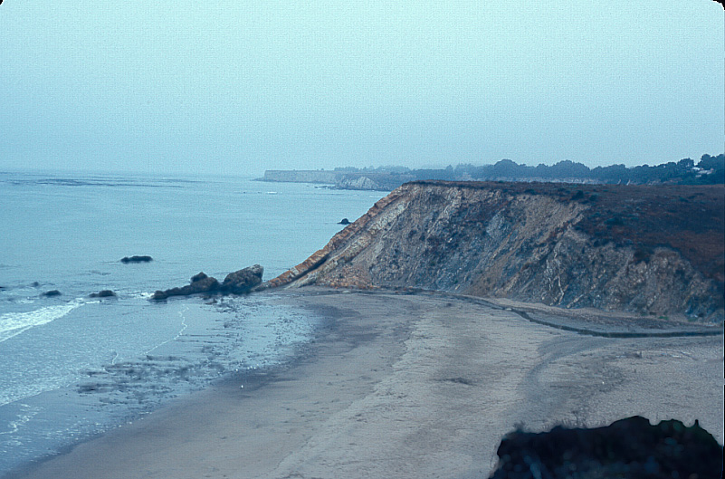
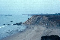 Click on image to enlarge (17K). Click here to display a larger version (181K).
This picture shows the mouth of Schooner Gulch as it enters the Pacific Ocean just short of the promontory. The way that the rock strata are tilted at the ocean's edge is indicative of local uplifting. The hollow pocket in the bedrock near the ocean may be the same type of formation that forms small aquifers in headwater areas of coastal streams. The ATT drilling crews would hit these pockets and fill them with drilling mud which then entered the streams where the aquifer contributed stream flow. August 1993. Photo by Pat Higgins.
To learn more about this topic click Info Links
To view additional information (data source, aquisition date etc.) about this page, click Metadata

 Click on image to enlarge (40K). Click here to display a larger version (171K).
 Click on image to enlarge (111K).
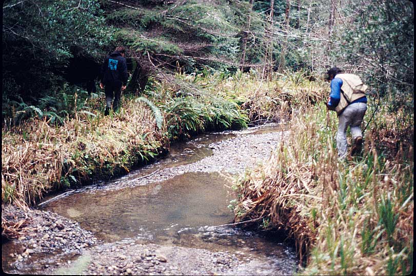 Click on image to enlarge (121K).
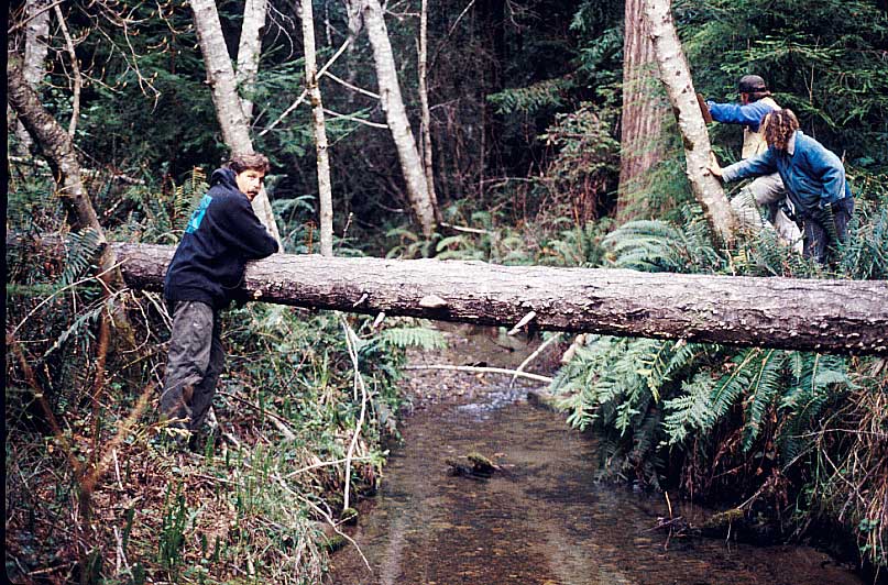 Click on image to enlarge (130K).
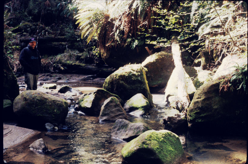 Click on image to enlarge (150K).
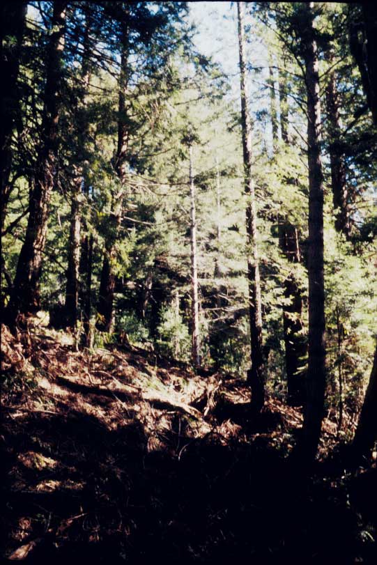 Click on image to enlarge (90K).
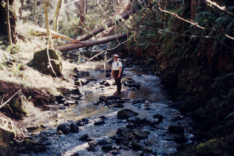 Click on image to enlarge (144K).
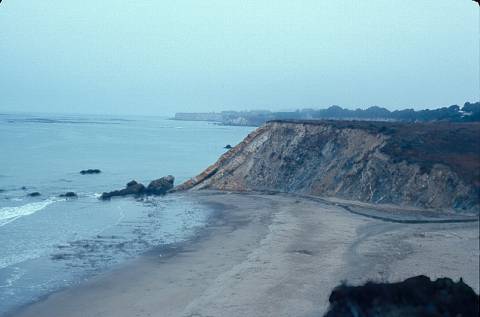 Click on image to enlarge (17K). Click here to display a larger version (181K).
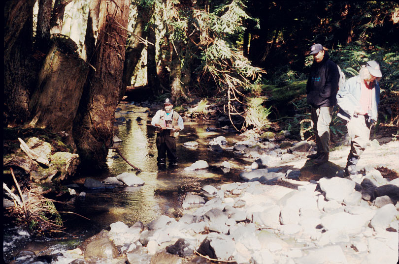