
|
Area/Topic | Bibliography | Background | Hypotheses | Home |
|
Map Page.
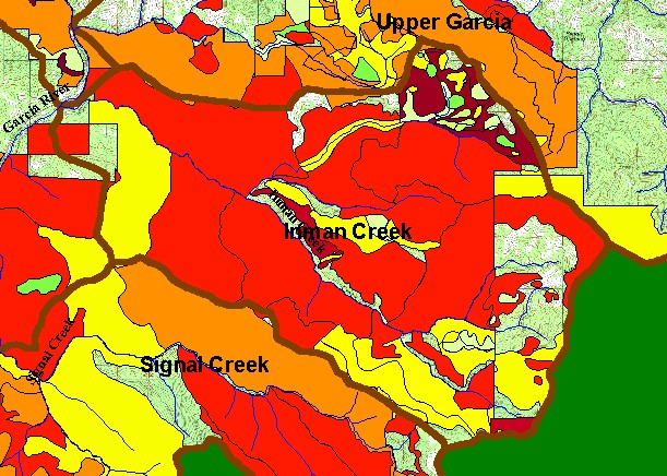
You selected the area Inman Creek and the topic Map: 1F Timber Harvest 1987-2002, Inman Creek Sub-basin |
| This is a map of timber harvests permitted by the California Department of Forestry (CDF) in the Inman Creek Calwater Planning Watershed and KRIS Garcia sub-basin between 1987 and 2002. Most of the Inman Creek basin has been harvested in the period from 1987 to 2002 and some areas have been entered more than once. Data were provided by the California Department of Forestry, Santa Rosa. Scale = 1:54,311 . | |||
|
|
||
To view metadata about a map layer, click on a link in the table below.
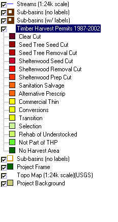
| Name of Layer in Map Legend | Metadata File Name |
|---|---|
| Streams (1:24k scale) | streams24.shp.txt |
| Sub-basins (no labels) | subbasins.shp.txt |
| Sub-basins (w/ labels) | subbasins.shp.txt |
| Change in Vegetation (1994-98)(TIFF) | vegchg.tif.txt |
| Timber Harvest Permits 1987-2002 | silvicul87_01.shp.txt |
| USFS Riparian Veg Size (1994)(TIFF) | vegsizebuf.tif.txt |
| USFS Vegetation Size (1994)(TIFF) | vegsize.tif.txt |
| Sub-basins (no labels) | subbasins.shp.txt |
| Project Frame | Unavailable |
| Topo Map (1:24k scale)(USGS) | Unavailable |
| Grayscale Hillshade (TIFF) | grayscale_light.tif.txt |
| Project Background | Unavailable |
| www.krisweb.com |