
| Area | Lower Garcia / Estuary |
| Topic | Stream Channel: Cross-Sections - Garcia at Baxman-3, 1991-1998 |
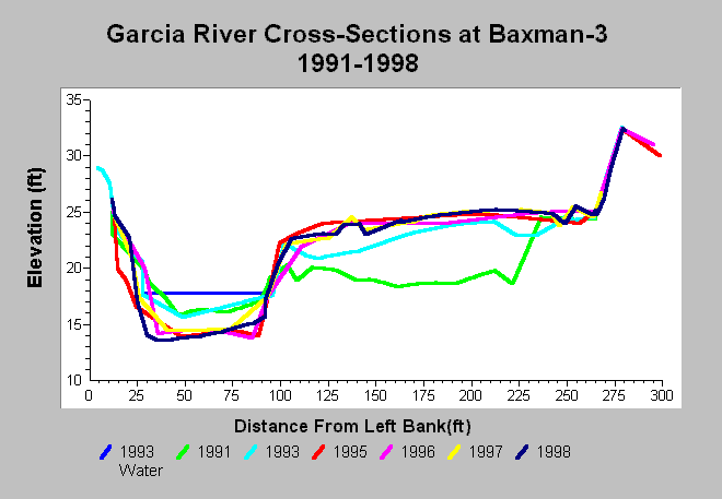
| Caption: This chart shows Garcia River cross-section surveys established by the Baxman Sand and Gravel in 1991, but then continued by the Mendocino County Water Agency after 1993. The cross-sections show slight aggradation occurred between 1993 and 1996, then scour in 1997 which continued through 1998. The channel has scoured and the point bar has re-established since gravel mining was haltered in 1991. This habitat is now over three feet deep which makes it superior salmonid rearing habitat. Data are from Mendocino County Water Agency. See InfoLinks for more information. | |
 |
To learn more about this topic click Info Links .
To view additional information (data source, aquisition date etc.) about this page, click Metadata .
To view the table with the chart's data, click Chart Table web page.
To download the table with the chart's data, click xs_garcia_baxman_xs3_1991_1998.dbf (size 14,700 bytes) .
| www.krisweb.com |