
| Area | Lower Garcia / Estuary |
| Topic | Stream Channel: Cross-Sections - Garcia at Baxman-4, 1991-1998 |
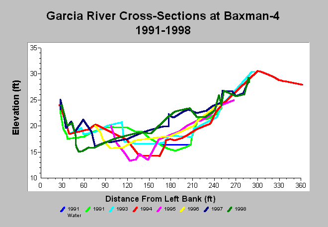
| Caption: This chart shows Garcia River cross-section surveys conducted between 1991 and 1998 at the Baxman-4 cross-section. The cross-section shows considerable shift in elevation with aggradation from 1991 to 1993, then degradation in 1994 and 1995 and finally major aggradation in 1996 and 1997. Since 1996, the thalweg has migrated to the left bank and a point bar is being established near the right bank. Data are from Mendocino County Water Agency. See InfoLinks for more information. | |
 |
To learn more about this topic click Info Links .
To view additional information (data source, aquisition date etc.) about this page, click Metadata .
To view the table with the chart's data, click Chart Table web page.
To download the table with the chart's data, click xs_garcia_baxman_xs4_1991_1998.dbf (size 11,802 bytes) .
| www.krisweb.com |