
| Area | Lower Garcia / Estuary |
| Topic | Stream Channel: Cross-Sections - Garcia at Hooper XS-2, 1991-1998 |
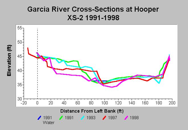
| Caption: This chart shows Garcia River cross-section surveys conducted between 1991 and 1998 at the Hooper XS-2 cross-section, located on the Hooper property (Oz). The channel width decreased between 1991 and 1993, and additional scour occurred near the right bank. The point bar scoured between 1993 and 1997. By 1998, the low flow channel and point bar scoured, while deposition occurred near the right bank. Data are from Mendocino County Water Agency. See InfoLinks for more information. | |
 |
To learn more about this topic click Info Links .
To view additional information (data source, aquisition date etc.) about this page, click Metadata .
To view the table with the chart's data, click Chart Table web page.
To download the table with the chart's data, click xs_garcia_hooper_xs2_1991_1998.dbf (size 6,178 bytes) .
| www.krisweb.com |