
| Area | Lower Garcia / Estuary |
| Topic | Stream Channel: Cross-Sections - Garcia at Kendall Lower-1, 1991-1997 |
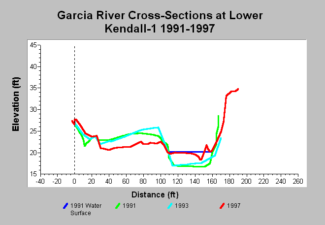
| Caption: This chart shows Garcia River cross-section surveys conducted at the Lower Kendall-1 cross-section, located on the Kendall property, between 1991 and 1997. The 1997 survey shows aggradation of the channel and erosion of and the point bar. The 1997 changes are possibly attributed to large storm events in 1995 and 1997 that reportedly caused large areas of bank erosion upstream of the cross-section. Erosional problems and channel stability may also have been affected by heavy equipment operation in the channel (Jackson 1997). Data are from Jackson (1997). See InfoLinks for more information. | |
 |
To learn more about this topic click Info Links .
To view additional information (data source, aquisition date etc.) about this page, click Metadata .
To view the table with the chart's data, click Chart Table web page.
To download the table with the chart's data, click xs_garcia_kendall_down_1991_1997.dbf (size 7,216 bytes) .
| www.krisweb.com |