|
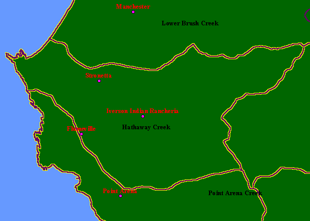
This is a map of the Calwater Planning Watersheds (purple outlines with black labels) and Populated Places (red labels) in the
Lower Garcia / Estuary sub-basin, with KRIS sub-basins (yellow outlines). The Lower Garcia/Estuary sub-basin overlaps 100%
with the the Hathaway Creek Calwater Planning Watershed. The lower North Fork Garcia Calwater encompasses a small piece
of the mainstem Garcia watershed just below the North Fork, including Olsen Gulch. Hathaway Creek proper occupies the lower
half of this sub-basin. Note that Stornetta was mis-spelled Stronetta in the attribute table of the ArcView shapefile provided to
KRIS, and that is why it is labelled "Stronetta" on this map. Scale = 1:70,842 .
|
|