|
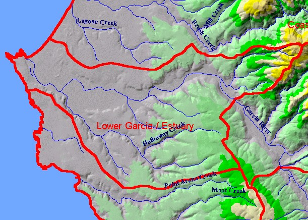
This is a map of the 1:24,000 scale USGS hydrography in the Lower Garcia / Estuary sub-basin, overlaid on top of an elevation
hillshade with KRIS Garcia sub-basins. The un-labeled stream at the northeastern edge of the sub-basin is Allen Creek. The
steepest relief in this sub-basin is in the headwaters of that stream. Note that while Allen Creek is within this KRIS Garcia
sub-basin, Olsen Gulch (which is the next upstream of Allen Creek on the right) falls into the North Fork Garcia Calwater Planning
Watershed. Data were contributed by the California Department of Forestry. Scale = 1:70,842 .
|
|