|
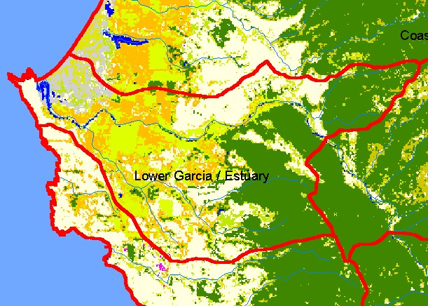
This is a map of the 1992 U.S. Environmental Protection Agency Landcover/Landuse in the Lower Garcia / Estuary sub-basin.
These data are derived from a 1992 Landsat image and show that only the far eastern portion of the sub-basin is conifer forest.
The majority of the sub-basin is composed of the coastal plain, which is a flat area mostly covered by grasslands and farms,
although the gray area is sand dunes to the north of the mouth of the Garcia River. Riparian restoration in the years since 1992 has
led to an increase in riparian vegetation along the lower mainstem Garcia River, but this is not shown in the 1992 image. Scale = 1:70,842 .
|
|