|
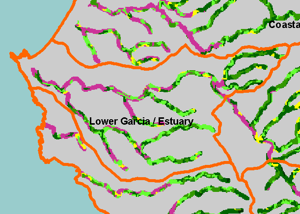
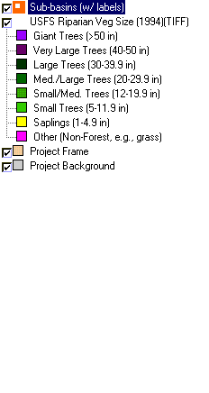
This is a map of vegetation size data within 90-meter riparian buffer zones in the Lower Garcia / Estuary sub-basin. The tree size
classifications were derived from Landsat multi-spectral images taken in 1994. Stand conditions are accurately represented at the
one hectare scale so may miss individual trees or narrow riparian buffers less than a hectare. The lower Garcia meanders through
dairy farms and grasslands, which register as non-forest, but may have substantial small willow buffers. Riparian restoration in the
years since 1994 has led to an increase in riparian vegetation along the lower mainstem Garcia River, but this is not shown in the
1994 image. Data were provided by the U.S. Forest Service Pacific Southwest Region Remote Sensing Lab, in cooperation with
the California Department of Forestry. Available layers include Vegetation Size, Topographic Map, Grayscale Hillshade, and
Change in Vegetation (1994-1998). Scale = 1:73,245 .
|
|