|
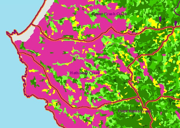
This is a map of 1994 vegetation size data in the Lower Garcia / Estuary sub-basin, overlaid on top of KRIS sub-basins and
1:24,000 streams. The tree size classifications were derived from Landsat multi-spectral images taken in 1994. Stand conditions
are accurately represented at the one hectare scale. The western coastal plain is covered by grasslands and farm lands which
show up as non-forest. Hardwood riparian species show mostly as small-trees (5-11. 9 inch diameter). Larger trees to the east
represent coniferous forests, with the largest in Allen Creek which enters the Garcia just downstream of this sub-basins eastern
boundary and in upper Hathaway Creek. Data were provided by the U.S. Forest Service Pacific Southwest Region Remote
Sensing Lab, in cooperation with the California Department of Forestry.
|
|