| Area |
Lower Garcia / Estuary |
| Topic |
Tour: Aerials 1994 Lower Garcia, Oz to Below Highway 1 |
 Click on image to enlarge (32K). Click here to display a larger version (243K).
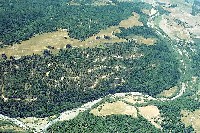
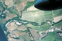
This aerial photo shows the mainstem Garcia River from its convergence with the North Fork (at left) downstream below the mouth of Olsen Gulch. The Buckridge gravel operation is apparent in 1994 below the North Fork at upper left. This portion of the mainstem actually falls strictly in the North Fork Garcia Calwater, which is also the KRIS North Fork sub-basin. Photo from Peter Dobbins of the Friends of Garcia River.
 Click on image to enlarge (33K). Click here to display a larger version (278K).
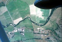
This aerial photo was taken in 1994 and shows the mainstem Garcia River around the mouth of Allen Creek, just downstream of the Lower Garcia Basin boundary. Although logging has taken place in the riparian zone back from the stream, a partially functional buffer has been retained. Photo contributed by Peter Dobbins and Friends of the Garcia River.
 Click on image to enlarge (168K).
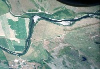
This 1994 aerial photo shows the lower mainstem Garcia River and the upper Manchester (Pt. Arena) Rancheria. Willows and alder are vigorously colonizing the mainstem gravel bar as a result of mostly drought years between 1987 and 1994. Photo contributed by Peter Dobbins and Friends of the Garcia River.
 Click on image to enlarge (142K).
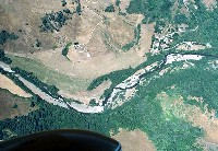
This 1994 aerial photograph shows the lower mainstem Garcia River just below the upper Manchester Rancheria with the Kendall property before the large bank failure and channel shift, which occurred from 1995-1998. Photo contributed by Peter Dobbins and Friends of the Garcia River.
 Click on image to enlarge (26K). Click here to display a larger version (205K).
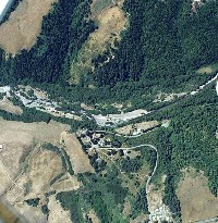
At right in this 1994 aerial photo is the Windy Hollow crossing and Baxman's gravel operation on the bar just above the crossing. Also in the picture is the lower Manchester (Pt. Arena) Rancheria. Dairy pasture in uplands near the river have turned brown, indicating that the picture was taken in summer. Photo contributed by Peter Dobbins and Friends of the Garcia River.
 Click on image to enlarge (24K). Click here to display a larger version (192K).
This 1994 aerial photo shows both Windy Hollow crossing and the Highway 1 Bridge (at right). Note the riparian buffer downstream of Windy Hollow encroaches on the stream in many places. Photo contributed by Peter Dobbins and Friends of the Garcia River.
 Click on image to enlarge (165K).
The mainstem Garcia River downstream of Highway 1 is shown here with dairy land mostly buffered from the river by a riparian zone. Photo contributed by Peter Dobbins and Friends of the Garcia River.
 Click on image to enlarge (121K).
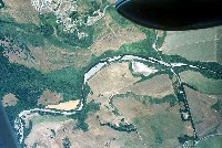
The lower mainstem of the Garcia River and the top of the estuary. The river is joined by Hathaway Creek where the bend with the large gravel bar shows at upper left in the photo. Tidal influence extends to just below Hathaway Creek but salt intrusion is slightly lower to Pot Hole at right in the downstream portion of the picture. Photo contributed by Peter Dobbins and Friends of the Garcia River.
To learn more about this topic click Info Links
To view additional information (data source, aquisition date etc.) about this page, click Metadata

 Click on image to enlarge (32K). Click here to display a larger version (243K).
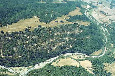 Click on image to enlarge (33K). Click here to display a larger version (278K).
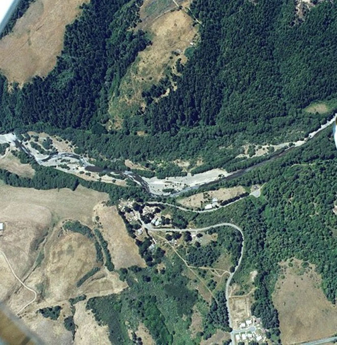 Click on image to enlarge (168K).
 Click on image to enlarge (142K).
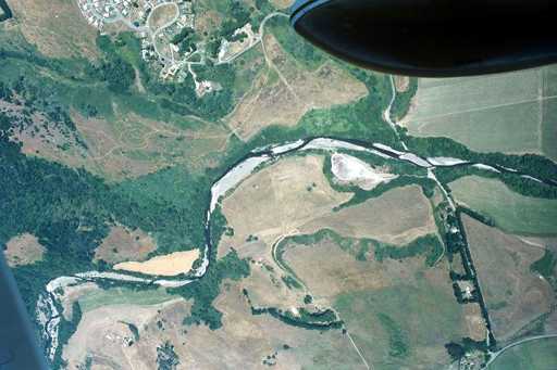 Click on image to enlarge (26K). Click here to display a larger version (205K).
 Click on image to enlarge (24K). Click here to display a larger version (192K).
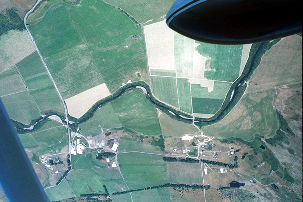 Click on image to enlarge (165K).
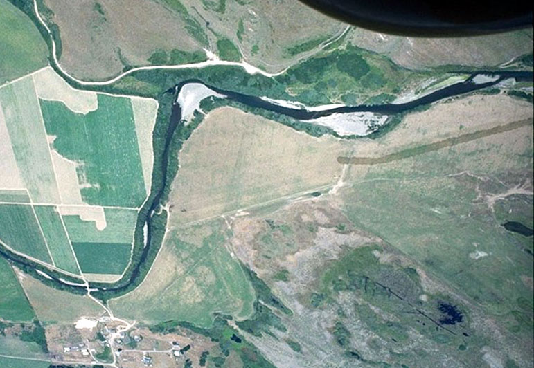 Click on image to enlarge (121K).