| Area |
Lower Garcia / Estuary |
| Topic |
Tour: Aerials 2000 #3 Lower Garcia @ Kendall |
 Click on image to enlarge (25K). Click here to display a larger version (209K).
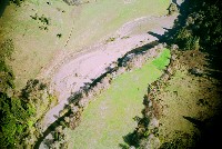
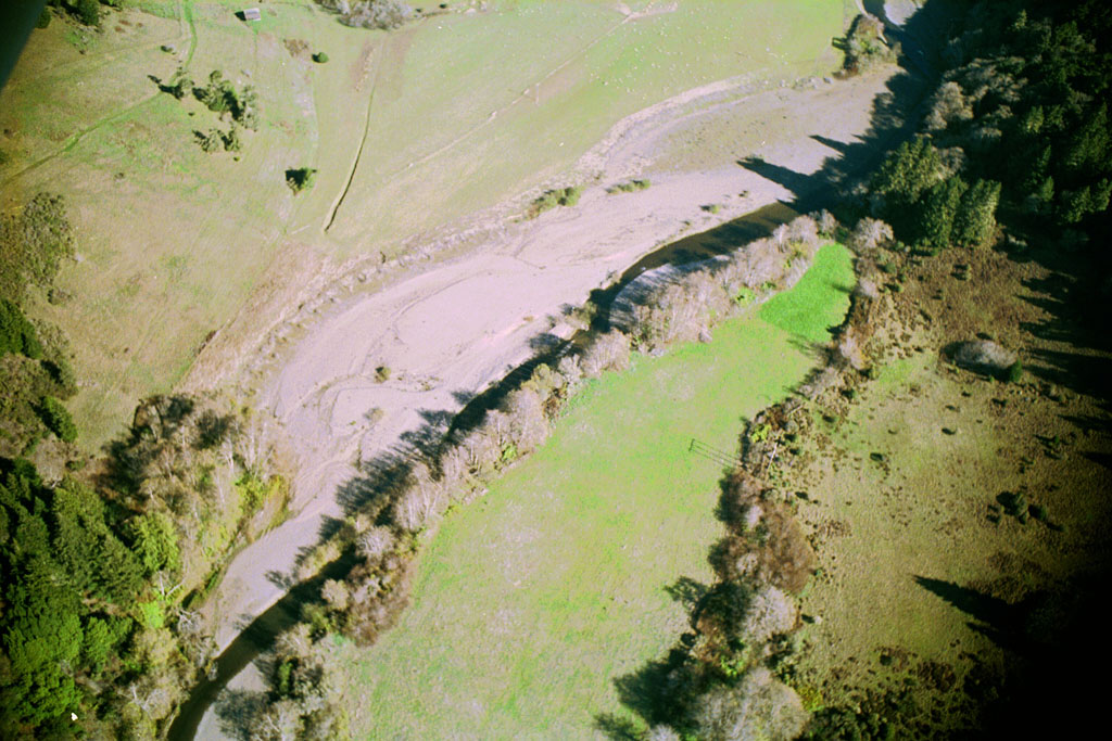
This aerial photo shows the Garcia River at the Kendall property in 2000. The river here is wide as a result of bank erosion. Although there was a small scale riparian restoration project here, high water in 1997 and use of heavy equipment in the channel caused it to partially fail. Photo provided by Peter Dobbins and Friends of the Garcia River.
 Click on image to enlarge (28K). Click here to display a larger version (236K).
The Garcia River makes a bend to the west below the Kendall property in this year 2000 aerial photo. Notice how the Garcia River returns to a confined channel as it moves downstream, running along the alder lined bank. This helps maintain cool temperatures for salmonids and provides cover for them from predators. Photo provided by Peter Dobbins and Friends of the Garcia River.
 Click on image to enlarge (21K). Click here to display a larger version (191K).
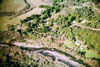
The Kendall Ranch is shown looking west from upstream with a meandering Garcia River in this year 2000 aerial photo, which was provided by Peter Dobbins and Friends of the Garcia River.
 Click on image to enlarge (23K). Click here to display a larger version (214K).
This year 2000 aerial photo shows the Kendall property looking straight down on the failed bank with the Garcia River tucked under alder canopy on near side. Photo provided by Peter Dobbins and Friends of the Garcia River.
 Click on image to enlarge (164K).
Aerial photo of Kendall property with hundreds of sheep grazing in the pasture near the center of the photo, which was taken in the winter of 2000. Photo provided by Peter Dobbins and Friends of the Garcia River.
 Click on image to enlarge (36K). Click here to display a larger version (296K).
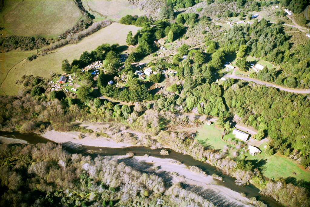
The upper Manchester (Pt Arena) Rancheria is shown in part here with the Garcia River running downstream from right to left. This reach is just below the Kendall property. Photo provided by Peter Dobbins and Friends of the Garcia River.
To learn more about this topic click Info Links
To view additional information (data source, aquisition date etc.) about this page, click Metadata

 Click on image to enlarge (25K). Click here to display a larger version (209K).
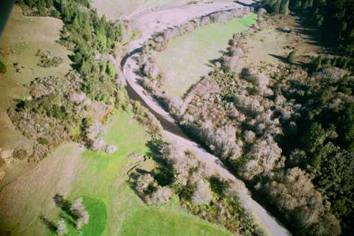 Click on image to enlarge (28K). Click here to display a larger version (236K).
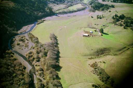 Click on image to enlarge (21K). Click here to display a larger version (191K).
 Click on image to enlarge (23K). Click here to display a larger version (214K).
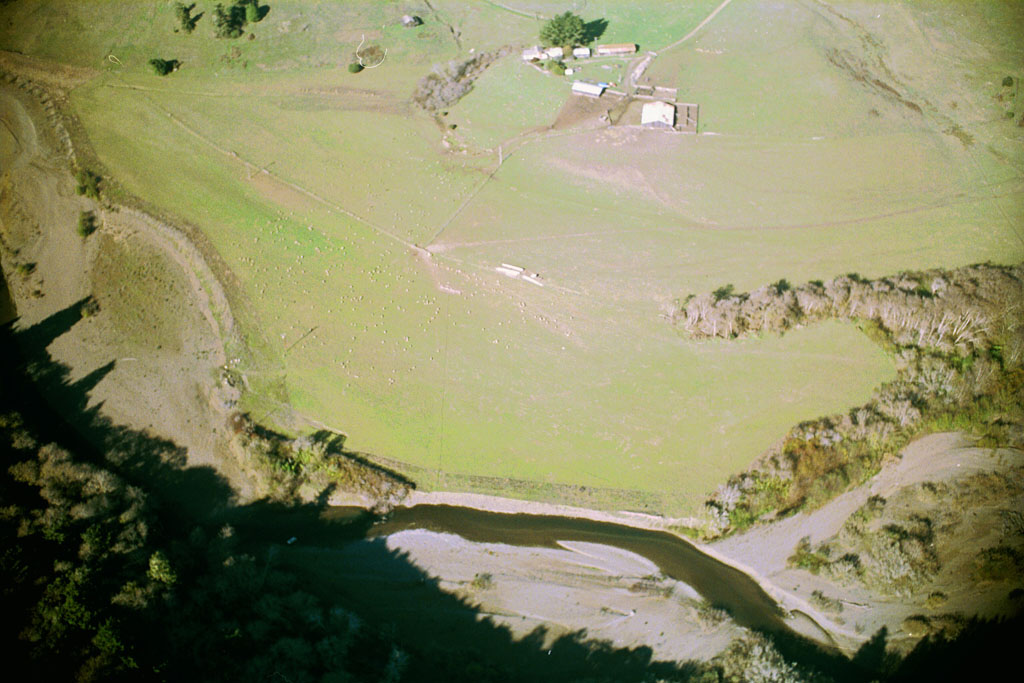 Click on image to enlarge (164K).
 Click on image to enlarge (36K). Click here to display a larger version (296K).
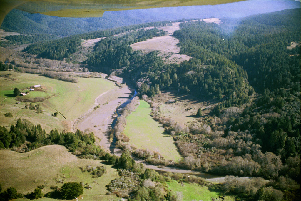