| Area |
Lower Garcia / Estuary |
| Topic |
Tour: Aerials Garcia Estuary 1942-1998 |
 Click on image to enlarge (40K). Click here to display a larger version (322K).
This photo shows the Garcia River estuary from directly overhead in 1942. The depth of the estuary cannot be discerned, but there is more water surface area and less berms of sediment than in subsequent years. The riparian zone in some parts of the estuary appears to more mature today than at the time of this 1942 photo. Note extensive wetlands to the north of the estuary. Photo provided by Peter Dobbins and Friends of the Garcia River.
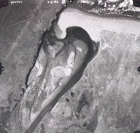
 Click on image to enlarge (105K).
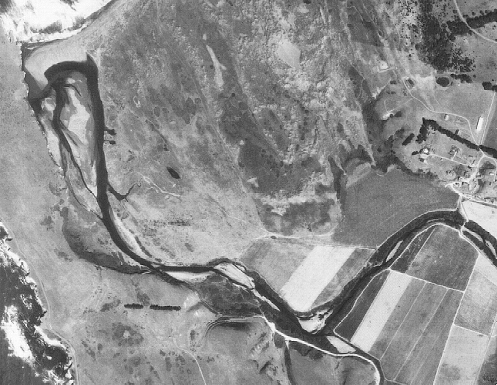
The estuary of the Garcia River in September 1959 is showing the early effects of Post WW II logging, but full sediment load from the 1955 flood does not seem to have cycled this far yet. Sand bars and islands occupy slightly larger areas than in 1942, but very significant changes can be seen by 1972 (see Picture #3). Photo provided by Peter Dobbins and Friends of the Garcia River.
 Click on image to enlarge (28K). Click here to display a larger version (287K).
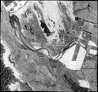
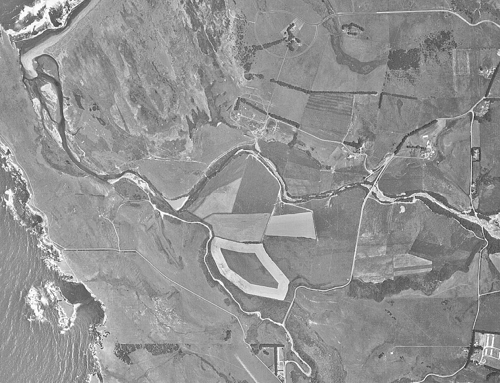
The estuary of the Garcia River in 1972 is showing major effects from Post WW II logging, the 1955 flood, 1964 flood and high flows in 1972 itself. Note that the sand bar at the mouth is much broader, the estuary itself is wider and sediment islands occupy large areas. Photo provided by Peter Dobbins and Friends of the Garcia River.
 Click on image to enlarge (28K). Click here to display a larger version (319K).
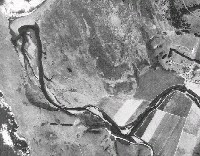
The Garcia River estuary in 1988 still has large sediment islands. Both 1987 and 1988 were relatively dry, with the last previous big water before this photo occurring in February 1986. Photo provided by Peter Dobbins and Friends of the Garcia River.
 Click on image to enlarge (108K).
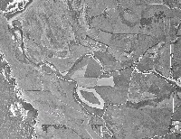
This 1992 aerial infrared photo of the Garcia River estuary shows the estuary after six years of drought. The water surface to island configuration looks very similar to that in 1988, which is expected with lack of flushing flows from the river in the four years intervening. Photo provided by Peter Dobbins and Friends of the Garcia River.
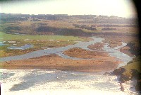
 Click on image to enlarge (87K).
This black and white photo shows the Garcia River estuary in close up view in 1992, the same as the infrared Picture #5. Because of the angle of the view, water depth is indicated, showing very restricted depth characteristic of estuary filling. Photo provided by Peter Dobbins and Friends of the Garcia River.
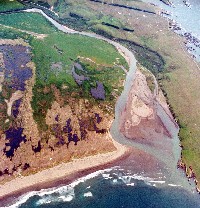 Click on image to enlarge (40K). Click here to display a larger version (315K).
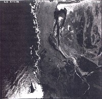
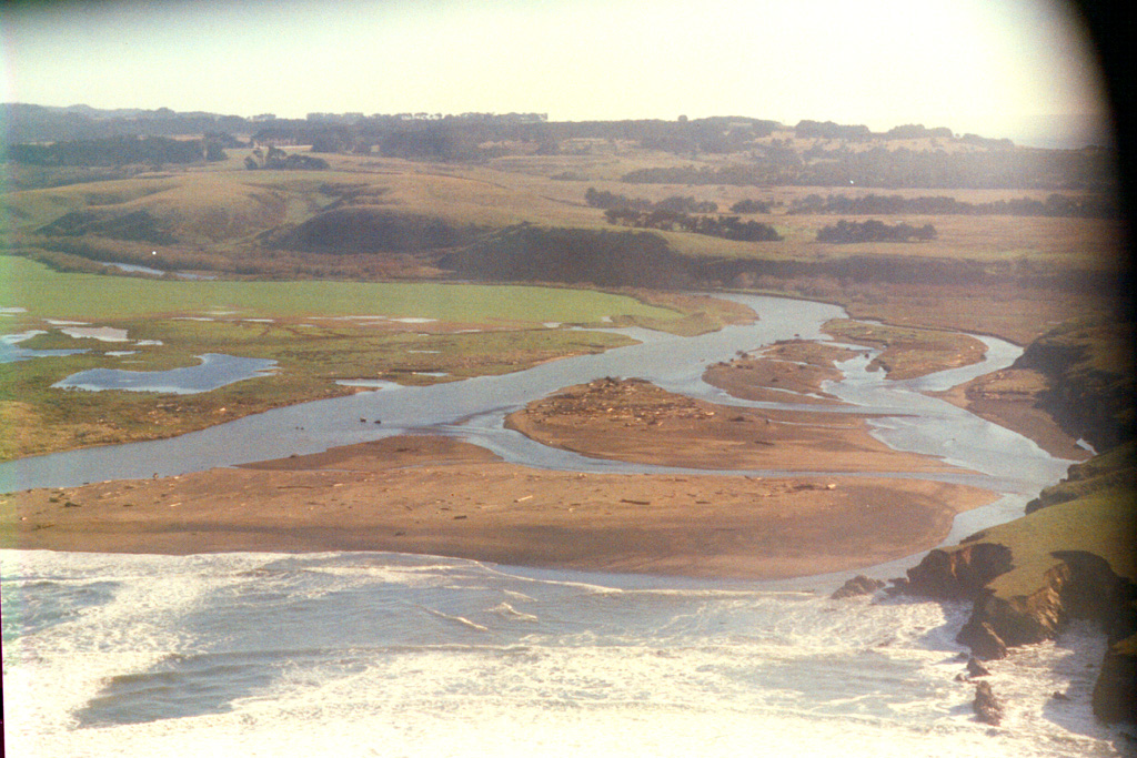
This color aerial oblique photo shows the Garcia River estuary looking east on March 31, 1995, after two major high flow events in January and March 1995. There is a large sediment plug in residence just inside the mouth of the estuary, and the sand bar outside the mouth is indicative of considerable transport into the ocean as well. This large pulse of sediment is likely related in part to logging that occurred in the Garcia River between 1985 and 1995 as well as sediment deposited in this low gradient area in earlier years. Photo provided by Peter Dobbins and Friends of the Garcia River.
 Click on image to enlarge (16K). Click here to display a larger version (354K).
This wide angle lens photo shows the Garcia River estuary in April 1998 with the river channel split. Although the river spilled out to the north during high flows, the mouth of the Garcia River has remained along the bluffs. Active sediment deposition is evident in this photo. High sediment supply in the intense January 1997 storm may have been transported with other sediment stored in the channel, as a result of sustained high flows in the El Nińo year of 1998. Photo provided by Peter Dobbins and Friends of the Garcia River.
To learn more about this topic click Info Links
To view additional information (data source, aquisition date etc.) about this page, click Metadata

 Click on image to enlarge (40K). Click here to display a larger version (322K).
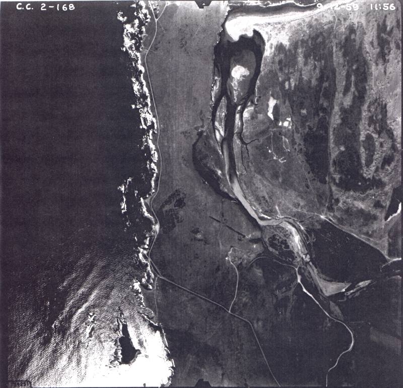 Click on image to enlarge (105K).
 Click on image to enlarge (28K). Click here to display a larger version (287K).
 Click on image to enlarge (28K). Click here to display a larger version (319K).
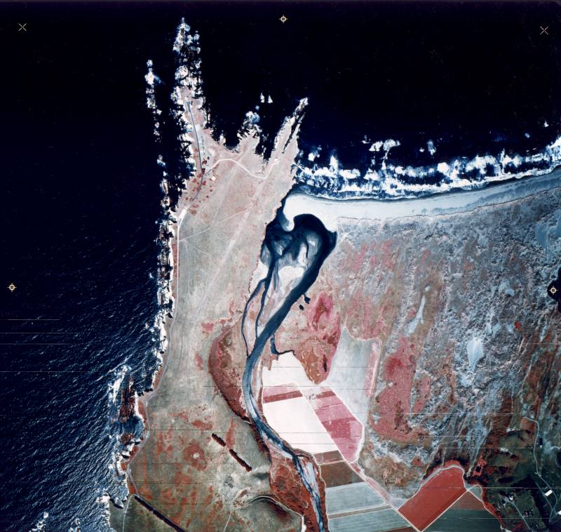 Click on image to enlarge (108K).
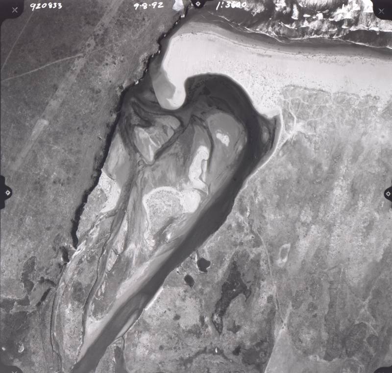 Click on image to enlarge (87K).
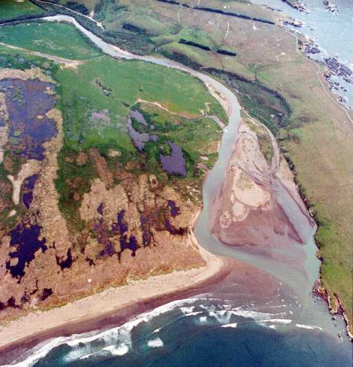 Click on image to enlarge (40K). Click here to display a larger version (315K).
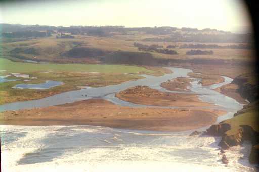 Click on image to enlarge (16K). Click here to display a larger version (354K).
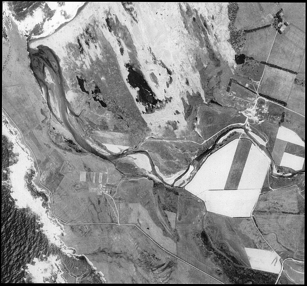