
| Area | Lower Garcia / Estuary |
| Topic | Tour: Aerials Garcia Estuary Infrared Photos |
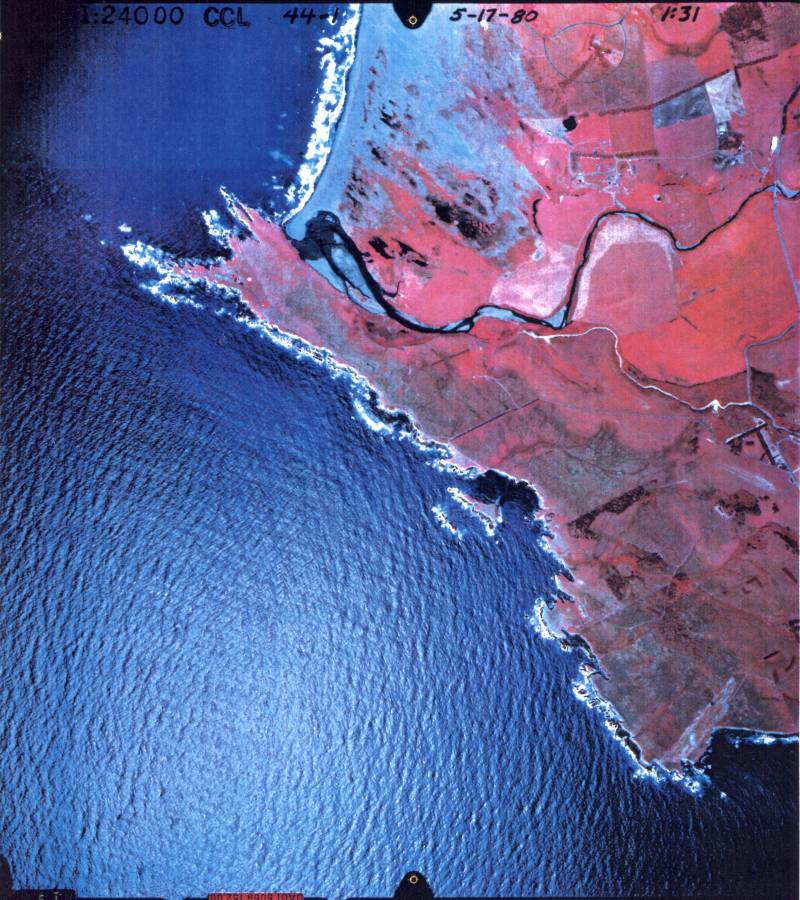
This photo shows the Garcia River estuary from directly overhead in a 1980 infrared aerial photo that also extends south of Pt Arena. This May 17 photo shows vigorous plant growth in red colors, with sand or bare areas (like those north or up in the photo from the mouth of the Garcia). Wetlands and crops both show in red. Note extensive wetlands to the north of the estuary, including standing water which shows as black or dark blue. Photo provided by Peter Dobbins and Friends of the Garcia River.
The estuary of the Garcia River in September 1980 is shown as a comparison to Picture #1, although the framing is slightly different. Extensive wetlands near in lower Brush Creek can be seen in this picture to the north of the Garcia estuary. A large lake formed here as a result of the 1906 earthquake to which Brush Creek was joined at the time. This may have been an old Brush Creek stream course along the San Andreas rift which crosses this picture from bottom to top, going offshore at the mouth of Alder Creek. Photo provided by Peter Dobbins and Friends of the Garcia River.
The Garcia River estuary is shown here just upstream of the mouth to the top of tide water at the mouth of Hathaway Creek (Bend Hole) at the lower center of photo. Crops, wetlands, riparian areas and some upland vegetation reflect vigorous growth associated with deeper red colors. Fallow fields show up as white or light blue. Photo provided by Peter Dobbins and Friends of the Garcia River. Photo taken in 1992.
This aerial infrared photo shows the lower Garcia River from above Highway 1 (at right) to Hathaway Creek (at lower left). Riparian areas, patches of forest (top) and hedge rows show the most intense red indicative of plant growth. Fields are paler colors, likely representative of a new crop not yet hitting the peak of growth. Photo provided by Peter Dobbins and Friends of the Garcia River. Photo taken in 1992.
This color aerial infrared photo shows the Garcia River below Highway 1 (top) to above Windy Hollow crossing (bottom). Vegetation is showing typical July patterns with crops showing high growth rates (red) and uplands drying out (gray at left). Photo provided by Peter Dobbins and Friends of the Garcia River. Photo taken in 1992.
Forested areas show in varying shades of red in this 1992 aerial infrared photo which covers from Oz (bottom) to Kendall's (top) along the lower Garcia River. The upper Manchester (Pt Arena) Reservation is at center right. Photo provided by Peter Dobbins and Friends of the Garcia River.
This infrared aerial shows the Garcia River at Oz near its center. Brush Creek is in the photo at right. Forests and riparian zones show the most vigorous plant growth, with deeper shades of red. Photo provided by Peter Dobbins and Friends of the Garcia River.
 Click on image to enlarge (150K).
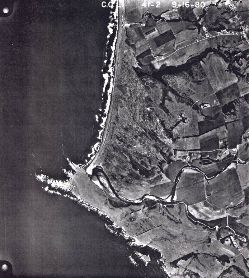 Click on image to enlarge (133K).
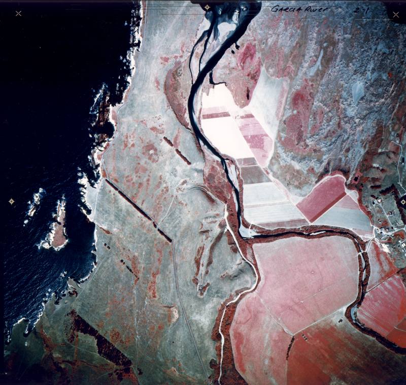 Click on image to enlarge (108K).
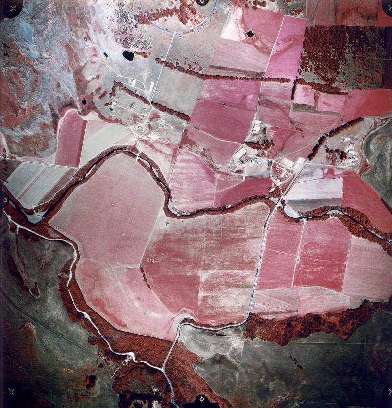 Click on image to enlarge (121K).
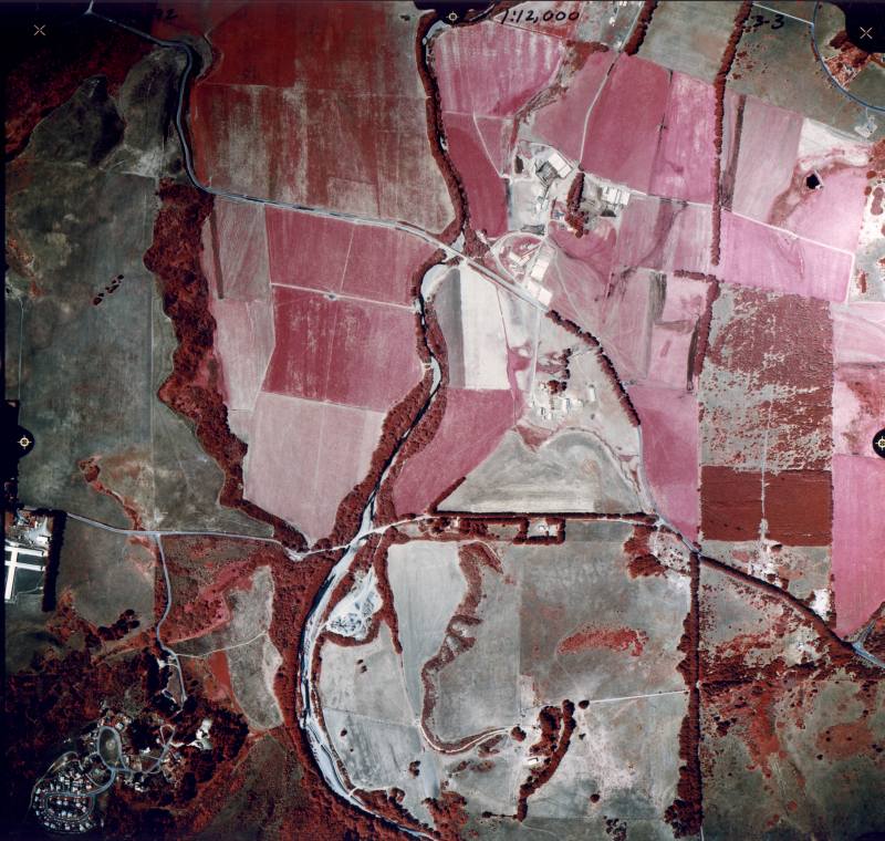 Click on image to enlarge (118K).
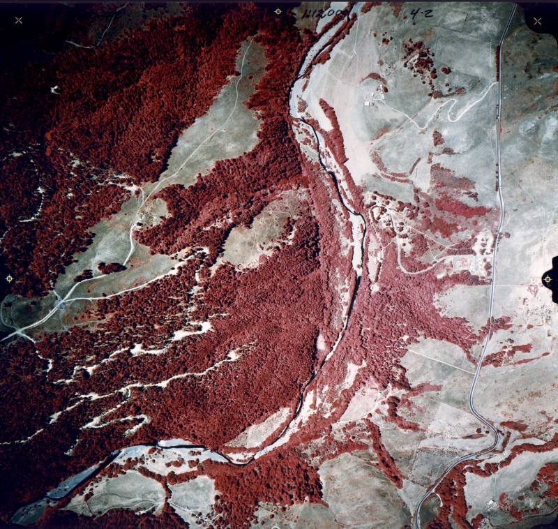 Click on image to enlarge (155K).
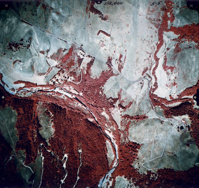 Click on image to enlarge (146K).
To learn more about this topic click Info Links
To view additional information (data source, aquisition date etc.) about this page, click Metadata
| www.krisweb.com |