| Area |
Lower Garcia / Estuary |
| Topic |
Tour: Garcia Estuary #4 Habitat Types |
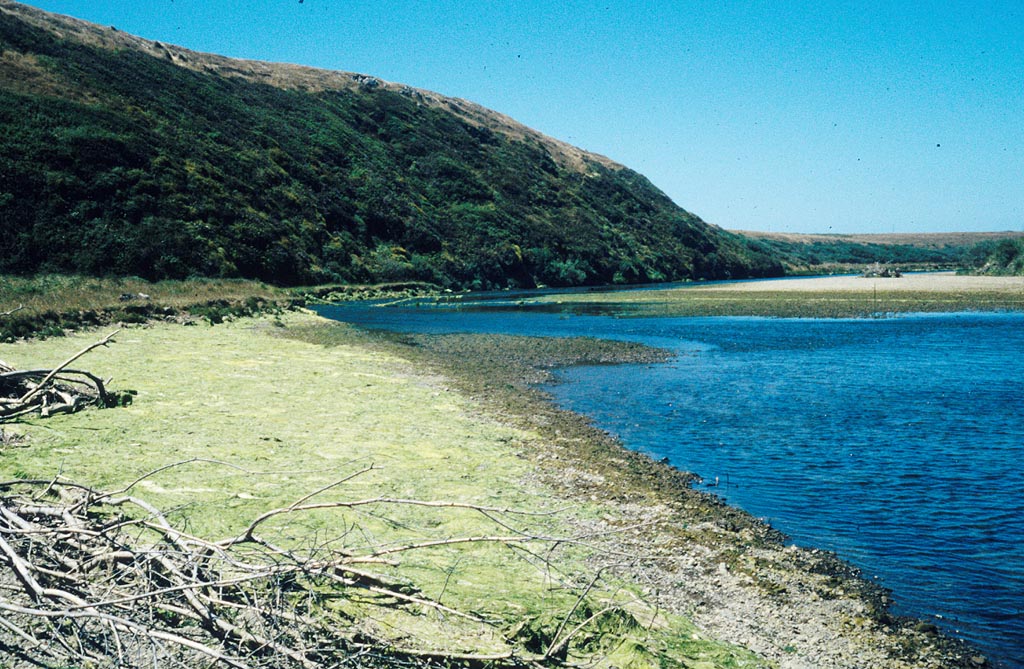
 Click on image to enlarge (28K). Click here to display a larger version (298K).
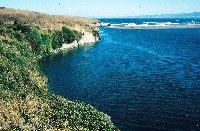
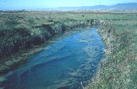
The Garcia River estuary is shown here during high tide in June 1995 with the mouth visible in the distance against the cliffs. This area was part of the bay subsystem, except for right near the mouth and cliffs, which was classified as Marine subsystem habitat. High flows in June kept most of the estuary, except this area, dominated by fresh water. Photo by Pat Higgins. See InfoLinks for discussions of how estuarine habitat categories were defined.
 Click on image to enlarge (19K). Click here to display a larger version (217K).
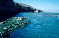
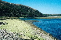
This water level shot was taken at low tide in the estuary along the south bank looking towards the ocean in July 1995. The marine algae covering the rock at left colonized much of the floor of the estuary once salt water intruded. The deep water along the cliffs was sampled once but few fish were captured as depth was greater than net height (eight feet). This is part of the Marine subsystem but shallower areas to the right were Bay subsystem habitat. Photo by Pat Higgins. See InfoLinks for more information on the related study.
 Click on image to enlarge (20K). Click here to display a larger version (187K).
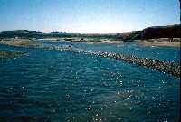
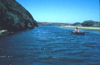
This photo was taken looking east in the estuary in the side channel to the south just up from where sampling Station #7 was located. This area was Bay subsystem even in early season because the freshwater flow is along the north bank. Marine fish juveniles and smelt were common here. Photo by Pat Higgins. See InfoLinks for more information on the related study.
 Click on image to enlarge (159K).
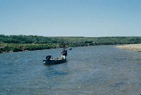
Pat Higgins tries not to get blown away at the lower end of the "Mud Flats" below the Miner Hole and above the Snag Hole in the Garcia estuary. This photo was taken in July when this section of the estuary had changed from freshwater dominated (Riverine) to salt influenced (Bay subsystem). Photo by Pat Higgins. See InfoLinks for more information on the related study.
 Click on image to enlarge (132K).
This photo shows a rare slough arm of the Garcia River estuary. This slough had juvenile herring in it and bay pipefish when sampled in August 1995. Photo by Pat Higgins. See InfoLinks for more information on the related study.
 Click on image to enlarge (103K).
This photo was taken looking downstream in the Garcia estuary at the Miner Hole, with Steve Cannata rowing the gear boat in August 1995. Photo by Pat Higgins. See InfoLinks for more information on the related study.
 Click on image to enlarge (27K). Click here to display a larger version (219K).
The tidal influence and salt intrusion is demonstrated by the green algae on the terrace of the Garcia River estuary above Miner Hole at low tide in August 1995. Salt water did not extend much further upstream than the Pot Hole, which is just out of view to the right. See Picture #8. Photo by Pat Higgins. See InfoLinks for more information on the related study.
 Click on image to enlarge (108K).
This is a June 1995 photo looking downstream in the Garcia River estuary to the Pot Hole. The pool along the willow and alder riparian was greater than ten feet deep. Although salt water intruded into this hole at depth in July and August, schools of older age steelhead still inhabited it but seemed to stay mostly above the salt wedge. Photo by Pat Higgins. See InfoLinks for more information on the related study.
To learn more about this topic click Info Links
To view additional information (data source, aquisition date etc.) about this page, click Metadata

 Click on image to enlarge (28K). Click here to display a larger version (298K).
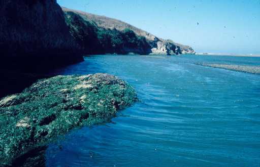 Click on image to enlarge (19K). Click here to display a larger version (217K).
 Click on image to enlarge (20K). Click here to display a larger version (187K).
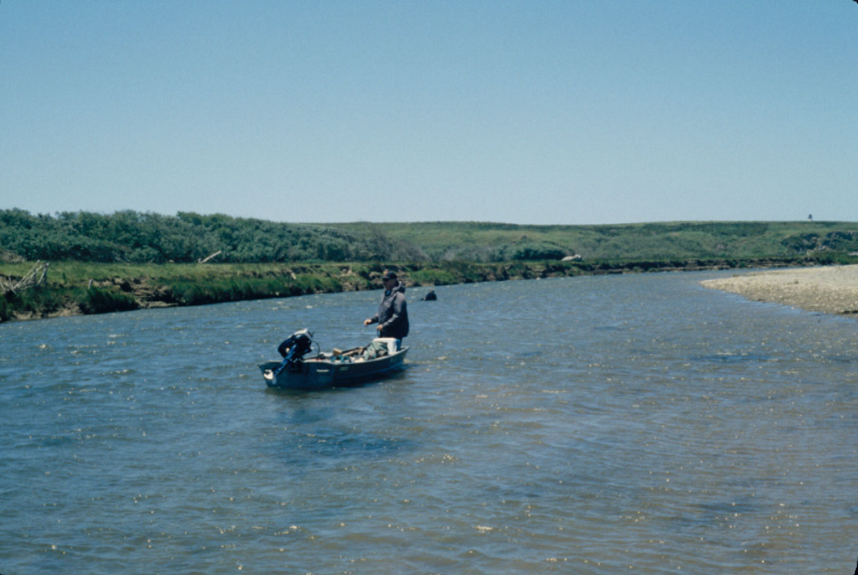 Click on image to enlarge (159K).
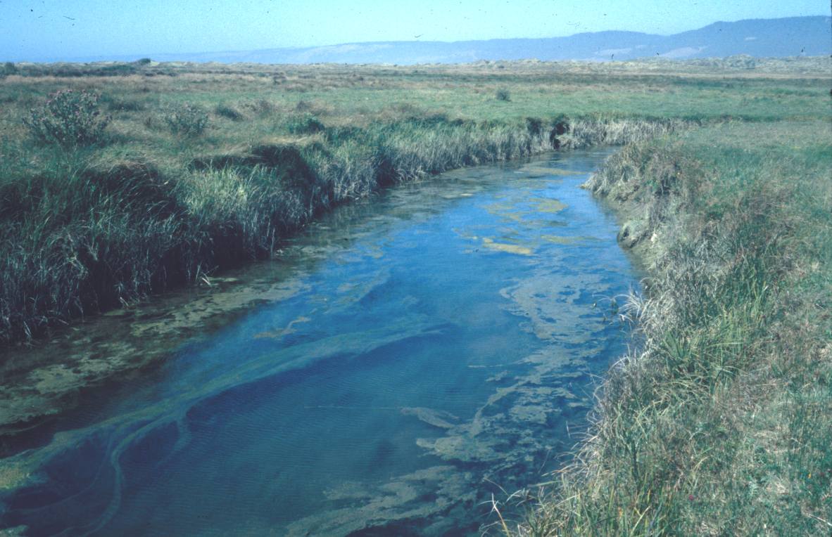 Click on image to enlarge (132K).
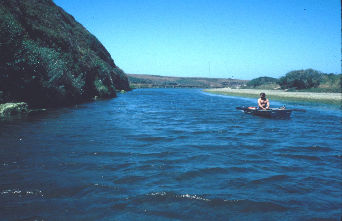 Click on image to enlarge (103K).
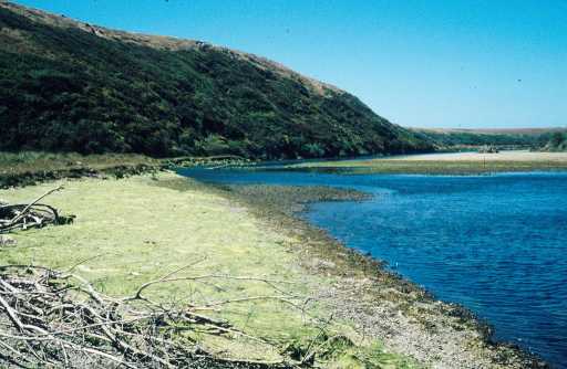 Click on image to enlarge (27K). Click here to display a larger version (219K).
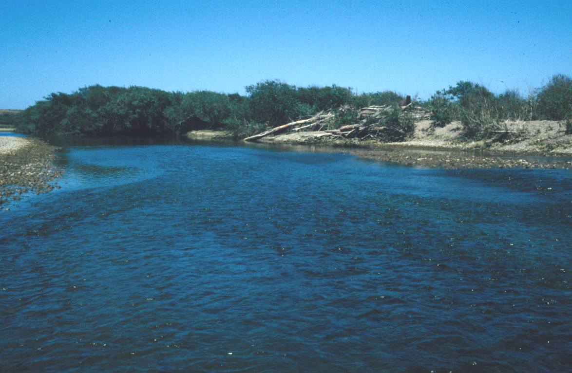 Click on image to enlarge (108K).
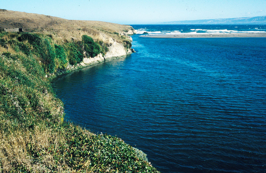