| Area |
Lower Garcia / Estuary |
| Topic |
Tour: Restoration #6 Kendall Property Failed Project |
 Click on image to enlarge (142K).
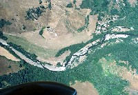
This 1994 aerial photo shows the riparian zone on the Kendall property. Note the intact riparian buffer along the north (upper) shore as this was washed away by high water in 1995. Photo by Peter Dobbins, Friends of Garcia River.
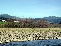
 Click on image to enlarge (25K). Click here to display a larger version (209K).
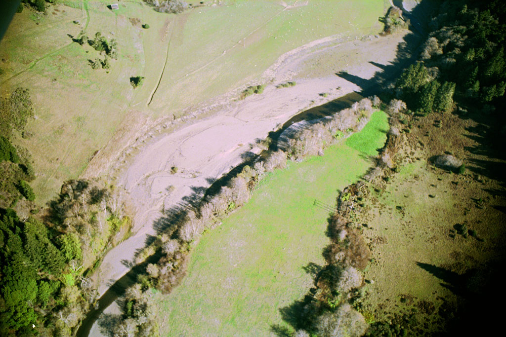
This aerial photo shows the same area as Picture #1 but looking east instead of north in 2000. Note that a very large piece of the field and the riparian trees are gone. Photo by Peter Dobbins, Friends of Garcia River.
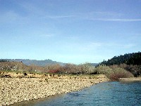
 Click on image to enlarge (23K). Click here to display a larger version (214K).
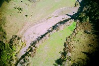
This year 2000 aerial photo looks straight down on the Kendall property at the location of the bank failure. Photo by Peter Dobbins, Friends of Garcia River.
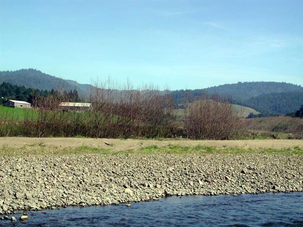
 Click on image to enlarge (18K). Click here to display a larger version (182K).
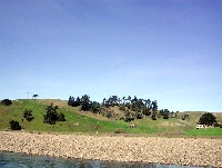
This is an eye level shot taken from a drift boat in February 2002 looking across the gravel terrace shown in Picture #3 from above. Photo by Pat Higgins. February 2002.
 Click on image to enlarge (27K). Click here to display a larger version (228K).
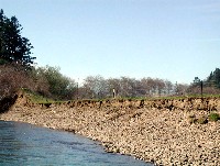
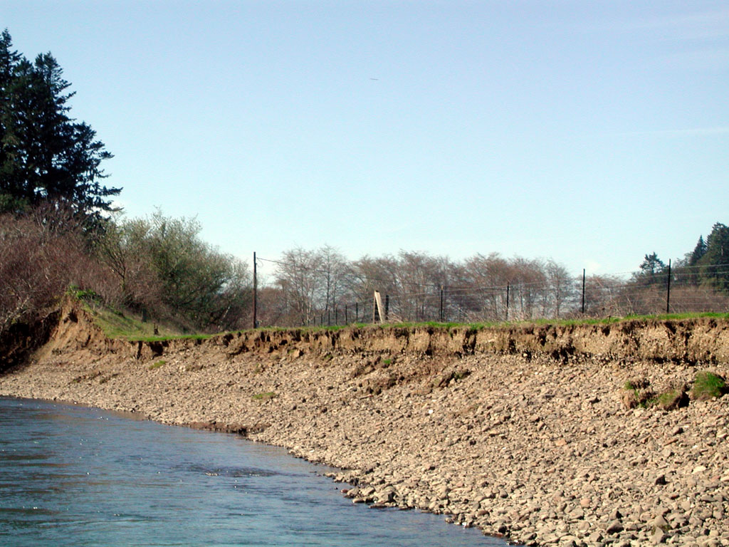
The raw, steep bank along the lower Kendall property is shown in this photo looking downstream. Photo by Pat Higgins. February 2002.
 Click on image to enlarge (19K). Click here to display a larger version (194K).
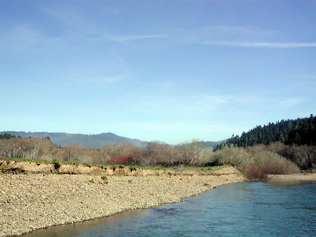
This photo was taken looking upstream from the same location as Picture #5 and shows the length of bank subject to erosion. Photo by Pat Higgins. February 2002.
 Click on image to enlarge (29K). Click here to display a larger version (260K).
This side view of the gravel terrace at the Kendall property shows a riparian remnant of a bio-engineering project that was not completed because permits were not issued in a timely fashion. Pro-active restoration steps might have avoided the major soil loss at this location. A bio-engineering project is planned with the new owners of the property in 2004 (Craig Bell, personal communication. Photo by Pat Higgins. February 2002.
To learn more about this topic click Info Links
To view additional information (data source, aquisition date etc.) about this page, click Metadata

 Click on image to enlarge (142K).
 Click on image to enlarge (25K). Click here to display a larger version (209K).
 Click on image to enlarge (23K). Click here to display a larger version (214K).
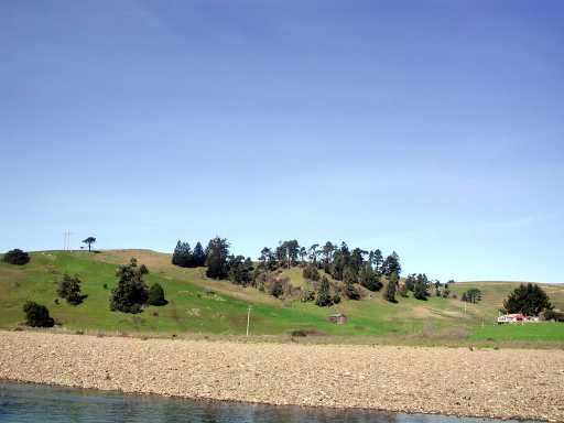 Click on image to enlarge (18K). Click here to display a larger version (182K).
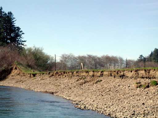 Click on image to enlarge (27K). Click here to display a larger version (228K).
 Click on image to enlarge (19K). Click here to display a larger version (194K).
 Click on image to enlarge (29K). Click here to display a larger version (260K).
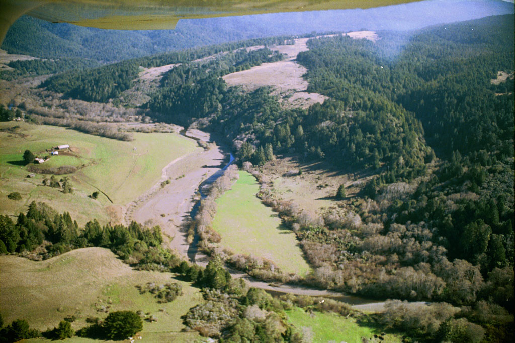