| Area |
Lower Garcia / Estuary |
| Topic |
Tour: River Level #2 Lower Garcia from Conner Hole to Below Bebe Ranch |
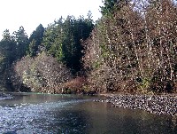
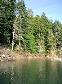
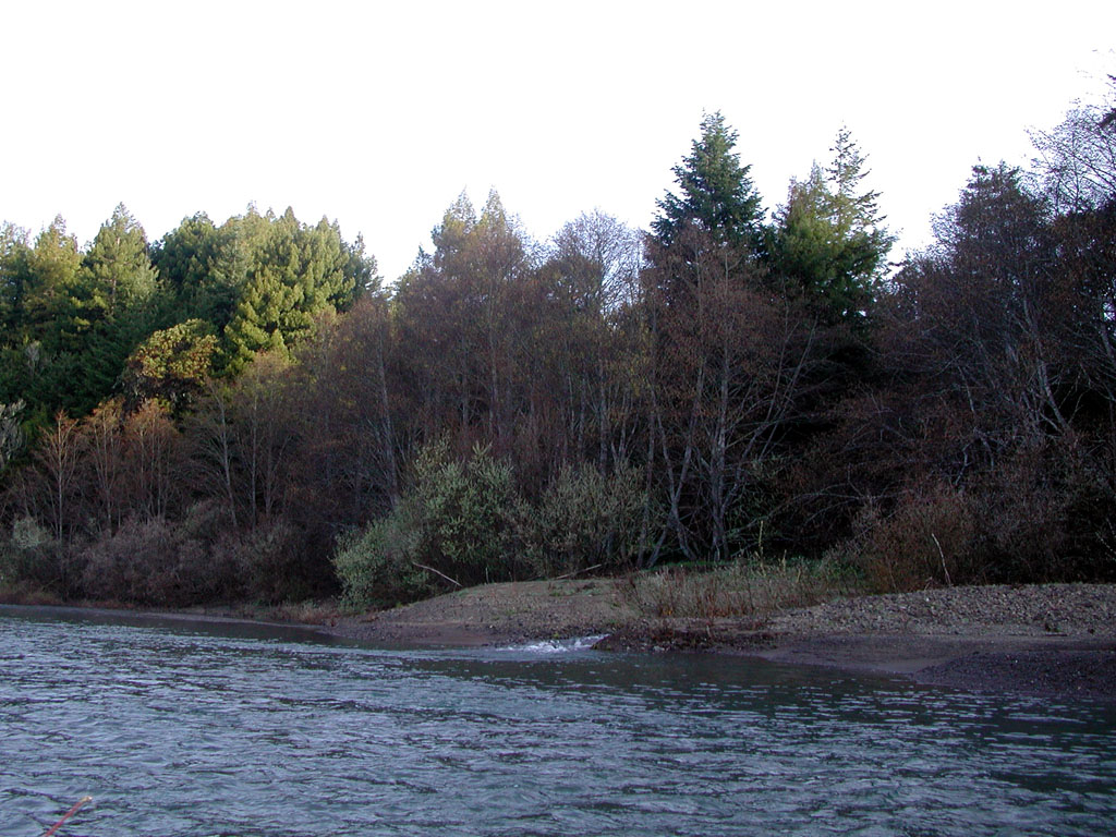
 Click on image to enlarge (178K).
This photo shows the mainstem Garcia River at the lower Conner Hole moving into a riffle on a February morning in 2002. Photo by Pat Higgins.
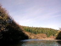
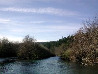
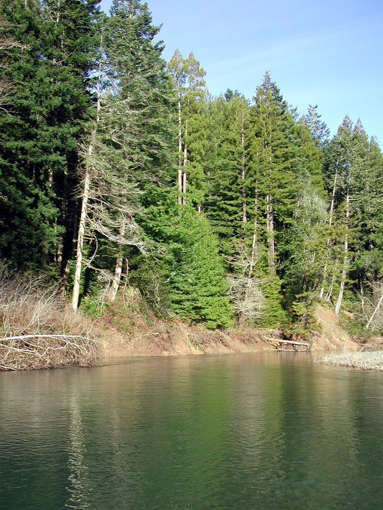
 Click on image to enlarge (36K). Click here to display a larger version (345K).
Looking upstream at the Conner Hole with alder forest overtopped by conifers. This was likely the condition of the Garcia River prior to disturbance, although the redwoods pictured would be another 100 feet taller, if mature. Note the coarse gravel on the terrace, not fine sediment as is typical of many sediment impaired north coast rivers. Photo by Pat Higgins. February 2002.
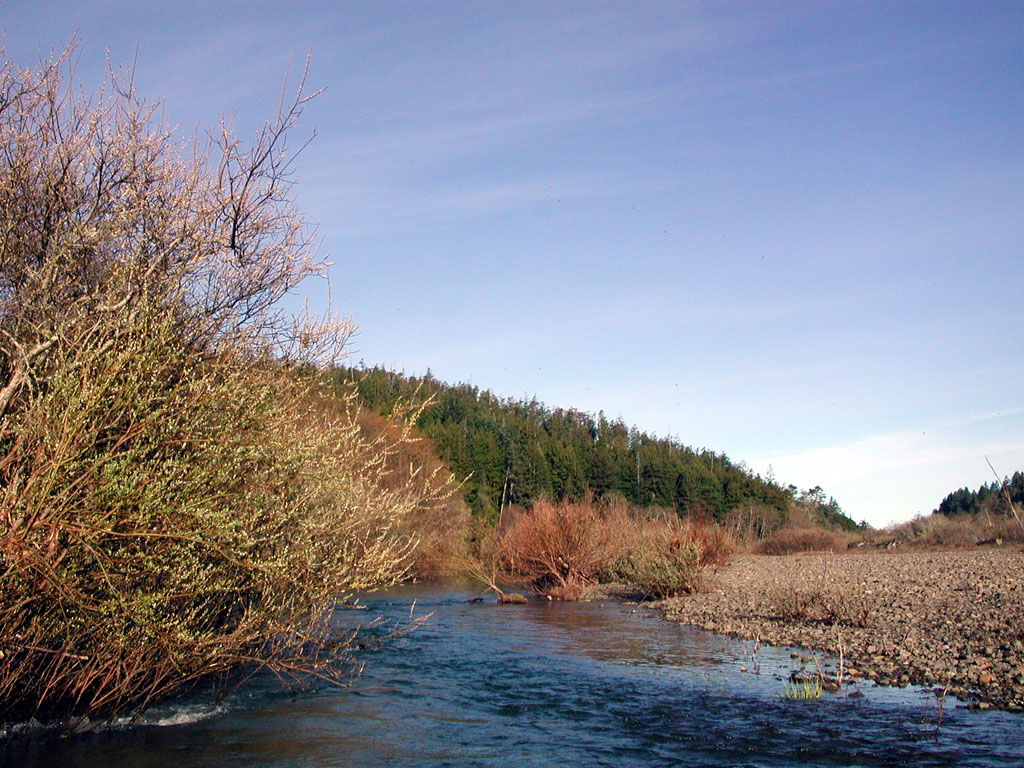
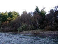 Click on image to enlarge (24K). Click here to display a larger version (235K).
This photo shows Olsen Gulch joining the mainstem Garcia River. Photo by Pat Higgins. February 2002.
 Click on image to enlarge (168K).
This photo was taken looking downstream on the Bebe Ranch with the mainstem Garcia River going into a riffle. Trout Unlimited has been planting the back terraces at this location to try and recruit conifers. There is already a coniferous over-story downstream in the photo. Photo by Pat Higgins. February 2002.
 Click on image to enlarge (27K). Click here to display a larger version (270K).
This is a shot of the Garcia mainstem narrowing into a pool forced by the current off the riparian willow thicket at left on the lower Bebe Ranch. Note the coarse nature of substrate on the gravel terrace at right. Photo by Pat Higgins. February 2002.
 Click on image to enlarge (36K). Click here to display a larger version (330K).
The Redwood Stump Hole on a February 2002 morning. Pool formation on the Garcia is very good with many pools over four feet in depth and some greater than 10 feet deep. Photo by Pat Higgins.
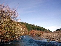
 Click on image to enlarge (19K). Click here to display a larger version (191K).
The Garcia River moves from a pool to a riffle through confining riparian alder and willow. The development of this relatively stable riparian community indicates that bedload is not radically over-supplied. Photo by Pat Higgins. February 2002.
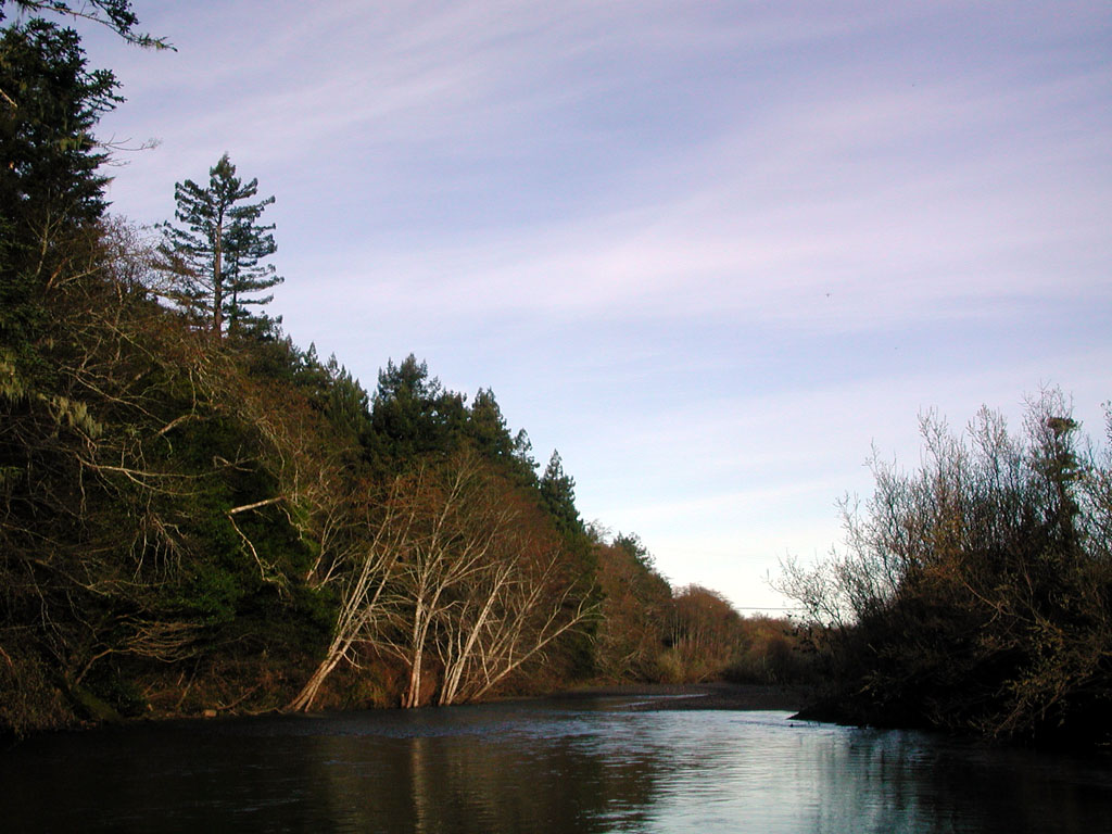
 Click on image to enlarge (40K). Click here to display a larger version (373K).
The Garcia River makes a sharp turn at the Slide Hole. This slide was re-activated recently. Note the geologic contact and seep across the middle of the feature. Photo by Pat Higgins. February 2002.
To learn more about this topic click Info Links
To view additional information (data source, aquisition date etc.) about this page, click Metadata

 Click on image to enlarge (178K).
 Click on image to enlarge (36K). Click here to display a larger version (345K).
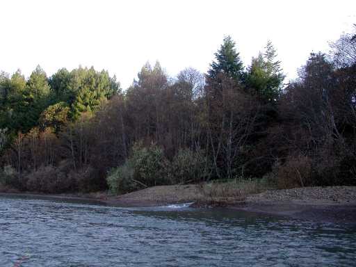 Click on image to enlarge (24K). Click here to display a larger version (235K).
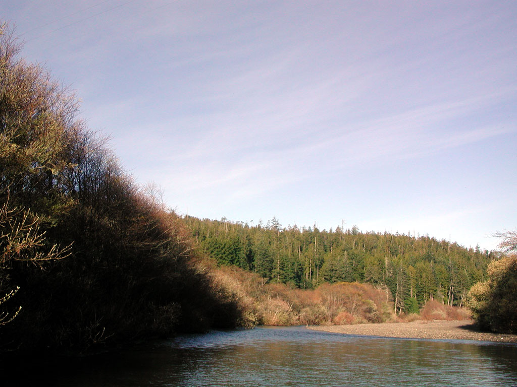 Click on image to enlarge (168K).
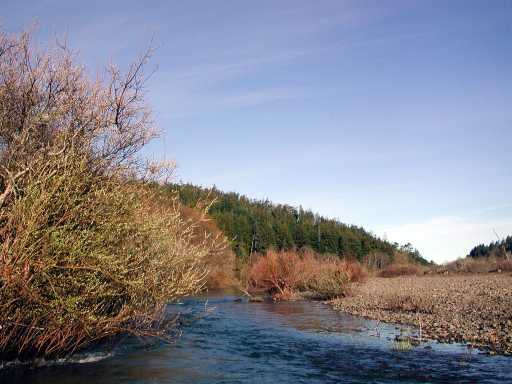 Click on image to enlarge (27K). Click here to display a larger version (270K).
 Click on image to enlarge (36K). Click here to display a larger version (330K).
 Click on image to enlarge (19K). Click here to display a larger version (191K).
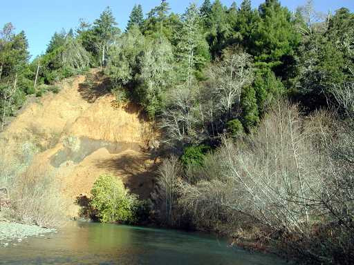 Click on image to enlarge (40K). Click here to display a larger version (373K).
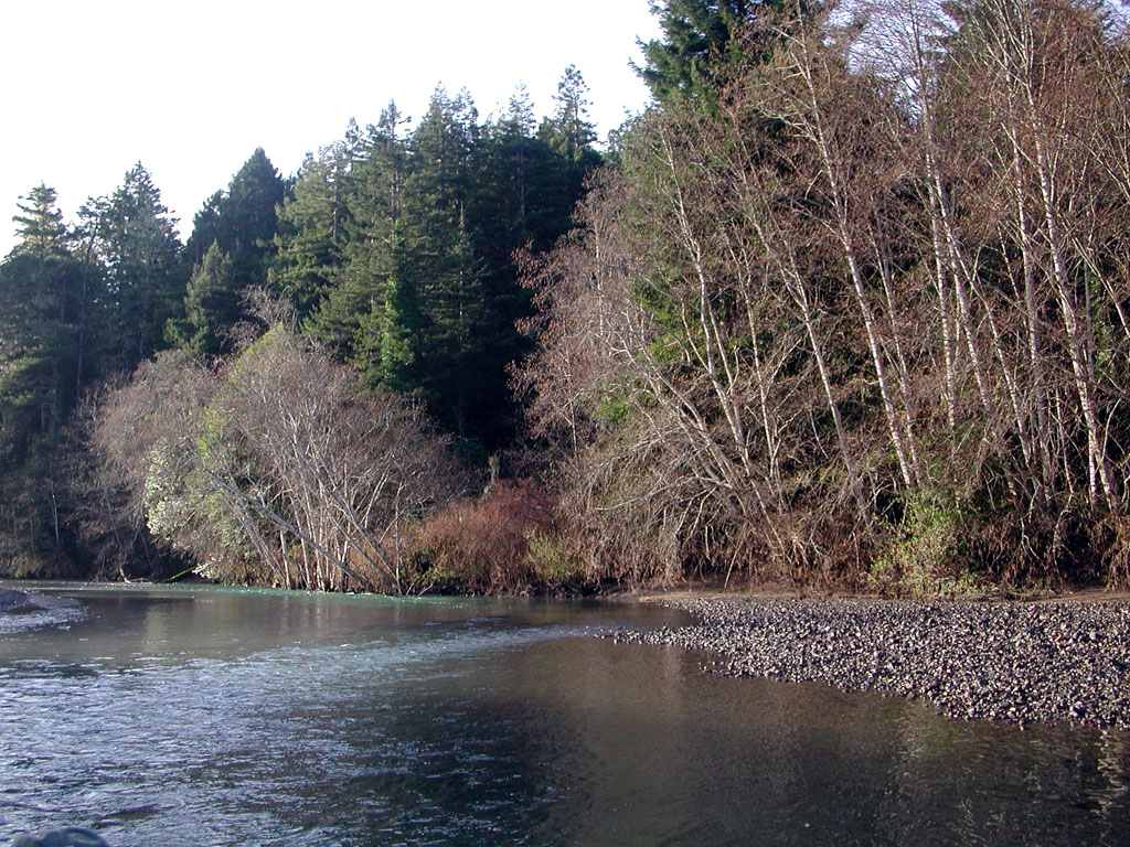