
| Area | Middle Garcia |
| Topic | Stream Channel: Cross-Sections - Garcia at Old Pier, 1993-2002 |
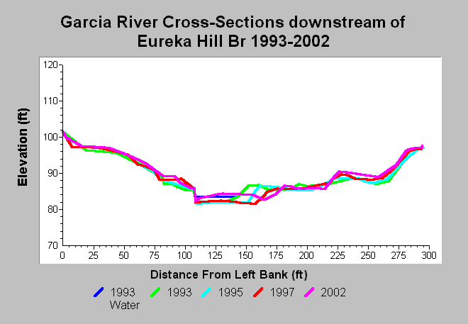
| Caption: This chart shows Garcia River cross-sections surveys conducted at the Old Pier datalogger, located downstream of Eureka Hill Bridge, between 1993 and 2002. The cross-sections show point bar erosion between 1993 and 1997. Significant aggradation at this specific cross section occurred between 1997 and 2002. Data are from Mendocino County Water Agency. See InfoLinks for more information. | |
 |
To learn more about this topic click Info Links .
To view additional information (data source, aquisition date etc.) about this page, click Metadata .
To view the table with the chart's data, click Chart Table web page.
To download the table with the chart's data, click xs_garcia_eurekahill_oldpeir_1993_2002.dbf (size 10,544 bytes) .
| www.krisweb.com |