
| Area | Middle Garcia |
| Topic | Stream Channel: Cross-Sections - Garcia at Salmon, 1993-1998 |
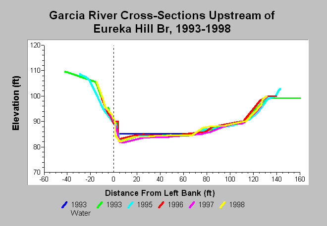
| Caption: This chart shows Garcia River cross-sections surveys conducted at the Salmon data logger, located upstream of Eureka Hill Bridge, between 1993 and 1998. Erosion of the left and right banks occurred between 1996 and 1997. This cross-section shows a dynamic equilibrium, alternating between aggradation and scour. This location has maintained a depth of greater than three feet since 1996, with depths greater than three feet preferred by juvenile salmonids for rearing. Data are from Mendocino County Water Agency. See InfoLinks for more information. | |
 |
To learn more about this topic click Info Links .
To view additional information (data source, aquisition date etc.) about this page, click Metadata .
To view the table with the chart's data, click Chart Table web page.
To download the table with the chart's data, click xs_garcia_eurekahill_salmon_1993_1998.dbf (size 5,923 bytes) .
| www.krisweb.com |