|
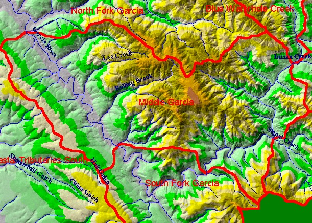
This is a map of the 1:24,000 scale USGS hydrography of the Middle Garcia sub-basin, overlaid on top of an elevation hillshade.
The un-labeled stream north of Lee Creek is the Little North Fork. The unlabeled Garcia tributary south of Rolling Brook is lower
Mill Creek. Listed from downstream to upstream order along the Garcia River beginning at the South Fork Garcia, the tributaries
entering the Garcia River from the north are Beebe Creek, Graphite Creek, and Caspar Creek. Ten meter DEM data for hillshade
were contributed by the California Department of Forestry. Scale = 1:82,686 .
|
|