
|
Area/Topic | Bibliography | Background | Hypotheses | Home |
|
Map Page.
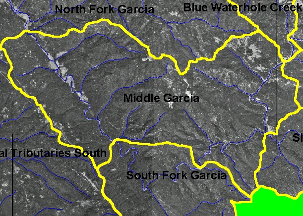
You selected the area Middle Garcia and the topic Map: 3A Digital Orthophotos (DOQs), Middle Garcia Sub-basin |
| This is a map showing digital orthophoto quadrangles (DOQs) in the Middle Garcia sub-basin, which provides a detailed view of the landscape when at a close zoom. At this scale, the wide gravel bar of the river below the South Fork and the natural grasslands at the northeastern boundary (upper right) stand out. Much of the sub-basin is covered with high road densities and early seral-stage forest. Numerous white dots are landings used for logging. The ridge-top bald spots at the middle of the sub-basin are part of a U.S. Air Force station. | |||
|
|
||
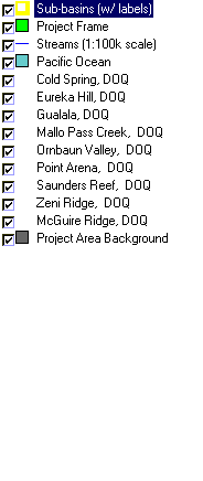
To view metadata about a map layer, click on a link in the table below.
| Name of Layer in Map Legend | Metadata File Name |
|---|---|
| Sub-basins (w/ labels) | subbasins.shp.txt |
| Project Frame | Unavailable |
| Streams (1:100k scale) | streams100.shp.txt |
| Pacific Ocean | Unavailable |
| Cold Spring, DOQ | coldspring.sid.txt |
| Eureka Hill, DOQ | eurekahill.sid.txt |
| Gualala, DOQ | gualala.sid.txt |
| Mallo Pass Creek, DOQ | mallopass.sid.txt |
| Ornbaun Valley, DOQ | ornbaun.sid.txt |
| Point Arena, DOQ | pointarena.sid.txt |
| Saunders Reef, DOQ | saundersreef.sid.txt |
| Zeni Ridge, DOQ | zeniridge.sid.txt |
| Gube Mountain, DOQ | gubemtn.sid.txt |
| McGuire Ridge, DOQ | mcguire.sid.txt |
| Topo Map (1:24k scale)(USGS) | Unavailable |
| Grayscale Hillshade (TIFF) | grayscale.tif.txt |
| Project Area Background | Unavailable |
| www.krisweb.com |