| Area |
Middle Garcia |
| Topic |
Tour: Olsen Gulch Erosion Control Projects by CFL |
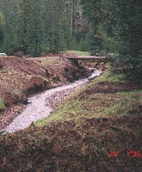 Click on image to enlarge (152K).
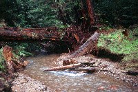
This photo shows a flatcar bridge spanning the channel of Olsen Gulch in the middle of a stream channel restoration project. The stream here was formerly disrupted by fill from a landing likely placed shortly after World War II. Jack Monschke directed excavation of 50,000 cubic yards of material and re-contoured the stream channel under contract to Coastal Forest Lands, Inc.
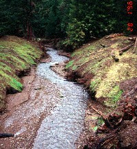
 Click on image to enlarge (168K).
Looking upstream on Olsen Gulch, large wood in the excavated stream channel begins the process of pool formation. More than 50,000 cubic yards of soil was excavated from the site as a whole. Jack Monschke, consultant to CFL and project director, is on the left with CDF inspector. Photo provided by Holly Lundborg of the North Coast Regional Water Quality Control Board. See InfoLinks for more information.
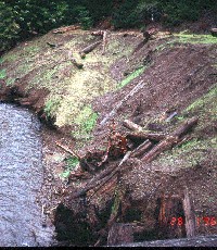
 Click on image to enlarge (161K).
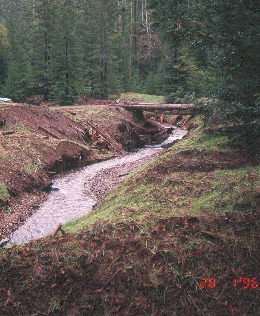
This photo was taken looking downstream on Olsen Gulch in the middle of the restoration project. The height of former fill is apparent in the photo. The stream bed remains fine, so there is no assurance that it has fully established a new grade. Project done by Jack Monschke for Coastal Forest Lands, Inc. Photo provided by Holly Lundborg of the North Coast Regional Water Quality Control Board.
 Click on image to enlarge (65K). Click here to display a larger version (200K).
This close up of the right bank looking downstream on Olsen Gulch shows large wood from the excavated fill left in the channel or placed on the slopes to help prevent gully and sheet erosion. Project done by Jack Monschke for Coastal Forest Lands, Inc. Photo provided by Holly Lundborg of the North Coast Regional Water Quality Control Board.
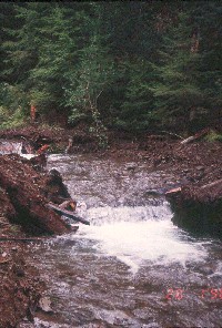 Click on image to enlarge (143K).
Large wood left after excavation of fill from an old landing was placed so as to constrict the channel of Olsen Gulch and to create scour below the spanning log. Project done by Jack Monschke for Coastal Forest Lands, Inc. Photo provided by Holly Lundborg of the North Coast Regional Water Quality Control Board.
 Click on image to enlarge (165K).
This structure is very similar to the one shown in Picture #6, with large wood from the excavated landing fill used to create a drop structure in the bed of Olsen Gulch. Project done by Jack Monschke for Coastal Forest Lands, Inc. Photo provided by Holly Lundborg of the North Coast Regional Water Quality Control Board.
 Click on image to enlarge (169K).
Spanning logs create drops and help scour pools, but "digger logs" placed vertically along the stream banks may be too short to remain stable and to fulfill a similar function. Olsen Gulch project done by Jack Monschke for Coastal Forest Lands. Photo provided by Holly Lundborg of the North Coast Regional Water Quality Control Board.
 Click on image to enlarge (158K).
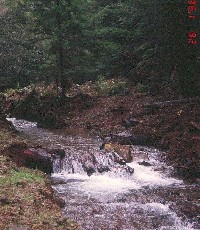
This photo was taken looking downstream on Olsen Gulch from a restoration site, where an old landing had buried the stream. The embedded wood sticking out of the stream indicates that the disturbed area was a legacy problem from post WW II logging. Photo provided by Holly Lundborg of the North Coast Regional Water Quality Control Board.
To learn more about this topic click Info Links
To view additional information (data source, aquisition date etc.) about this page, click Metadata

 Click on image to enlarge (152K).
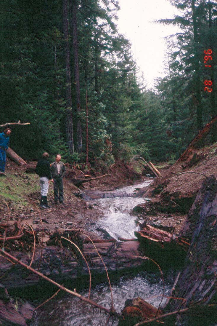 Click on image to enlarge (168K).
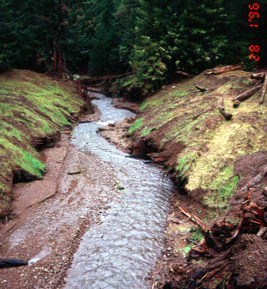 Click on image to enlarge (161K).
 Click on image to enlarge (65K). Click here to display a larger version (200K).
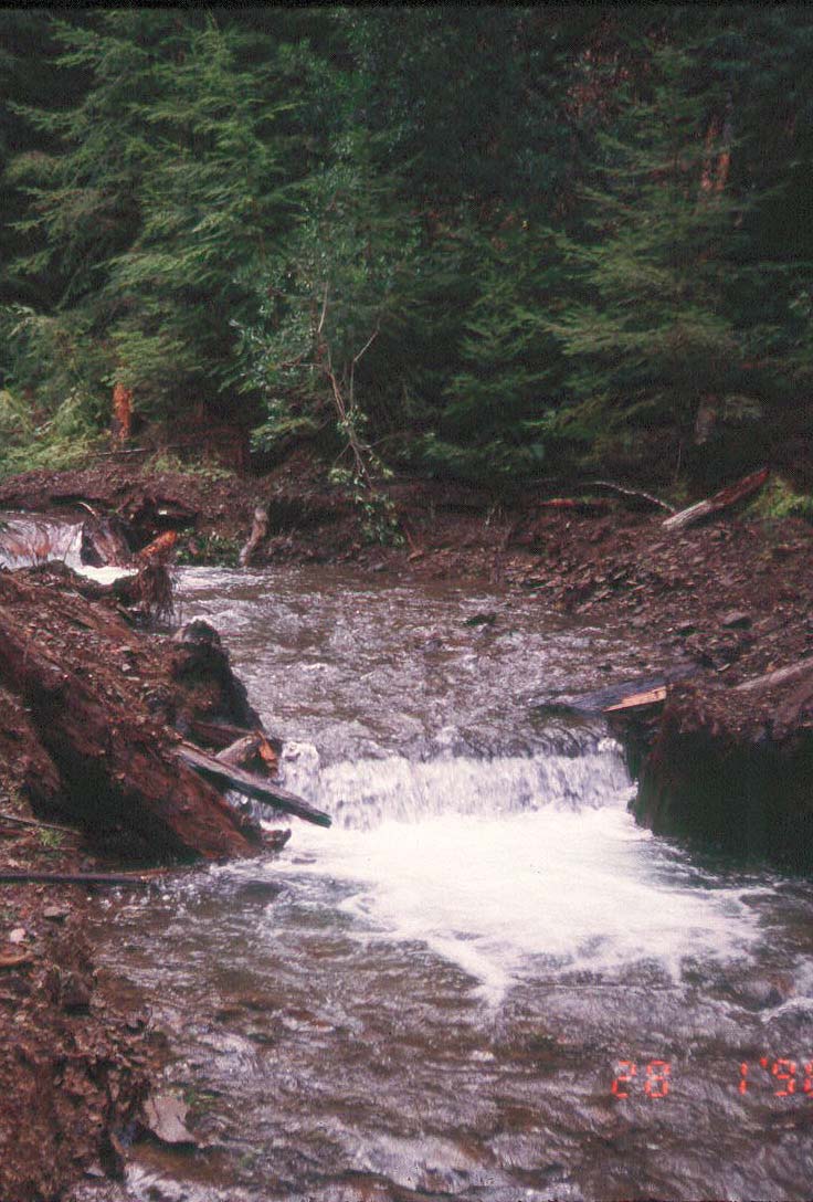 Click on image to enlarge (143K).
 Click on image to enlarge (165K).
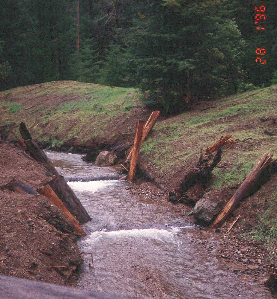 Click on image to enlarge (169K).
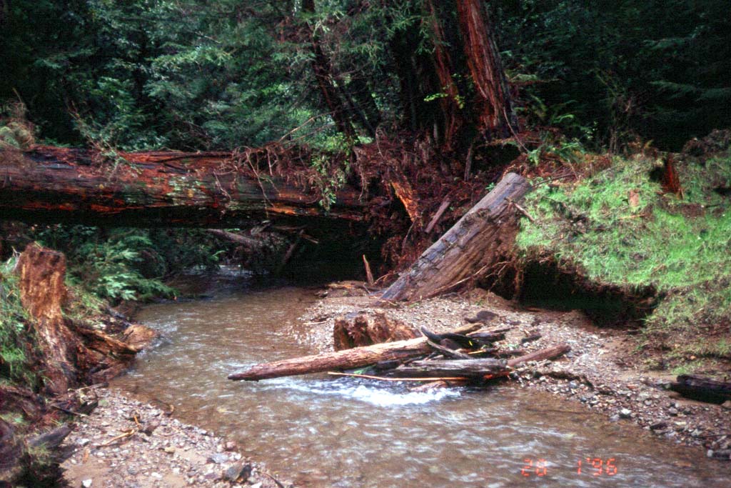 Click on image to enlarge (158K).
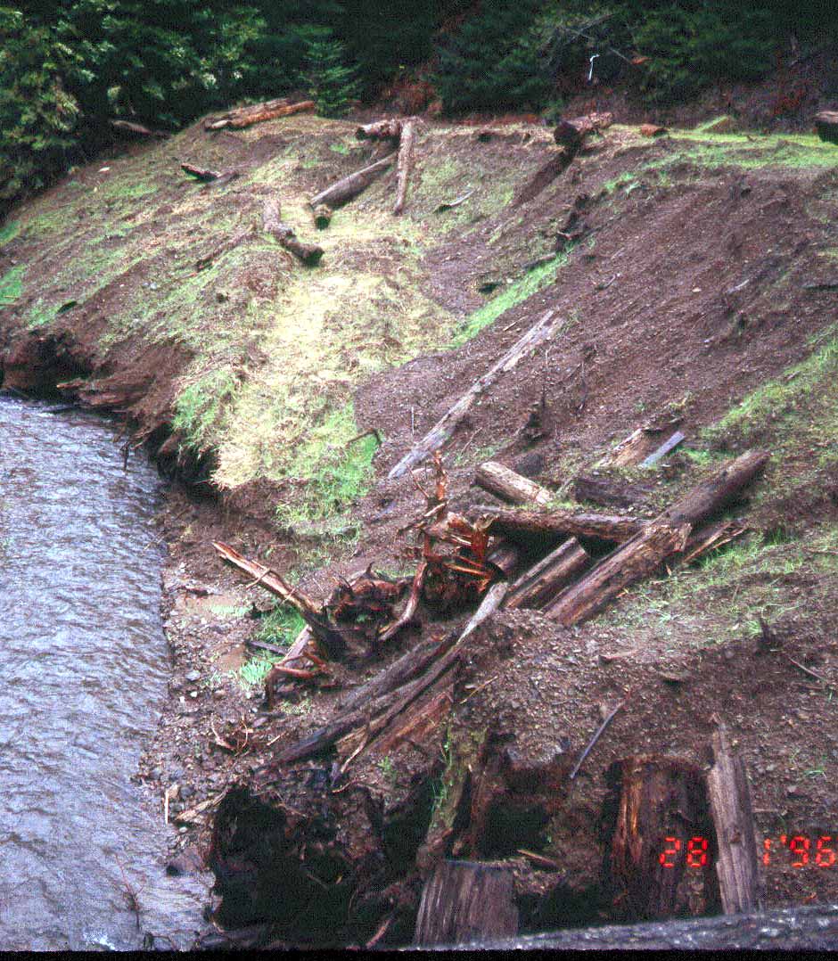