
| Area | Mill/Pardaloe Creeks |
| Topic | Climate: Annual Rainfall - Yorkville, 1941-2000 |
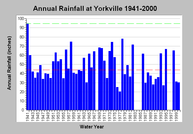
| Caption: This chart shows annual rainfall accumulation recorded at the Yorkville rain gage (DWR # F80 9851 00) between 1941 and 2000, missing water years 1968, 1983-1985 and 1996-1997. Rainfall measurements are by water year (Oct 1- Sept 30). For the period of record, the minimum total rainfall accumulation occurred in 1977 (20.30 inches) and the maximum during 1941 (94.70 inches). The latter is shown as a dashed green line while the median rainfall of approximately 44 inches is shown as a dashed red line. Data are compiled by the California Department of Water Resources. See InfoLinks for more information. | |
 |
To learn more about this topic click Info Links .
To view additional information (data source, aquisition date etc.) about this page, click Metadata .
To view the table with the chart's data, click Chart Table web page.
To download the table with the chart's data, click climate_rainfall_annual_yorkville.dbf (size 1,238 bytes) .
| www.krisweb.com |