| Area | Mill/Pardaloe Creeks |
| Topic | Habitat: Habitat Categories by Length Pardaloe Cr 1991 |
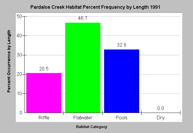
| Caption: This chart shows the results of a 1991 Pardaloe Creek habitat typing survey with relative lengths of pools, riffles and runs (flatwater), and dry reaches of stream displayed. Flatwater habitats were the most common and pool frequency by length was 33%, less than optimal for salmonid habitat (CDFG, 1998). Data collected as part of Garcia River Watershed Enhancement Plan (Mendocino County Resource Conservation District, 1992). See InfoLinks for more information. | |
 |
To learn more about this topic click Info Links .
To view additional information (data source, aquisition date etc.) about this page, click Metadata .
To view the table with the chart's data, click Chart Table web page.
To download the table with the chart's data, click habtype_freqbylen_pardaloe_nf_lowgar_1991.dbf (size 354 bytes) .
| www.krisweb.com |
