
| Area | Mill/Pardaloe Creeks |
| Topic | Habitat: Percent Canopy Type for Pardaloe Creek 1991 |
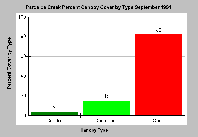
| Caption: The chart above shows the results of a September 1991 Pardaloe Creek habitat typing survey as the type of canopy cover over the stream. Canopy is measured with a densiometer from the center of the stream. Data indicate 82% of habitats surveyed along Pardaloe Creek lacked any shade, while 15% were shaded by deciduous trees but only 3% by conifers. Data collected as part of Garcia River Watershed Enhancement Plan (Mendocino County Resource Conservation District, 1992). See InfoLinks for more information. | |
 |
To learn more about this topic click Info Links .
To view additional information (data source, aquisition date etc.) about this page, click Metadata .
To view the table with the chart's data, click Chart Table web page.
To download the table with the chart's data, click hab_can_gar_all.dbf (size 521 bytes) .
| www.krisweb.com |