

|
Area/Topic | Bibliography | Background | Hypotheses | Home |
|
Map Page.
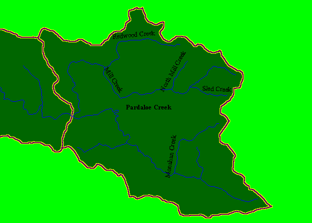
You selected the area Mill/Pardaloe Creeks and the topic Map: 1A Calwater Planning Watersheds, Mill/Pardaloe Cr Sub-basin |
| This is a map of the Calwater Planning Watersheds (purple outlines with black labels) and USGS hydrography and it shows the area in the KRIS Mill/Pardaloe sub-basin, which coincides with the Pardaloe Creek Calwater. Mill Creek is the upper main tributary and Pardaloe Creek is the lower. They join to form the Garcia River at the western boundary of this sub-basin. Calwaters from the California Department of Forestry and stream data are from the U.S. Geological Survey. Scale = 1:75,911 . | |||
|
|
||
To view metadata about a map layer, click on a link in the table below.
| Name of Layer in Map Legend | Metadata File Name |
|---|---|
| Streams (USGS 1:100) | streams100.shp.txt |
| Calwater PWS (small labels) | calw22.shp.txt |
| Sub-basins (no labels) | subbasins.shp.txt |
| Project Frame | Unavailable |
| www.krisweb.com |