|
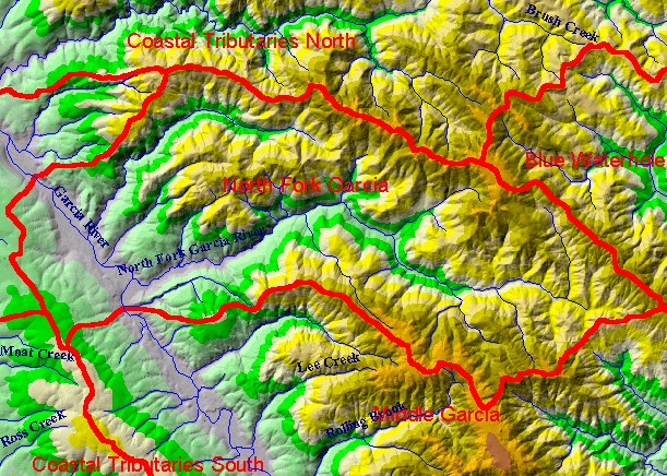
This is a map of the 1:24,000 scale USGS hydrography in the North Fork Garcia KRIS sub-basin, overlaid on top of an elevation
hillshade. The boundaries of this sub-basin follow exactly the NF Garcia Calwater Planning Watershed. The un-labeled tributary at
the north edge of the sub-basin is Olsen Gulch, which feeds the mainstem Garcia River reach that falls within this sub-basin. The
un-labeled tributary between Olsen Gulch and the North Fork Garcia River is Olsen Creek. The 10 Meter DEM data on which the
hillshade is based is from the California Department of Forestry. Scale = 1:78,892 .
|
|