|
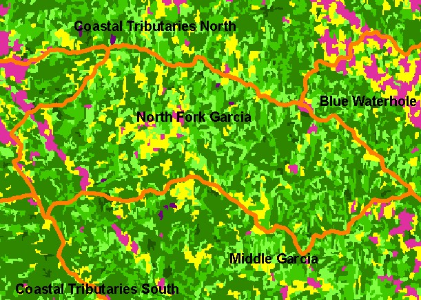
This is a map of 1994 vegetation size data in the North Fork Garcia sub-basin, overlaid on top of KRIS sub-basins, Calwater
Planning Watersheds and 1:24,000 streams. The tree size classifications were derived from Landsat multi-spectral images taken in
1994. Stand conditions are accurately represented at the one hectare scale. The small diameter tree size indicates early seral
stage conditions in much of the sub-basin, reflecting recent timber harvest. The Garcia River mainstem (western part of Calwater/
at left) shows up as non-forest, but that is more related to the wide gravel bar and not recent logging. Data were provided by the
U.S. Forest Service Pacific Southwest Region Remote Sensing Lab, in cooperation with the California Department of Forestry.
|
|