
|
Area/Topic | Bibliography | Background | Hypotheses | Home |
|
Map Page.
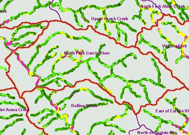
You selected the area North Fork Garcia and the topic Map: 1E USFS Riparian Veg Size, North Fork Garcia Sub-basin |
| This is a map of vegetation size data within 90-meter riparian buffer zones in the North Fork Garcia sub-basin. The tree size classifications were derived from Landsat multi-spectral images taken in 1994. Stand conditions are accurately represented at the one hectare scale. While the non-forest signature of the mainstem Garcia River bed to the west is due to bar width, the small diameter tree size in the North Fork Garcia riparian zone reflect recent timber harvest. Data were provided by the U.S. Forest Service Pacific Southwest Region Remote Sensing Lab, in cooperation with the California Department of Forestry. Available layers include Vegetation Size, Topographic Map, Grayscale Hillshade, and Change in Vegetation (1994-1998). Scale = 1:81,568 . | |||
|
|
||
To view metadata about a map layer, click on a link in the table below.
| Name of Layer in Map Legend | Metadata File Name |
|---|---|
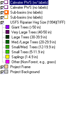
| Calwater PWS (w/ labels) | calw22.shp.txt |
| Calwater PWS (no labels) | calw22.shp.txt |
| Sub-basins (no labels) | subbasins.shp.txt |
| Sub-basins (no labels) | subbasins.shp.txt |
| Change in Vegetation (1994-98)(TIFF) | vegchg.tif.txt |
| USFS Riparian Veg Size (1994)(TIFF) | vegsizebuf.tif.txt |
| USFS Vegetation Size (1994)(TIFF) | vegsize.tif.txt |
| Project Frame | Unavailable |
| Topo Map (1:24k scale)(USGS) | Unavailable |
| Grayscale Hillshade (TIFF) | grayscale_light.tif.txt |
| Project Background | Unavailable |
| www.krisweb.com |