|
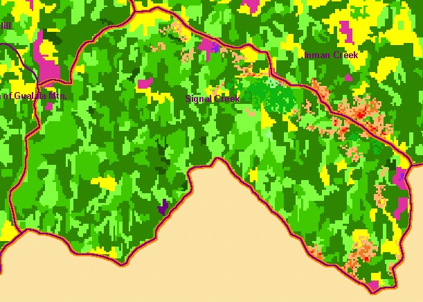
This is a map of 1994 vegetation size data in the Signal Creek sub-basin, with USGS 1:24,000 streams and the 1994 to 1998 change
scene detection. The tree size classifications were derived from Landsat multi-spectral images taken in 1994. Stand conditions are
accurately represented at the one hectare scale. The small diameter tree size indicates early seral stage conditions in much of the
sub-basin, reflecting a recent fire and timber harvest, as there are no natural grasslands in this sub-basin area except along the
eastern border. The change scene detection shows vegetation changes in that period according to comparison of Landsat images.
Data were provided by the U.S. Forest Service Pacific Southwest Region Remote Sensing Lab and the California Department of
Forestry.
|
|