|
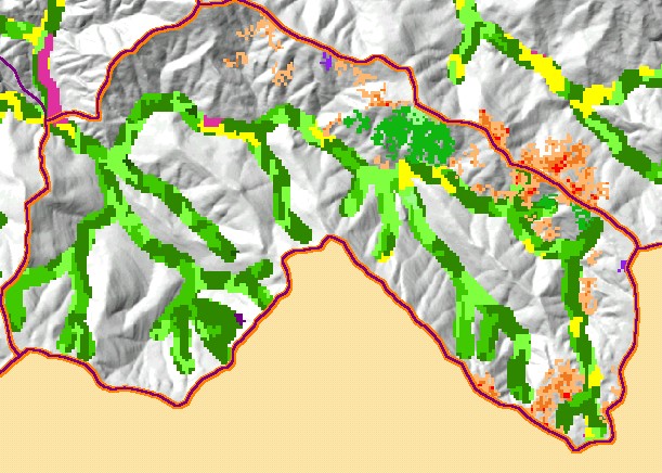
This is a map of vegetation size data within 90-meter riparian buffer zones in the Signal Creek sub-basin with USGS 1:24,000
streams, a Grayscale Hillshade and 1994 to 1998 change scene detection. The tree size classifications were derived from Landsat
multi-spectral images taken in 1994. Stand conditions are accurately represented at the one hectare scale. The small diameter tree
size indicates early seral stage conditions in much of the riparian zones in the sub-basin, which is in part owing to recent timber
harvests. The change scene detection shows vegetation changes between 1994 and 1998 according to comparison of Landsat
images. Data were provided by the U.S. Forest Service Pacific Southwest Region Remote Sensing Lab and the California
Department of Forestry. Available layers include Vegetation Size, Topographic Map, and Change in Vegetation (1994-1998). Scale = 1:40,916 .
|
|