|
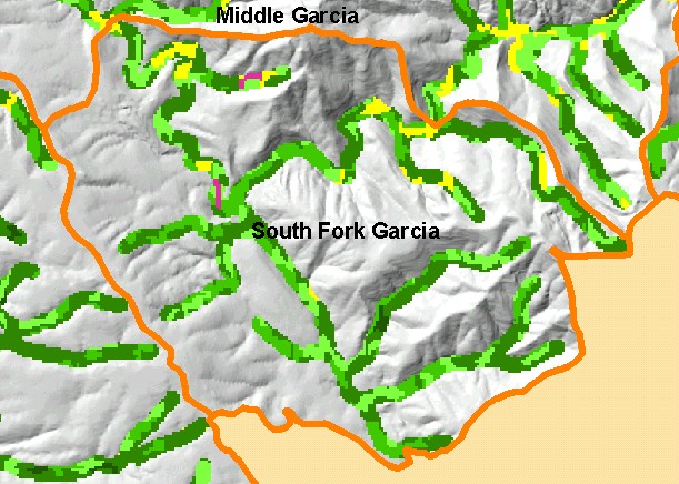
This is a map of vegetation size data within 90-meter riparian buffer zones in the South Fork Garcia sub-basin, displayed with KRIS
sub-basins and a grayscale hillshade. The tree size classifications were derived from Landsat multi-spectral images taken in 1994.
Stand conditions are accurately represented at the one hectare scale. The small diameter tree size indicates mid and early seral
stage conditions in much of the riparian zones in the sub-basin, reflecting timber harvest over the last 25 years. Data were
provided by the U.S. Forest Service Pacific Southwest Region Remote Sensing Lab, in cooperation with the California Department
of Forestry. Available layers include Vegetation Size, Topographic Map, and Change in Vegetation (1994-1998). Scale = 1:48,818 .
|
|