|
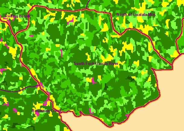
This is a map of 1994 vegetation size data in the South Fork Garcia sub-basin, overlaid on top of KRIS sub-basins, Calwater
Planning Watersheds and 1:24,000 streams. The tree size classifications were derived from Landsat multi-spectral images taken in
1994. Stand conditions are accurately represented at the one hectare scale. The small diameter tree size indicates early seral stage
conditions in much of the sub-basin, reflecting timber harvest in the last twenty five years. Data were provided by the U.S. Forest
Service Pacific Southwest Region Remote Sensing Lab, in cooperation with the California Department of Forestry. Click the
check box next to a layer to toggle it on/off. Available layers include Riparian Vegetation Size, Topographic Map, Grayscale
Hillshade, and Change in Vegetation (1994-1998). Scale = 1:49,048 .
|
|