
| Area | South Fork Garcia |
| Topic | Tour: South Fork PWA/MRC Road Decommissioning (TU NC Coho Project) |
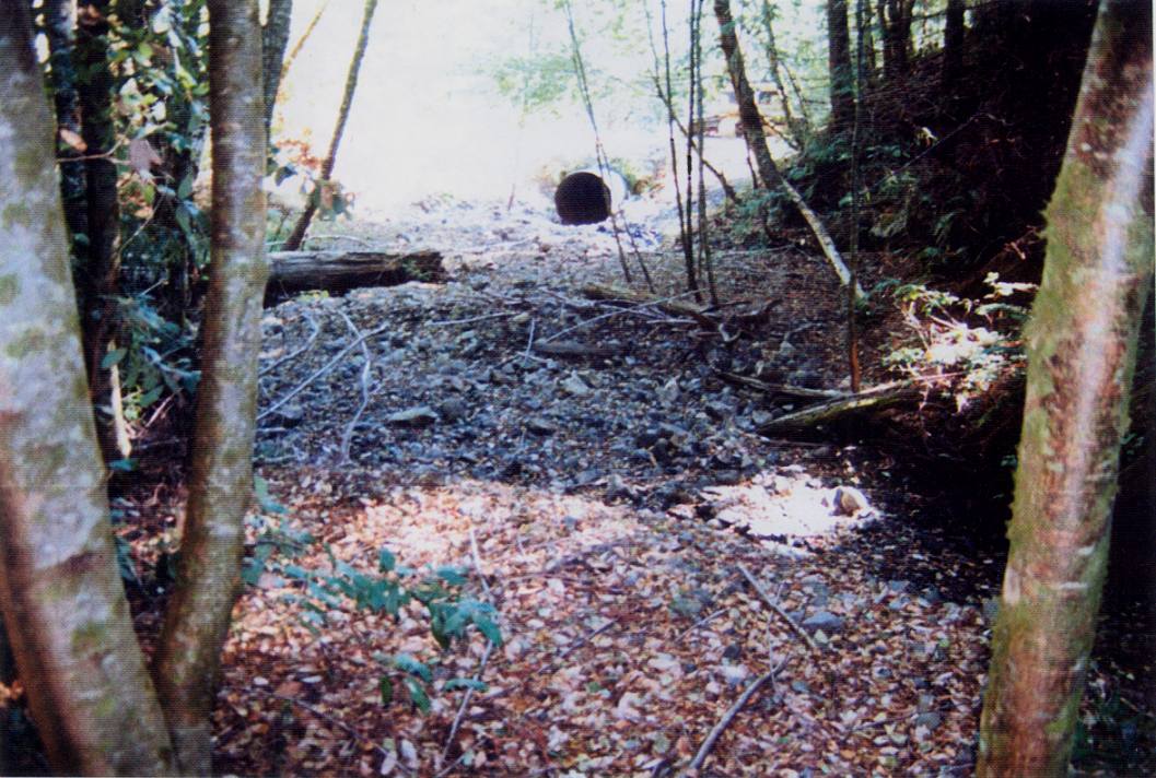
Before photo of site conditions looking downstream across large plain of channel stored sediment, with undersized 6 foot diameter culvert under the roadway. See Picture #2 for an "after" shot. The project involved road related erosion control on Mendocino Redwood Company land with work completed by Pacific Watershed Associates and work partially funded by the California Department of Fish and Game. This Picture is from Figure 1 in PWA (2001) and shows Site 50, G-006 Road.
After photo looking downstream from the same location as Picture #1. All channel stored sediment and the culvert crossing have been excavated, and a flatcar bridge has been installed. The bridge was purchased with contributions from the Mendocino County Resource Conservation District. Picture is from Figure 2 in PWA (2001) and shows Site50_G006.
View looking down the road before erosion control efforts, which was later decommissioned (see Picture#4). The road bed in the middle portion of the photo between the cutbank and the twin redwoods in the distance has been constructed in a Class II stream bed. The project involved road related erosion control on Mendocino Redwood Company land with work completed by Pacific Watershed Associates partial funding by the California Department of Fish and Game. Picture is from Figure 3 in PWA (2001) and shows Site 13, B-Line.
After treatment photo taken from the same location when the road bed has been decommissioned and a new 1000 foot section of no impact road has been constructed.(not shown in photo) to bypass this reach of road. The road was "put to bed" by excavating sidecast fill and outsloping the road. In the middle portion of the photo natural stream channel capacity has been re-established. Picture is from Figure 4 in PWA (2001) and shows Site 13, B-Line.
View upstream at the same reach of road seen in figures 3 and 4 (Pictures #3-4). The truck in the distance is at the photo point where Figures 3 and 4 were taken. The natural stream channel flows forward the camera and is significantly constricted by introduced road fill and slash. See Picture #6 to see how this site was fixed. The project involved road related erosion control on Mendocino Redwood Company land with work completed by Pacific Watershed Associates with partial funding by the California Department of Fish and Game. Picture is from Figure 5 in PWA (2001) and shows Site 13, B-Line.
After treatment photo illustrating the application of in-place outsloping to remove a road at the same location as Picture #5. The natural stream channel has been reconstructed by removing all man introduced fill and slash, and now has a 6 foot wide channel bed designed to convey peak flood flows with minimal future erosion. Picture is from Figure 6 in PWA (2001) and shows Site 13, B-Line.
Before photo of road reach which exhibits unstable fill slopes between the orange flagging to the person in the photo (see PIcture #8 for after). A main fish bearing tributary to the South Fork Garcia is located 75 feet downslope of the road, and the potential fill failure was determined to have a risk of delivering some sediment to the stream. Danny Hagans of Pacific Watershed Associates is in the distance doing final planning. Picture is also Figure 7 in PWA (2001) and shows Site 94, G-005-01 Road.
After treatment photograph from the same location as Picture #7. The unstable fill slope has been excavated beyond the orange flagging and the spoil material has been placed on the stable portion of the road bed with a prominent outslope. Note how the spoil material now extends to the base of the small conifer on the cutbank in the middle of the photo (the spoil material is nearly 3 feet deep at the former inboard edge of the road). A sizeable cross-road drain has been constructed in the foreground of the photo to disperse road runoff. Picture is from Figure 8 in PWA (2001) and shows Site 94, G-005-01 Road.
 Click on image to enlarge (150K).
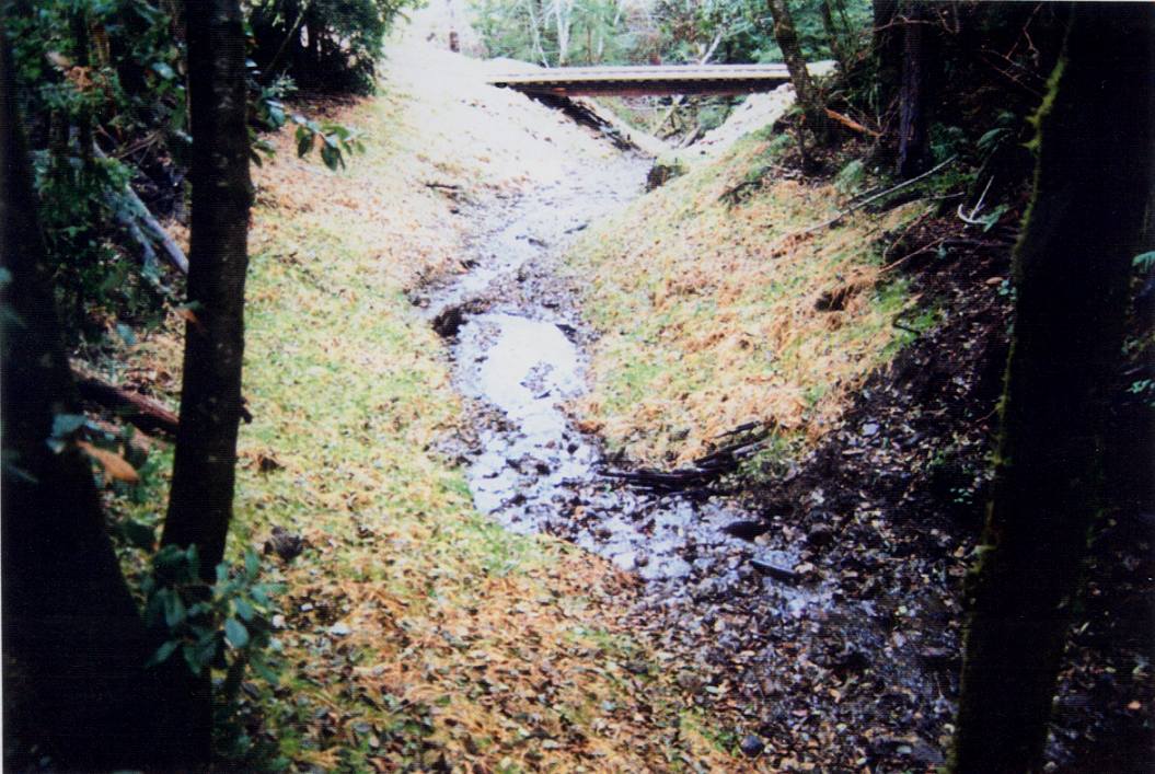 Click on image to enlarge (142K).
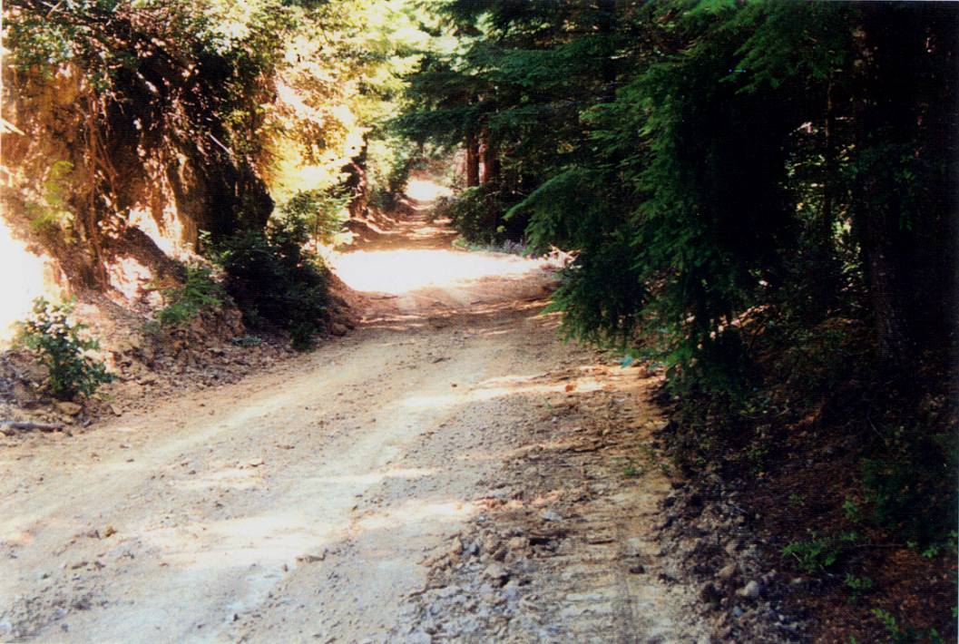 Click on image to enlarge (143K).
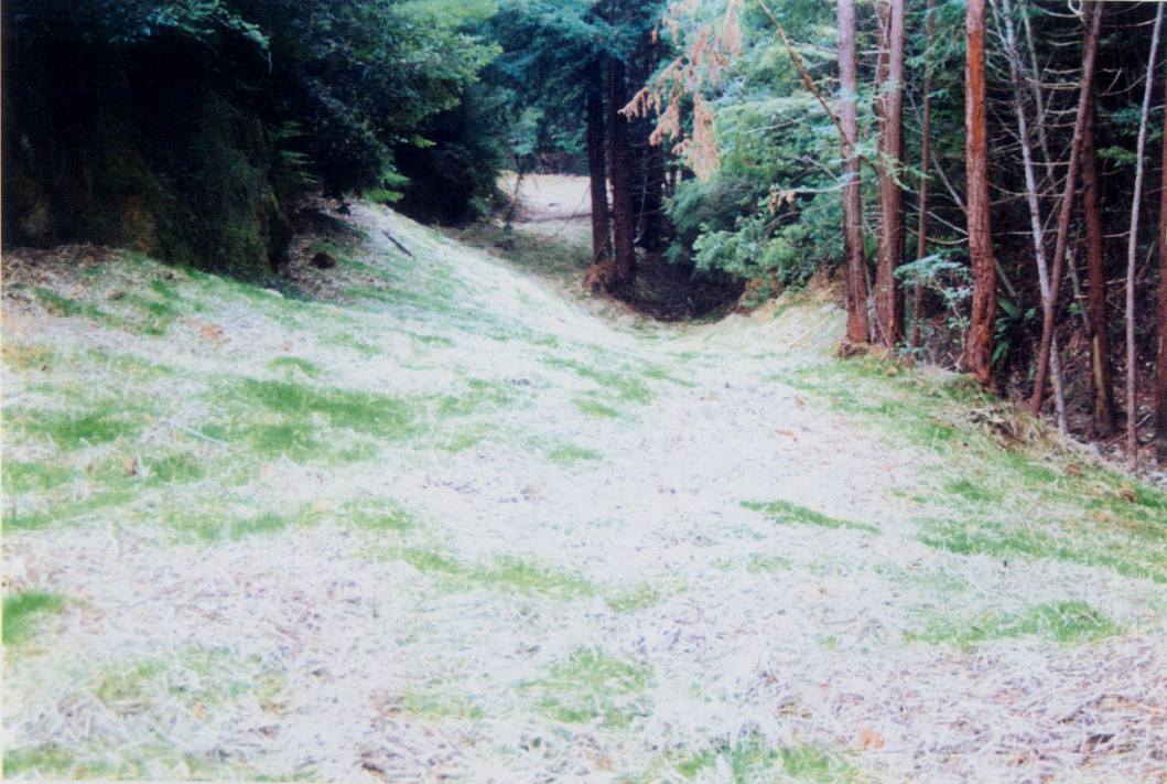 Click on image to enlarge (123K).
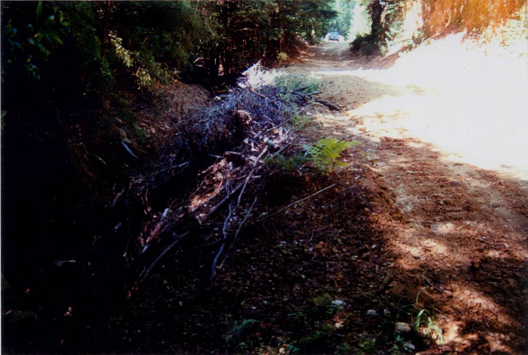 Click on image to enlarge (109K).
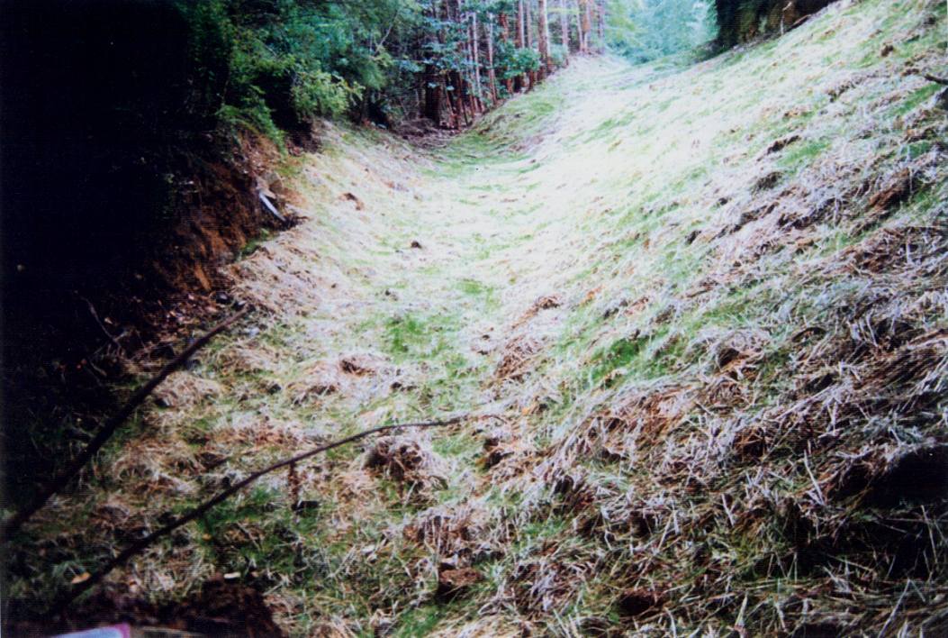 Click on image to enlarge (152K).
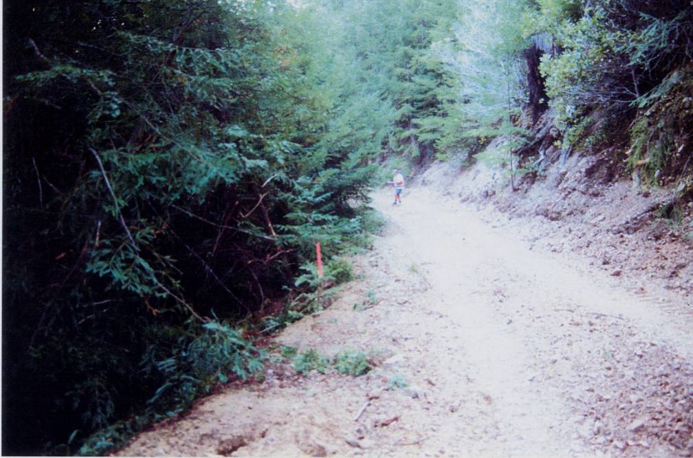 Click on image to enlarge (113K).
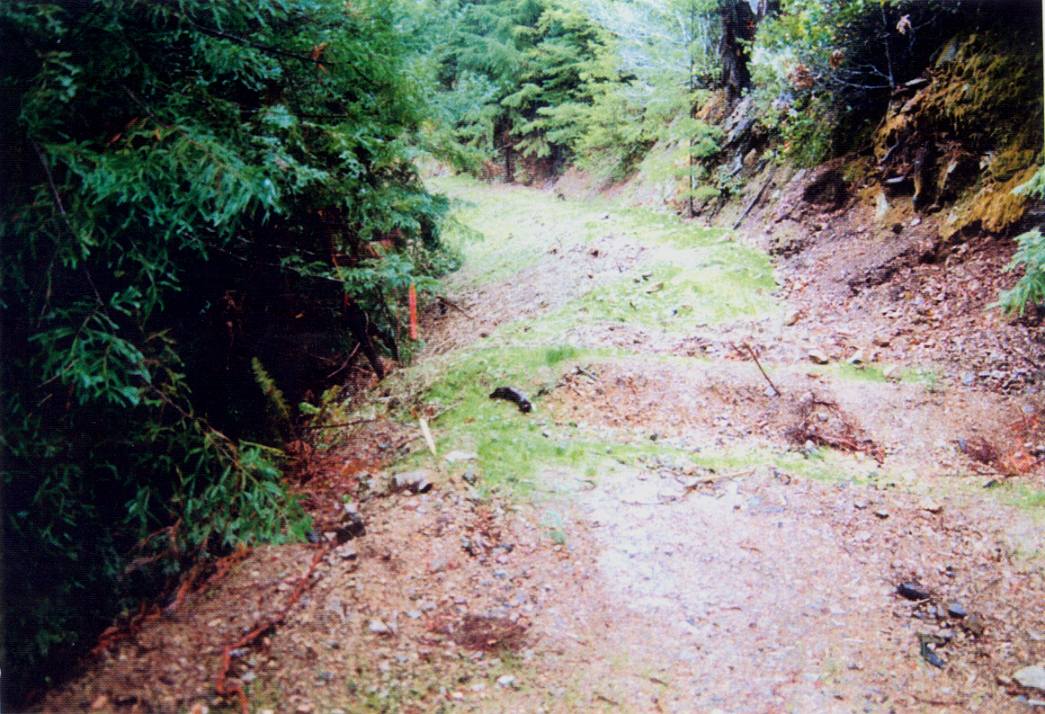 Click on image to enlarge (146K).
To learn more about this topic click Info Links
To view additional information (data source, aquisition date etc.) about this page, click Metadata
| www.krisweb.com |