
| Area | South Fork Garcia |
| Topic | Tour: South Fork PWA/MRC Road Decommissioning (TU NC Coho Project) #2 |
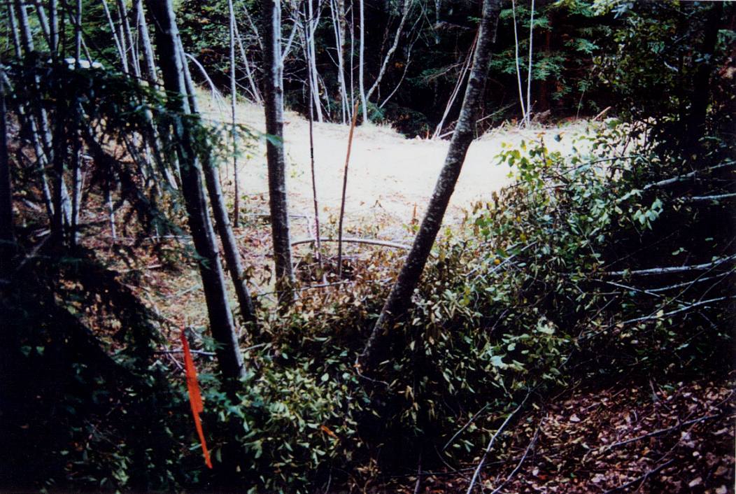
Before photo looking downstream at a large stream crossing to be decommissioned or properly pulled (see Picture #2). Prior to opening the road to vehicular access, the road was completely overgrown with similarly sized alder which are visible in the photo. The crossing fill was eroding annually as a result of a plugged culvert. Future erosion at the site was estimated to be 25 cubic yards. This TU North Coast Coho project involved road related erosion control on Mendocino Redwood Company land with work completed by Pacific Watershed Associates partial funding by the California Department of Fish and Game. This picture is from Figure 9 in PWA (2001) and shows Site 100, G-005-01 Road.
After treatment photo looking downstream at the same location as Picture #1. Note the orange flagging, redwood branch and leaf litter in the foreground denote the same location. The excavation involved removing over 900 yds3 of fill from the stream crossing. The formerly buried stump helped to define the fill versus native soil material boundary. The channel has a 5 foot wide stream bed and 2:1 side slopes designed to accommodate peak flood flows. Picture is from Figure 10 in PWA (2001) and shows Site 100, G-005-01 Road.
After photograph of section of road which has had unstable fill material excavated and replaced with an outslope along the base of the cutbank. The unstable fill, which posed a risk of sediment delivery to the stream down to the left, extended out to the top of the stump prior to the excavation. This TU North Coast Coho project involved road related erosion control on Mendocino Redwood Company land with work completed by Pacific Watershed Associates partial funding by the California Department of Fish and Game. Picture is from Figure 11 in PWA (2001) and shows Site 99, G005-01 Road.
This after photograph exhibits the same treatment as in Figure 11 (Picture #3) (i.e. excavating unstable fill material along the outside edge of the road), except for the road was not decommissioned but retained for future use. The fill material was excavated and loaded into dump trucks to be hauled to a stable location down the road for permanent storage. In upgrading the road, the road width was lessened, the inboard ditch was filled and eliminated, the road was re-shaped to exhibit a mild outslope with no berms, and periodic rolling dips were constructed along the road bed to ensure dispersed road runoff. Note the rolling dip a bout 60 feet behind the truck. Picture is from Figure 12 in PWA (2001) and shows Site 106, G-005-01 Road
 Click on image to enlarge (162K).
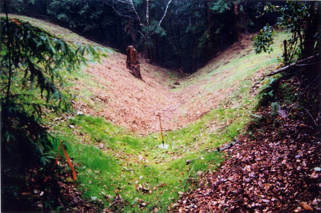 Click on image to enlarge (157K).
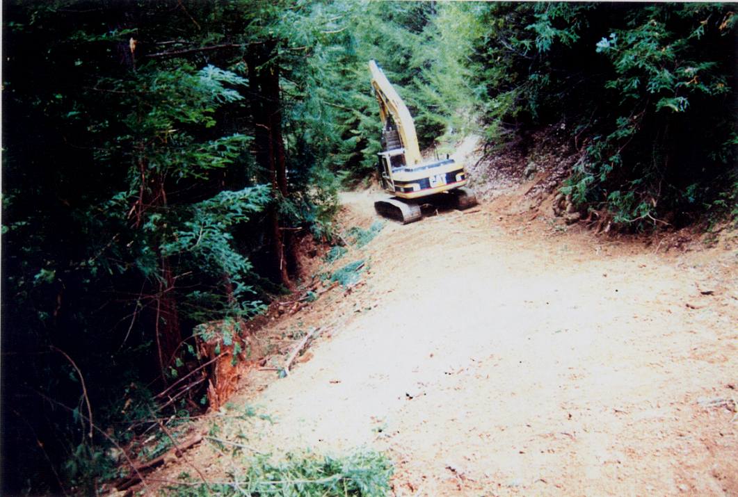 Click on image to enlarge (125K).
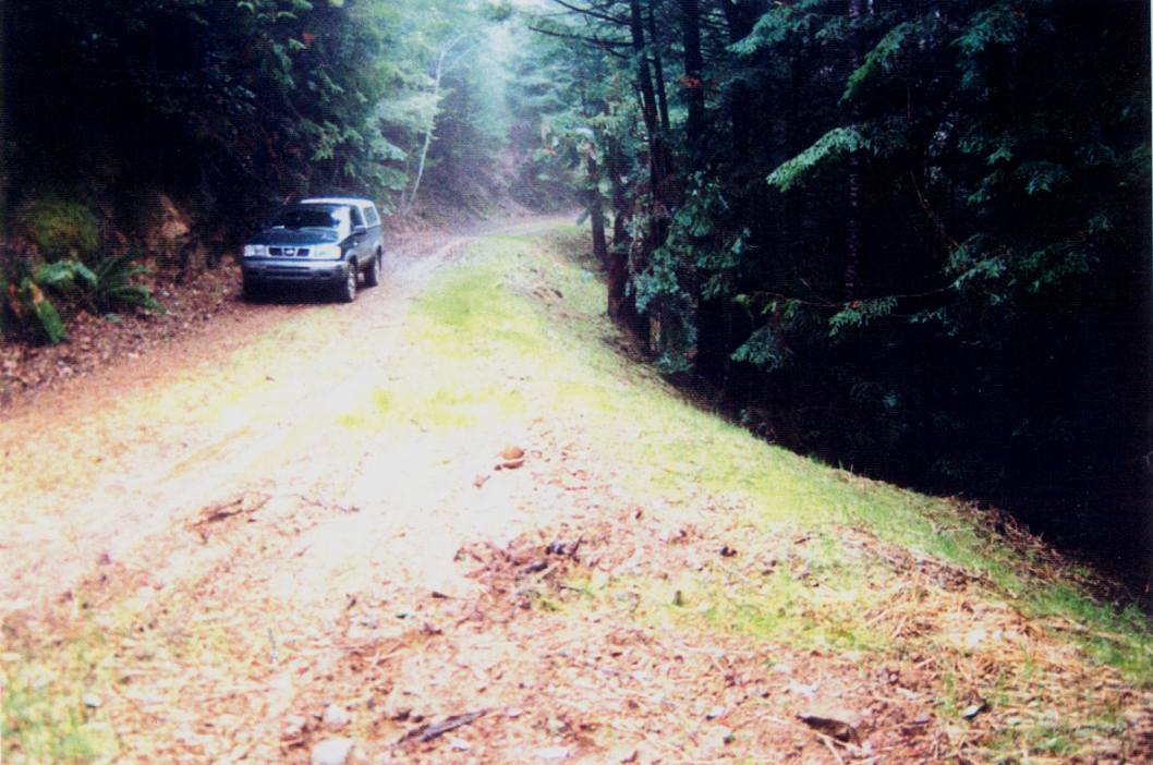 Click on image to enlarge (109K).
To learn more about this topic click Info Links
To view additional information (data source, aquisition date etc.) about this page, click Metadata
| www.krisweb.com |