|
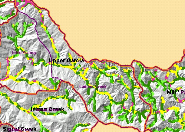
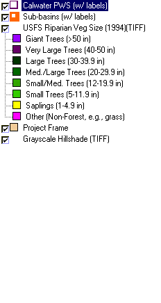
This is a map of vegetation size data within 90-meter riparian buffer zones in the Larmour Creek Calwater Planning Watershed,
overlaid on top of a Grayscale Hillshade. The tree size classifications were derived from Landsat multi-spectral images taken in
1994. Stand conditions are accurately represented at the one hectare scale. The small diameter tree size and non-forest in the
riparian areas to the north (upper part of the watershed) indicate natural grasslands in that area, although timber harvests have also
contributed to small riparian tree diameters in some areas of this sub-basin. The mainstem Garcia River runs through this Calwater
and small trees diameters along some of its reaches likely make it subject to warming there. Data were provided by the U.S. Forest
Service Pacific Southwest Region Remote Sensing Lab, in cooperation with the California Department of Forestry. Available
layers include Vegetation Size, Topographic Map, and Change in Vegetation (1994-1998). Scale = 1:76,937 .
|
|