|
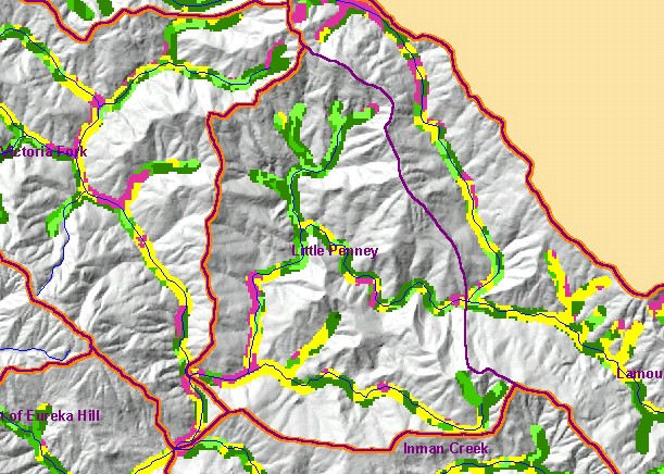
This is a map of vegetation size data within 90-meter riparian buffer zones in for the Little Penney Calwater Planning Watershed
and a Grayscale Hillshade backdrop. The tree size classifications were derived from Landsat multi-spectral images taken in 1994.
Stand conditions are accurately represented at the one hectare scale. Although small diameter tree size in riparian zones along the
southwest and eastern boundary of the basin reflect natural grasslands and oak woodlands, other reaches with early seral stage
riparian conditions reflect recent timber harvest. Data were provided by the U.S. Forest Service Pacific Southwest Region Remote
Sensing Lab, in cooperation with the California Department of Forestry. Available layers include Vegetation Size, Topographic
Map, and Change in Vegetation (1994-1998). Scale = 1:57,230 .
|
|