|
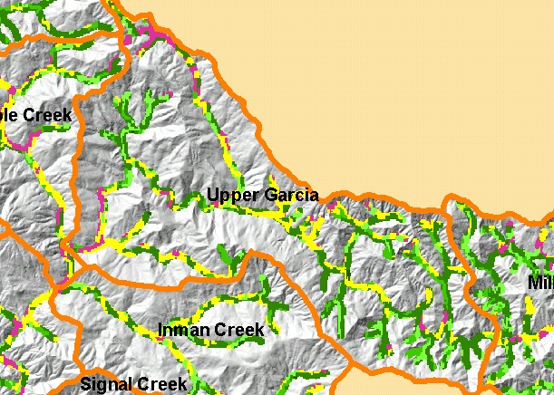
This is a map of vegetation size data within 90-meter riparian buffer zones in the Upper Garcia sub-basin, displayed with KRIS
sub-basins and a grayscale hillshade. The tree size classifications were derived from Landsat multi-spectral images taken in 1994.
Stand conditions are accurately represented at the one hectare scale. Small diameter riparian tree size may be in part as a result
of mťlange terrain which gives rise to grasslands and oak woodlands; however, timber harvest has also reduced tree size in some
stream reaches in this sub-basin. Natural grassy areas show as white on the USGS topographic map. Data were provided by the
U.S. Forest Service Pacific Southwest Region Remote Sensing Lab, in cooperation with the California Department of Forestry.
Available layers include Vegetation Size, Topographic Map, permitted Timber Harvests (1987-2001), and Change in Vegetation
(1994-1998). Scale = 1:83,488 .
|
|