
|

|
Background | Hypotheses| Bibliography | Maps | Home |
|
|
|
Background | Hypotheses| Bibliography | Maps | Home |
KRIS Web Background Pages: Cumulative Watershed Effects
![]()
The Doty Creek drainage has been extensively logged with timber harvests now covering over 50% of its watershed area logged in ten years. Low pool frequency and depth show that this intensive land use activity has filled the channel below. The Shallow Landslide Stability Model (SHALSTAB) shows chronic instability, the highest rating, along the inner gorge of Doty Creek.
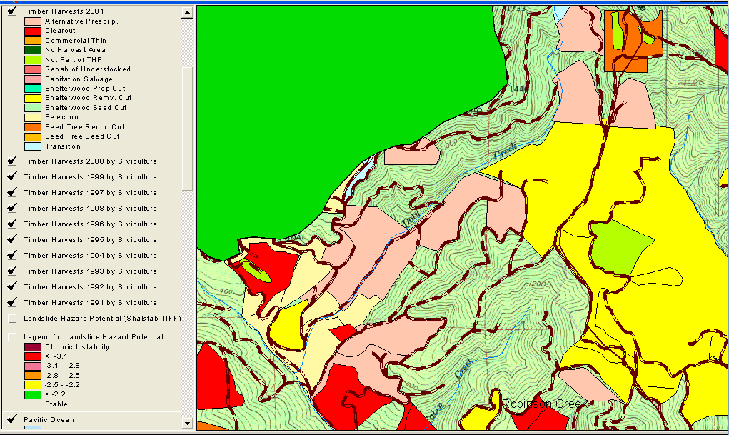 |
Doty Creek is the eastern headwater tributary of the Little North Fork Gualala, although the Calwater for the area is named after the smaller Doty Creek. The map at left shows timber harvests between 1991 and 2001 as mapped by the California Department of Forestry with over 50% of the basin harvested in ten years. This high degree of disturbance of highly unstable ground (see next graphic) is consistent with sediment yield |
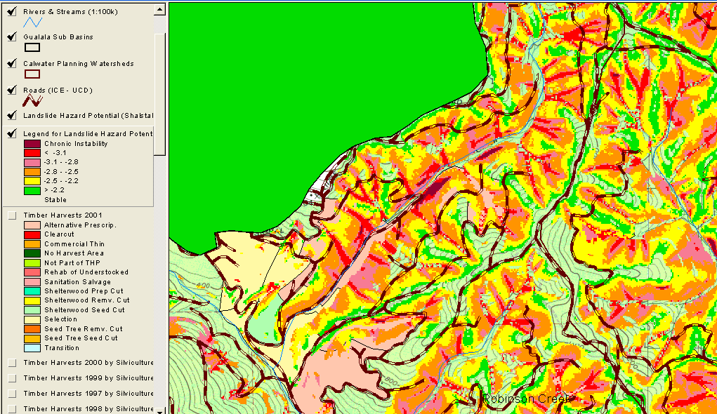 |
The map image at left shows the risk of shallow landslides in Doty Creek and where roads cross areas of various risk. Roads cross high risk areas at many locations and a main haul road goes right up the mainstem of Doty Creek. |
![]()
| www.krisweb.com |