 |
 |
| Background | Hypotheses | Bibliography | Maps | Home |
|
|
| Background | Hypotheses | Bibliography | Maps | Home |
KRIS Gualala Map Project:
Geology View
![]()
Note: Geologic information, electronic maps and models within KRIS projects are meant to provide background information and as an analysis tool but not as a decision making tool. California requires that licensed geologists be involved directly in decisions related to geologic conditions (see requirement). The California Geologic Survey has reservations regarding the content of KRIS Gualala (see comment note), including slope stability maps, and their endorsement of the contents of this page is not implied.
![]()
No electronic mapping data related to Gualala River geology and landslides were made available by the California Geologic Service to the KRIS project. Consequently there is limited geologic information in the KRIS Map project. Themes include a colored hill shade model and slope steepness based on a 10 meter resolution digital elevation model. An image of shallow landslide risk created by IFR staff is also displayed in this view (see Modeling Shallow Landslides background page). Stream gradient developed from 10 meter DEMs is another theme in the Geology View because it provides insight into sediment transport. Erodibility of the dominant soils (kkfact), derived from Natural Resources Conservation Service (1998) data, is also included in this view. Rainfall data for the Gualala is based on an Oregon State University precipitation model.
 |
At left
is a Gualala River basin elevation map in meters with an elevation grid
of 1000 by 1400 cells. Each cell contains an individual elevation value
for a10x10 meter location on the ground. The various elevations are
grouped together by color. This map is used to compute steepness and wetness.
The highest elevations in the basin are along the eastern and northern boundaries.
|
 |
An artificial
3D landscape with an overlay showing slope steepness, both constructed from
the 10 meter DEM is displayed at left. Slope steepness is greatest in the
Gualala River basin. The steepest slopes are located in the North Fork,
Rockpile, parts of Buckeye Creek and the eastern Wheatfield. Steep slopes
occur in relatively few locations in the South Fork.
|
 |
Landslide hazards for the Gualala River basin are depicted at left (see Modeling Shallow Landslides). Areas of highest risk have low, negative scores (orange/red color codes). The highest risk slopes are concentrated in the North Fork Gualala River watershed, although slopes are also susceptible to debris sliding in much of Rockpile, parts of Buckeye Creek and the central and eastern Wheatfield. Inner gorge locations also show high risk of debris slides, such as area along the South Fork and lower Wheatfield. |
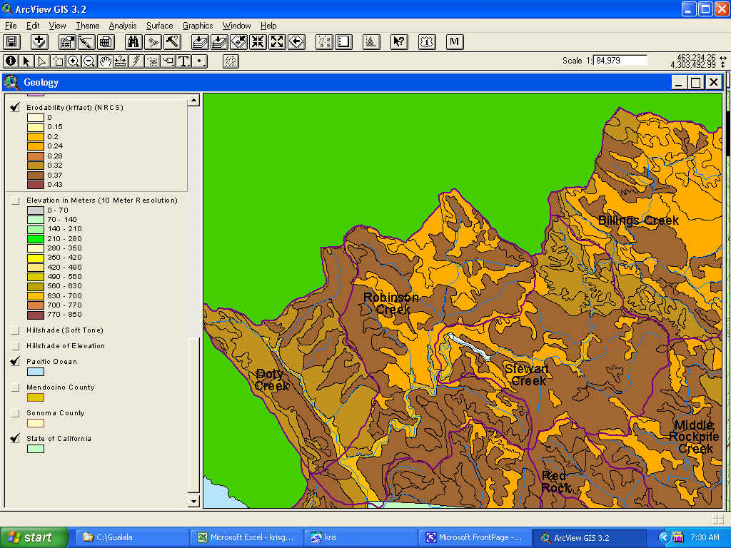 |
Soils data at the 1:24000 scale are available for only the Mendocino County portion of the Gualala River watershed and are displayed at left. The theme is the soil erodibility index referred to as kkfact. Darker colors represent higher erosion risk, and as the map shows, a large part of the North Fork falls into the latter category. Valley floors rank lowest in erosion risk along the North Fork corridor. Data provided by the Natural Resources Conservation Service (NRCS). |
 |
The rainfall isopleths shown above for the Gualala basin are those generated using the Oregon State University model and it is based on 1961-1996 regional rainfall. The map shows that rainfall at the coast is 30-40 inches annually and that patches in the interior basin may reach 70-80 inches. |
![]()
References
Dietrich, W.E. et al. 1998. A validation study of the shallow slope stability model, SHALSTAB, in forested lands of Northern California. Stillwater Ecosystem, Watershed & Riverine Sciences. Berkeley, CA. 59 pp.
Natural Resources Conservation Service (NRCS). 1998. Soil Survey Geographic (SSURGO) database for Mendocino County, Western Part, California. NRCS State Soil Scientist, Davis, CA.
Sterling, Stephen. 2002. California Geologic Survey review comments on KRIS Gualala. In a letter to Patrick Higgins, Institute for Fisheries Resources, Arcata, CA. Dated 3/15/02. 3 p.
| www.krisweb.com |