| Area |
Buckeye Creek |
| Topic |
Tour: Buckeye Creek CDFG Photos 2001 |
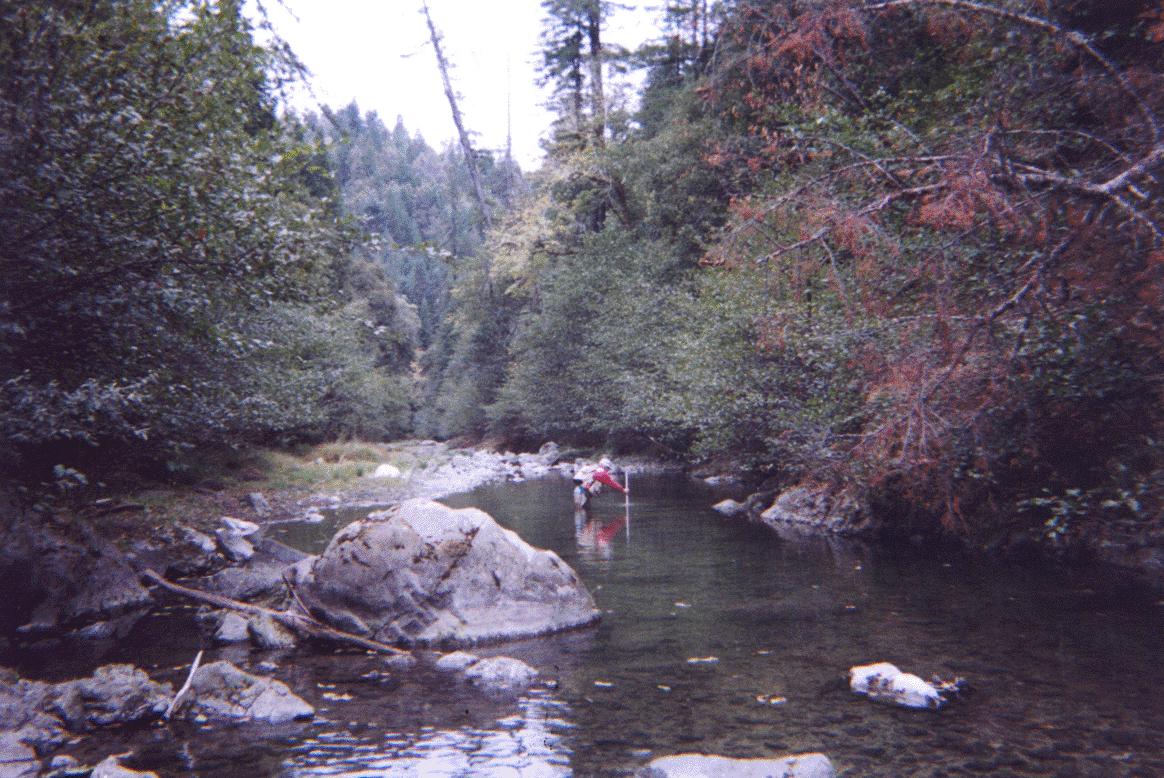
 Click on image to enlarge (45K). Click here to display a larger version (359K).
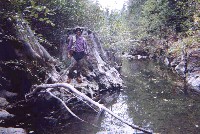
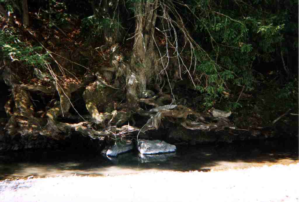
This picture shows a mid-channel pool that had steelhead of three age classes present. Embeddedness at the pool tail crest was 25-50%. Photo provided courtesy of the California Department of Fish and Game, North Coast Watershed Assessment Program. CDFG information below:
BC_HU.201
09.05.01
64oF H2O
Mid-channel pool [4.2]
Embeddedness=2
Substrate=C
Shelter value=3
SH YOY; 1+; 2+ present
 Click on image to enlarge (96K). Click here to display a larger version (711K).
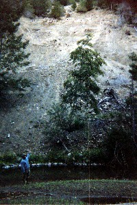
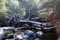
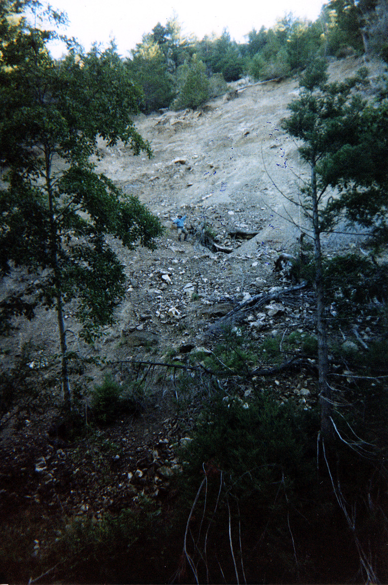
This picture shows a large streamside landslide along Buckeye Creek. See Picture #3 for a close up of the slide. According to CDFG notes the habitat in the picture is a lateral scour pool and embeddedness at the pool tail crest was 25-50%. Note fine sediment on the terrace in the foreground. Photo provided courtesy of the California Department of Fish and Game, North Coast Watershed Assessment Program. CDFG information below:
BC_HU.0206
Buckeye Creek
Photo #
HU #0206
09.10.01
48oF H2O
Lateral scour pool [5.4]
Embeddedness=2
Substrate=C
Shelter value=2
Landslide
N38o44.867' X W123o25.524'
N38o44.845' X W123o25.515'
SH YOY; 1+ present.
 Click on image to enlarge (90K). Click here to display a larger version (717K).
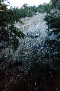
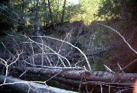
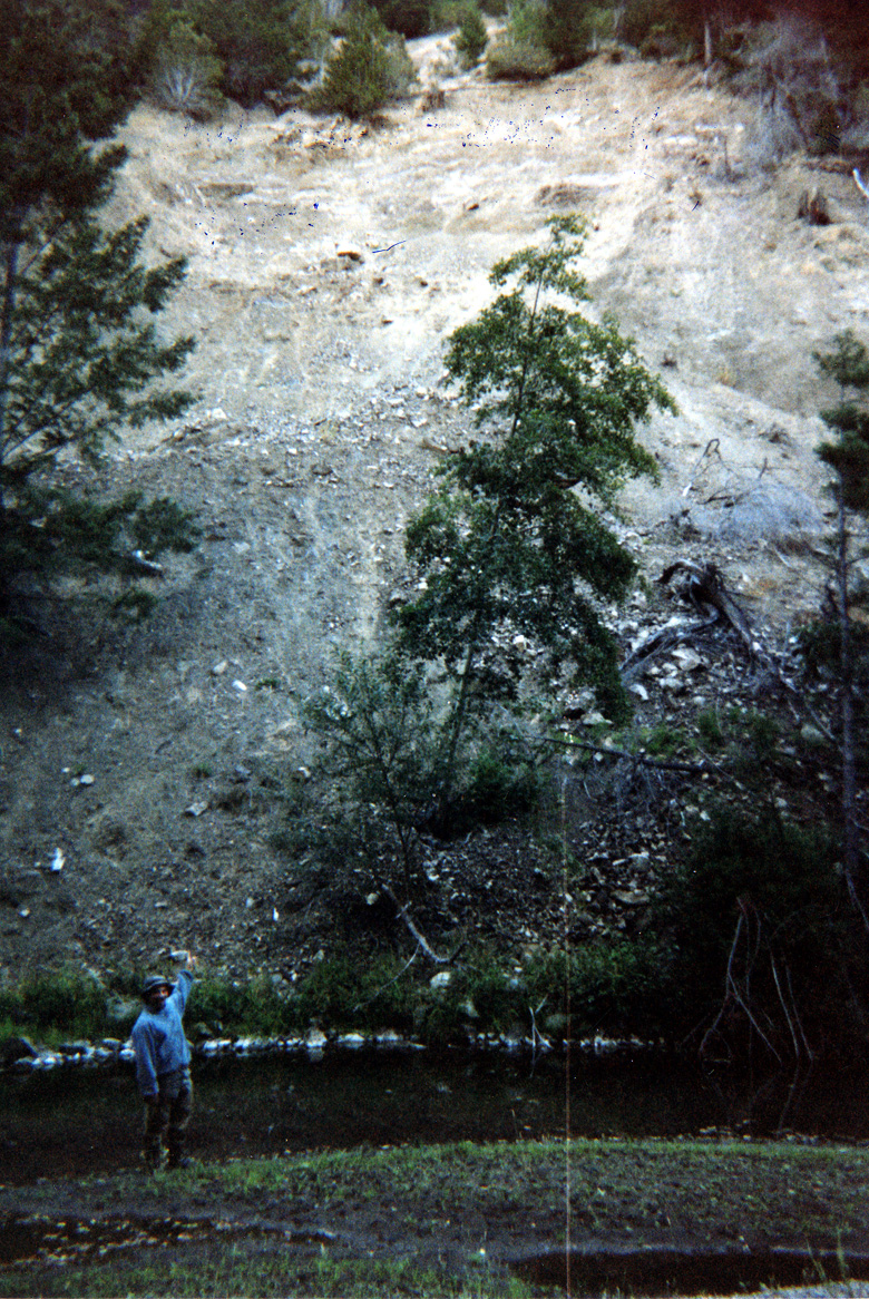
Close up of slide adjacent to Buckeye Creek at the same location as Picture #2. Note figure in blue on slide for scale. Photo provided courtesy of the California Department of Fish and Game, North Coast Watershed Assessment Program. CDFG information below:
BC_HU.0206
Buckeye Creek
Photo #
HU #0206
09.10.01
48oF H2O
Lateral scour pool [5.4]
Embeddedness=2
Substrate=C
Shelter value=2
Landslide
N38o44.867' X W123o25.524'
N38o44.845' X W123o25.515'
SH YOY; 1+ present.
 Click on image to enlarge (60K). Click here to display a larger version (179K).
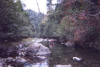
This picture shows a mid-channel pool in Buckeye Creek with restricted depth (max 3.2 feet, mean 1.5 feet). Hardwood overstory with light mix of conifers with fairly open canopy is typical of Buckeye Creek. Photo provided courtesy of the California Department of Fish and Game, North Coast Watershed Assessment Program. CDFG notes below:
BE_HU.0376
Photo #1
HU #376
Air temp 61oF
H2O temp 57oF
Mid-channel pool [4.2]
Max depth 1.5ft, mean depth 3.2ft
125ft long, 24ft wide
Kathy measuring 4.2
 Click on image to enlarge (81K).
This picture shows a pool formed by an old redwood stump, which gives an indication of the site potential of trees in this reach of Buckeye Creek. According to CDFG notes, this is a mid-channel pool with a maximum depth of 5.8 feet but a mean depth of 2.1 feet. Bedrock bordering channel in combination with root wad creates higher focus of hydraulic energy leading to scour at this location. Photo provided courtesy of the California Department of Fish and Game, North Coast Watershed Assessment Program. CDFG notes below:
BE_HU.0384
Photo #2
HU #384
10/17/01
Air temp 61oF
H2O temp 57oF
Allen at root wads
Mid-channel pool [4.2]
Max depth 5.8ft, mean depth 2.1
138ft long, 27ft wide
 Click on image to enlarge (81K).
This picture shows a large wood jam along Buckeye Creek providing cover for juvenile salmonids and habitat complexity to aid survival of high winter flows. Wood looks as if it is old and not recently recruited. Photo provided courtesy of the California Department of Fish and Game, North Coast Watershed Assessment Program. CDFG information below:
BE_HU.0444
Photo #15
HU #444
10/14/01
Air temp 56oF
H2O temp 54oF
LWD right bank 15ft X35ft X 10ft
 Click on image to enlarge (46K).
This picture shows a bank failure along Buckeye Creek with small conifers spanning the channel. According to CDFG information provided, the habitat unit is a mid-channel pool 3.1 feet deep. Photo provided courtesy of the California Department of Fish and Game, North Coast Watershed Assessment Program. CDFG information below:
BE_HU.0501
10/24/01
H2O temp 52oF
Mid-channel pool [4.2]
3.1ft deep, 21ft wide, 28ft wide
Shelter value=2
LDA 8ft X 14ft X 5ft
Erosion 40ft long, 18ft tall, 10ft deep
 Click on image to enlarge (95K).
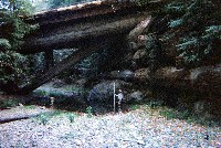
CDFG habitat surveyor underneath old failing log bridge, also known as a Humboldt Crossing. The size of the trees gives an indication of local site potential. CDFG information provided classifies the habitat unit as a mid-channel pool. Photo provided courtesy of the California Department of Fish and Game, North Coast Watershed Assessment Program. CDFG information below:
BE_HU.0519
10/34/01
Air temp 70oF
H2O temp 54oF
Mid-channel pool [4.2]
Bridge 35ft X 60ft X 18ft
Shelter value=2
N38o45.477'
W123oF19.495'

 Click on image to enlarge (45K). Click here to display a larger version (359K).
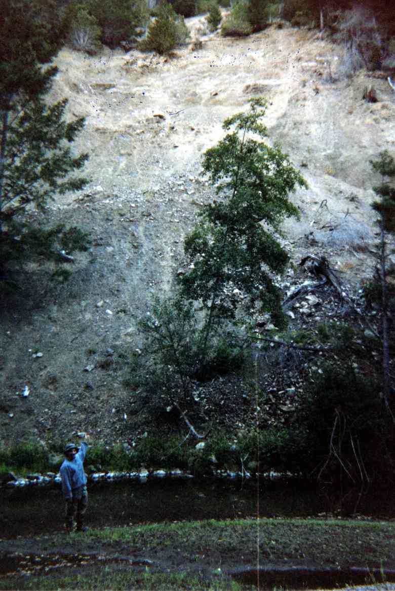 Click on image to enlarge (96K). Click here to display a larger version (711K).
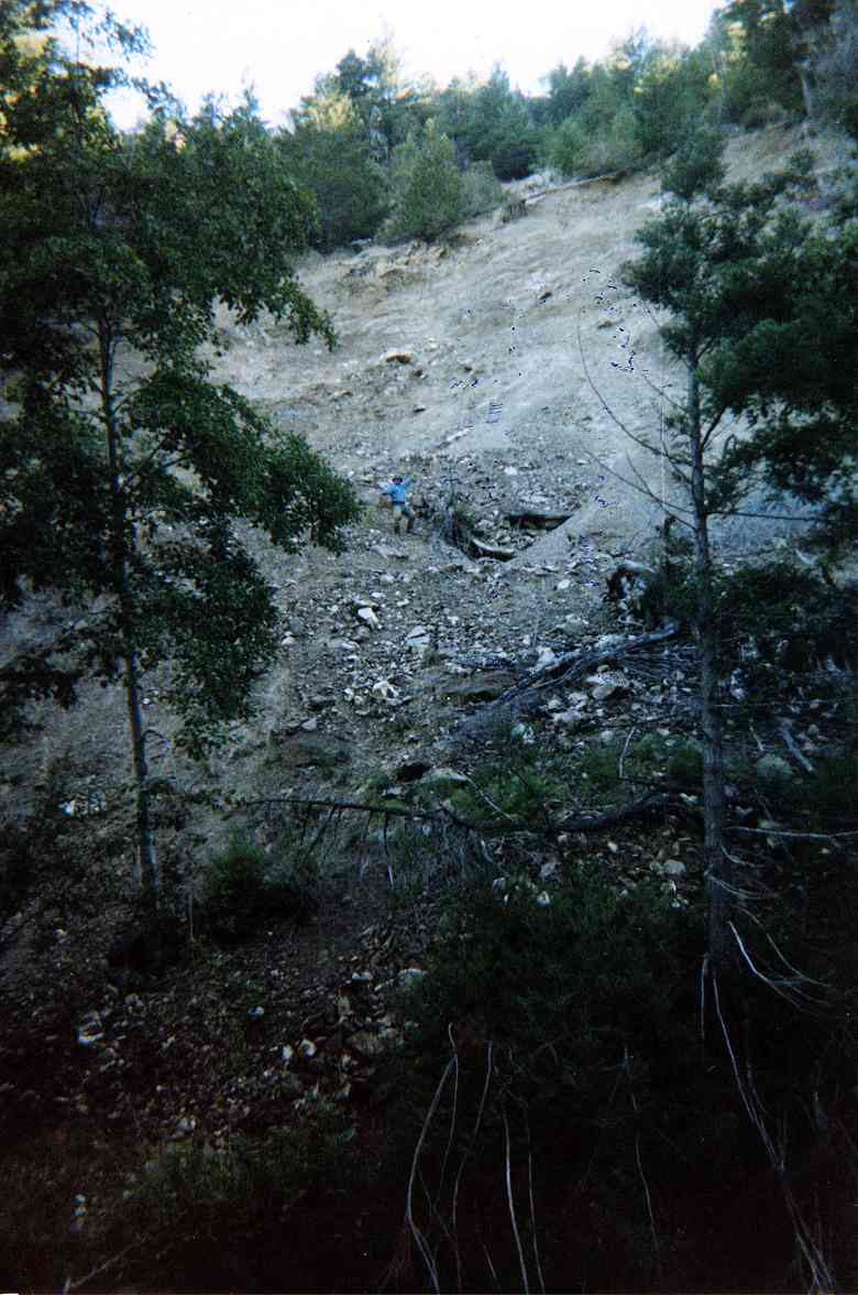 Click on image to enlarge (90K). Click here to display a larger version (717K).
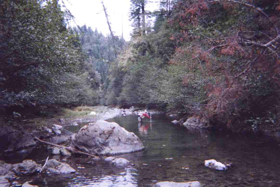 Click on image to enlarge (60K). Click here to display a larger version (179K).
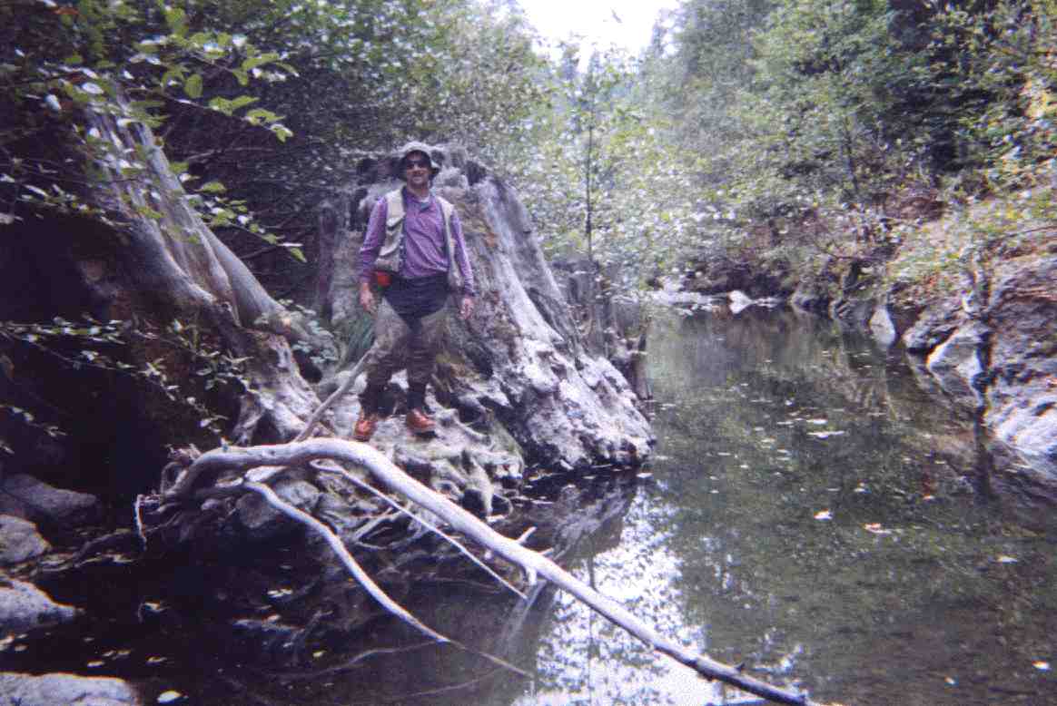 Click on image to enlarge (81K).
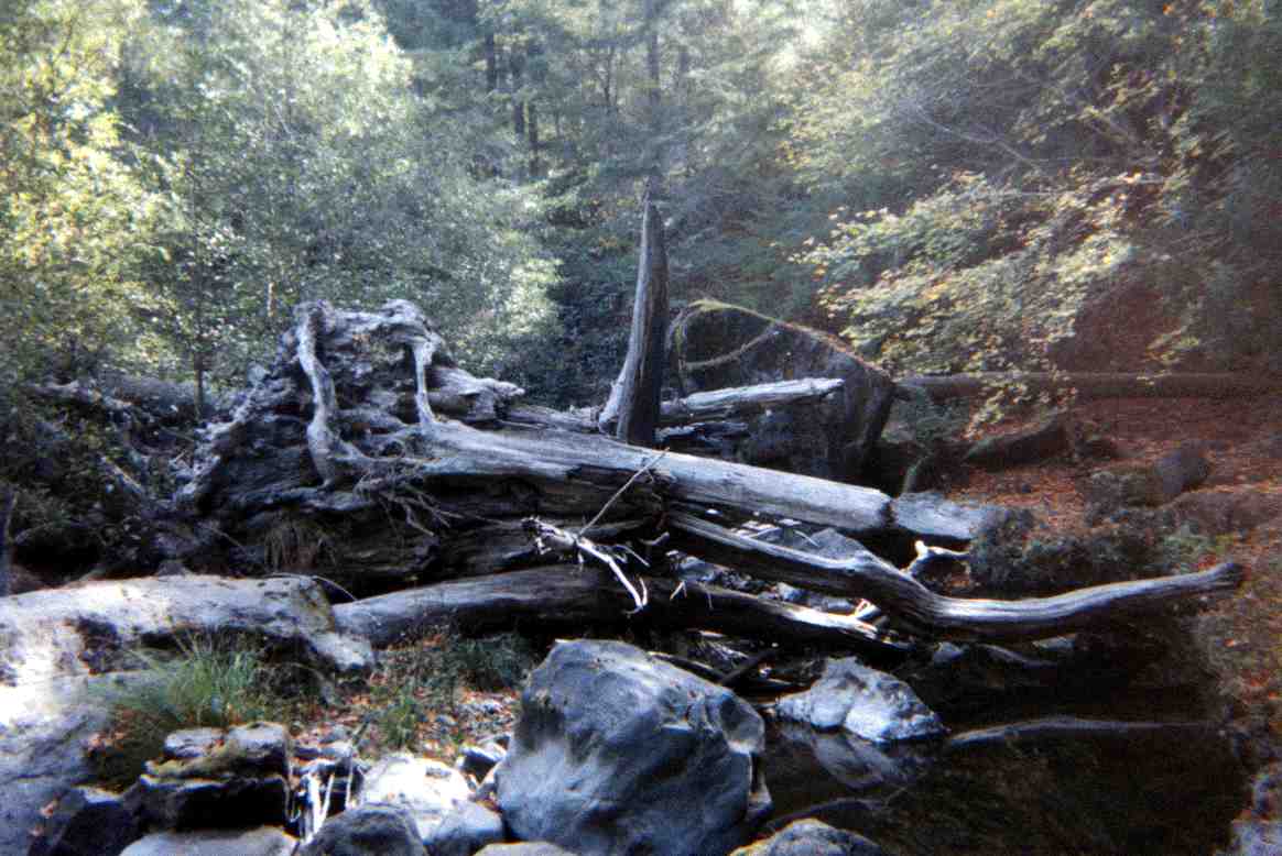 Click on image to enlarge (81K).
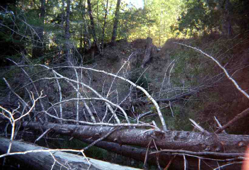 Click on image to enlarge (46K).
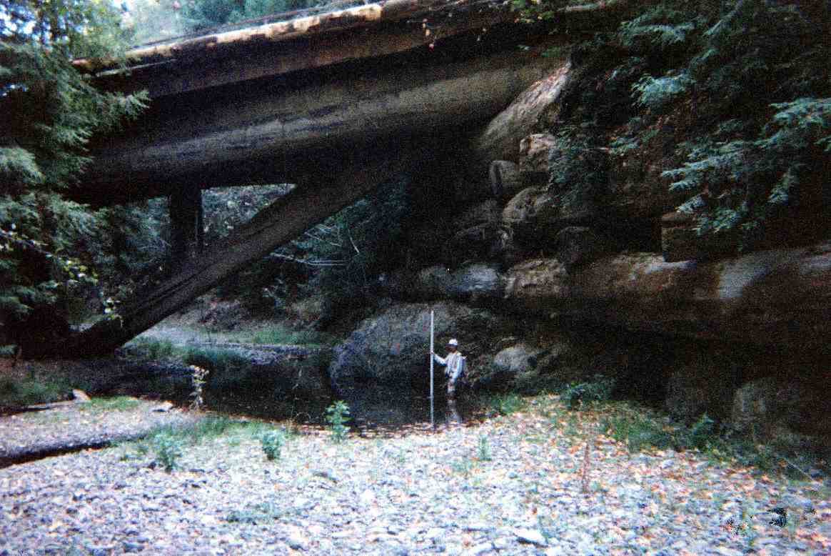 Click on image to enlarge (95K).