| Area |
Buckeye Creek |
| Topic |
Tour: Gualala Historical Aerial Pictures, Buckeye Creek |
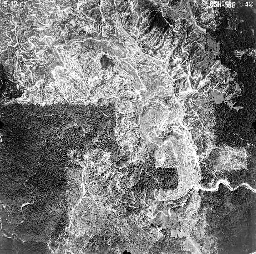
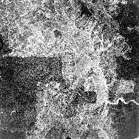 Click on image to enlarge (136K). Click here to display a larger version (628K).
The photo above was taken on May 12, 1961 and shows active logging along Buckeye Creek near its convergence with Franchini Creek. Almost the entire Franchini Creek watershed is visible at upper right and it has been 100% clear-cut with extremely dense skid trail networks. This intensive post WW II logging caused catastrophic change to both Franchini and Buckeye Creeks after the 1964 flood. Photo provided courtesy of Don Morse, California Department of Forestry (FRAP), North Coast Watershed Assessment Program.
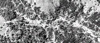 Click on image to enlarge (133K). Click here to display a larger version (1,033K).
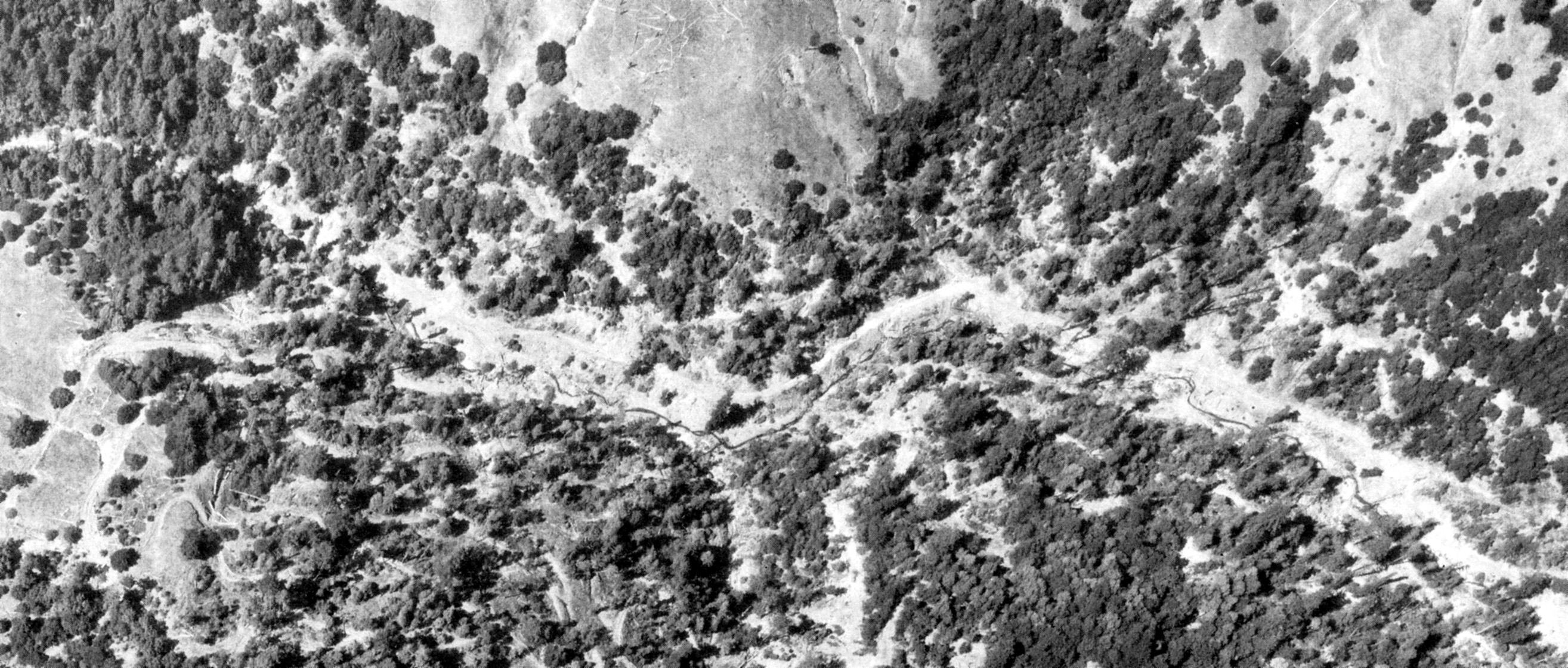
This close up aerial photo of Flatridge Creek taken in 1965 shows stream capture and debris torrents, scouring or burying riparian trees and making the channel shallow and open. Photo provided courtesy of Don Morse, California Department of Forestry (FRAP), North Coast Watershed Assessment Program
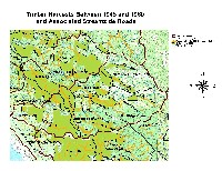 Click on image to enlarge (84K). Click here to display a larger version (247K).
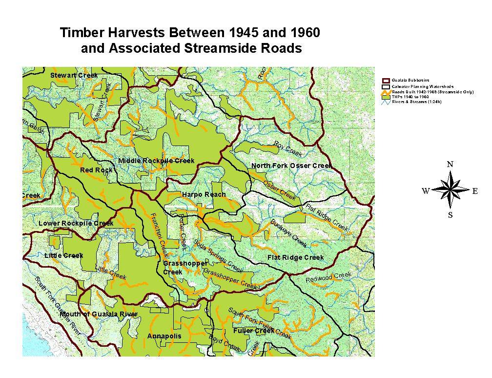
The map above shows logging that went on in the Buckeye Creek basin between 1940 and 1960. The orange lines indicate where roads and/or log skidding followed streams. Map digitized by Don Morse, California Department of Forestry (FRAP), North Coast Watershed Assessment Program

 Click on image to enlarge (136K). Click here to display a larger version (628K).
 Click on image to enlarge (133K). Click here to display a larger version (1,033K).
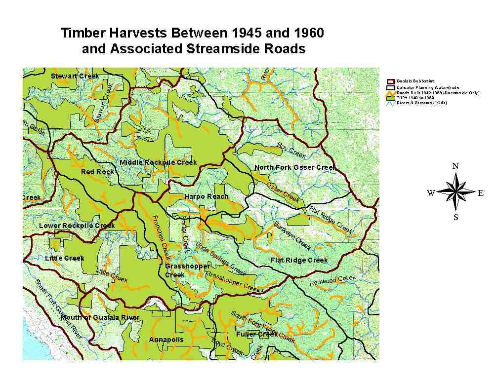 Click on image to enlarge (84K). Click here to display a larger version (247K).
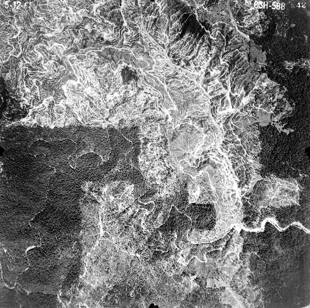