| Area |
Estuary |
| Topic |
Tour: Gualala Estuary/Lower River Aerials 1965 vs. 1988 |
 Click on image to enlarge (84K). Click here to display a larger version (742K).
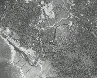
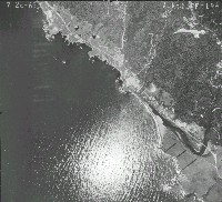
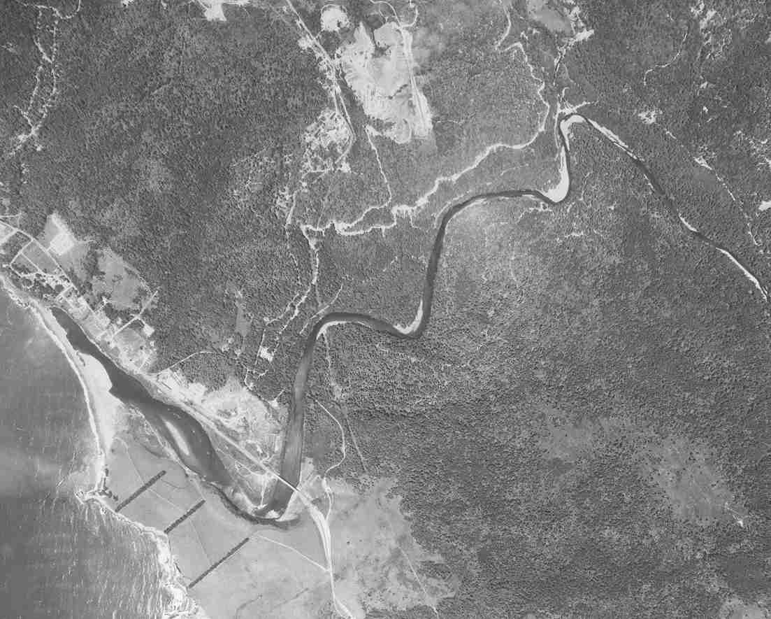
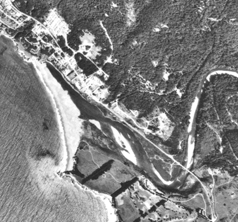
The aerial photo above shows the Gualala River estuary/lagoon in July of 1965 with the Highway 1 Bridge visible at lower right. Signs of aggradation from 1964 flood are evident as point bar deposit in upper right of photo and the shallowness of the lagoon. Transport from tributaries of material deposited in 1964 continued in 1972 and 1974, subsequent high flow years. See next photo to see more advanced aggradation in the lower Gualala in 1988. Photo scanned from the collection of the Ukiah office of the U.S. Natural Resources Conservation Service (NRCS) and the Mendocino Resources Conservation District.
 Click on image to enlarge (80K). Click here to display a larger version (388K).
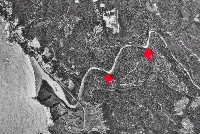
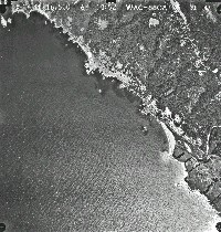
The aerial photo above shows the Gualala River estuary/lagoon in May 1988 with the Highway 1 Bridge visible at lower left. Aggradation is more advanced than in 1965 photos as evidenced by larger point bars, especially below the North Fork (red arrows). Lower flow conditions could also alter the amount of bars showing and 1988 was a fairly low flow year (based on Noyo River USGS gauge). Sediment impacts in this reach are at least in part owing to effects of 1964 flood as sediment cycles slowly out of lower gradient reaches of rivers such as the lower Gualala. Photo scanned from the collection of the Ukiah office of the U.S. Natural Resources Conservation Service (NRCS) and the Mendocino Resources Conservation District as part of Gualala River Literature Assimilation (Higgins, 1997).
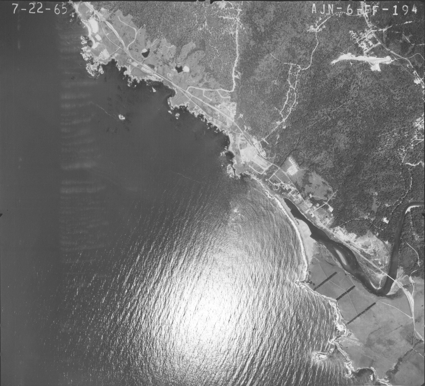
 Click on image to enlarge (109K). Click here to display a larger version (551K).
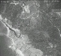
This aerial photo is the one from which Picture #1 was extracted. Town of Gualala and mouth of the river is at center left. Photo scanned from the collection of the Ukiah office of the U.S. Natural Resources Conservation Service (NRCS) and the Mendocino Resources Conservation District as part of Gualala River Literature Assimilation (Higgins, 1997).
 Click on image to enlarge (171K). Click here to display a larger version (841K).
This aerial photo is the one from which Picture #2 was extracted. Town of Gualala and mouth of the river is at lower left. The lower North Fork Gualala is visible from the center of the photo to upper right. Photo scanned from the collection of the Ukiah office of the U.S. Natural Resources Conservation Service (NRCS) and the Mendocino Resources Conservation District as part of Gualala River Literature Assimilation (Higgins, 1997).
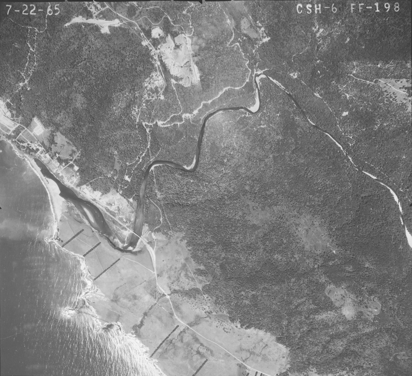
 Click on image to enlarge (96K). Click here to display a larger version (530K).
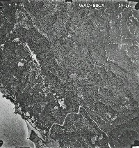
This aerial photo shows the town of Gualala and mouth of the river just to right of center in the photo in July 1965. Photo scanned from the collection of the Ukiah office of the U.S. Natural Resources Conservation Service (NRCS) and the Mendocino Resources Conservation District as part of Gualala River Literature Assimilation (Higgins, 1997).
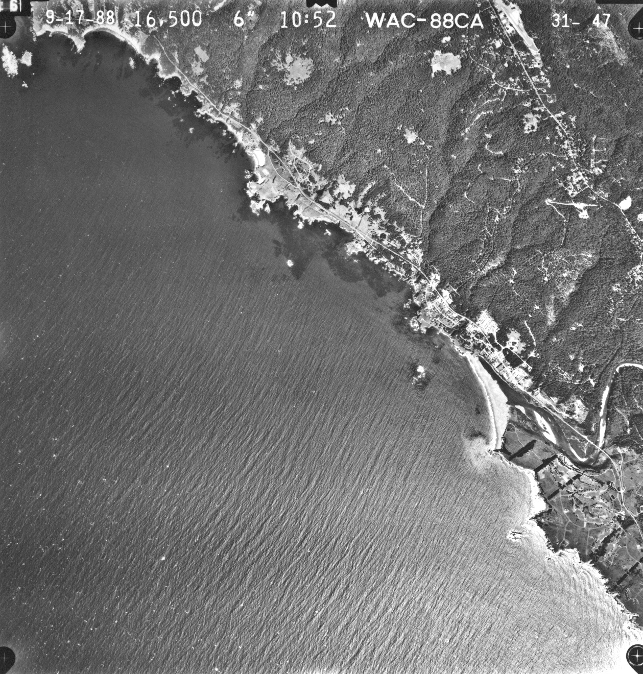
 Click on image to enlarge (143K). Click here to display a larger version (745K).
This aerial photo shows the town of Gualala and mouth of the river just below and to the right of center in the photo taken in September 1988.See Picture #8 for zoom of estuary. Photo scanned from the collection of the Ukiah office of the U.S. Natural Resources Conservation Service (NRCS) and the Mendocino Resources Conservation District as part of Gualala River Literature Assimilation (Higgins, 1997).
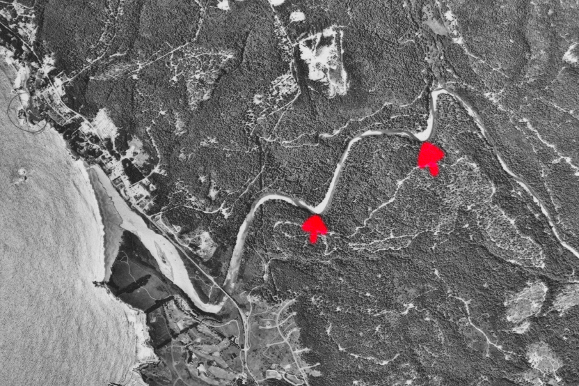
 Click on image to enlarge (21K).
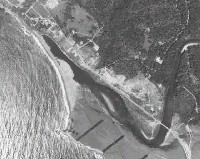
Zoom in on the Gualala estuary/lagoon in 1965 from Picture #. Lighter areas in the lagoon indicate lack of depth and the beginning of aggradation resulting from the 1964 flood. See Picture #8 for a comparison with September 1988. Photo scanned from the collection of the Ukiah office of the U.S. Natural Resources Conservation Service (NRCS) and the Mendocino Resources Conservation District as part of Gualala River Literature Assimilation (Higgins, 1997).
 Click on image to enlarge (73K). Click here to display a larger version (340K).
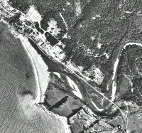
The Gualala estuary/lagoon is showing more advanced aggradation from 1965 (Picture #7) with more exposed point bars and less of the active channel occupied by water in this September 1988 view. Lower flow conditions may also have contributed to area exposed, as flow conditions in 1988 were low (based on Noyo River gauge data). Photo scanned from the collection of the Ukiah office of the U.S. Natural Resources Conservation Service (NRCS) and the Mendocino Resources Conservation District as part of Gualala River Literature Assimilation (Higgins, 1997).

 Click on image to enlarge (84K). Click here to display a larger version (742K).
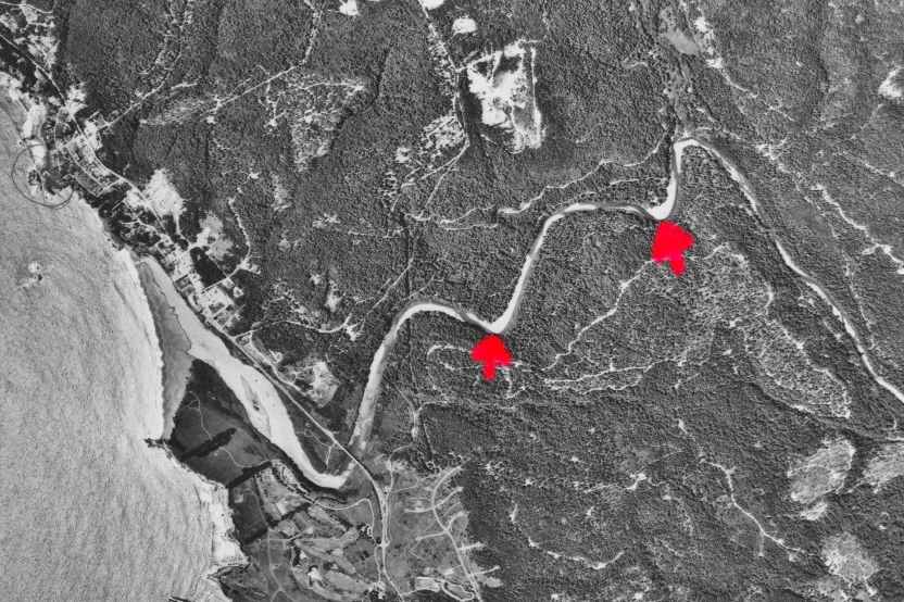 Click on image to enlarge (80K). Click here to display a larger version (388K).
 Click on image to enlarge (109K). Click here to display a larger version (551K).
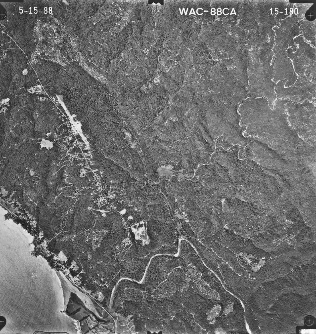 Click on image to enlarge (171K). Click here to display a larger version (841K).
 Click on image to enlarge (96K). Click here to display a larger version (530K).
 Click on image to enlarge (143K). Click here to display a larger version (745K).
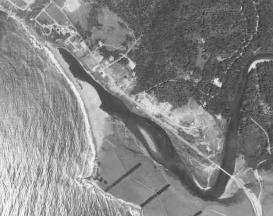 Click on image to enlarge (21K).
 Click on image to enlarge (73K). Click here to display a larger version (340K).