| Area |
North Fork |
| Topic |
Tour: Aerial Photos NF Gualala 1988 |
 Click on image to enlarge (151K). Click here to display a larger version (870K).
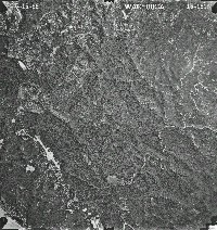
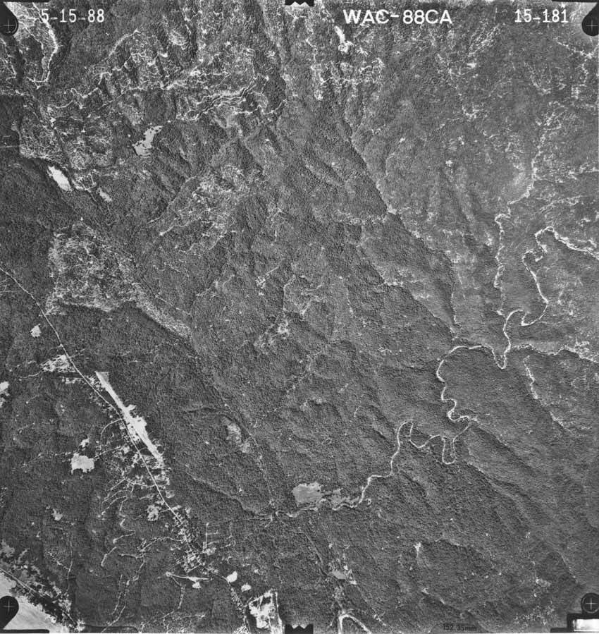
This photo covers from the convergence of the North Fork and South Fork Gualala, just to the right of center at the very bottom of the picture, to the headwaters of the Little North Fork Gualala and South Fork Garcia River, which adjoin at upper left. From west to east (left to right), one can see the beach near the town of Gualala at extreme lower left, the North Fork Gualala meandering east from lower right to center right, and Dry Creek watershed at upper right. Note the intensive, recent timber harvest in the Little North Fork basin and adjacent upper South Fork Garcia. The legacy of road scars from Post WW II logging is visible at upper right in the Dry Creek watershed. Photo scanned from the collection of the Ukiah office of the U.S. Natural Resources Conservation Service (NRCS) and the Mendocino Resources Conservation District as part of Gualala River Literature Assimilation (Higgins, 1997).
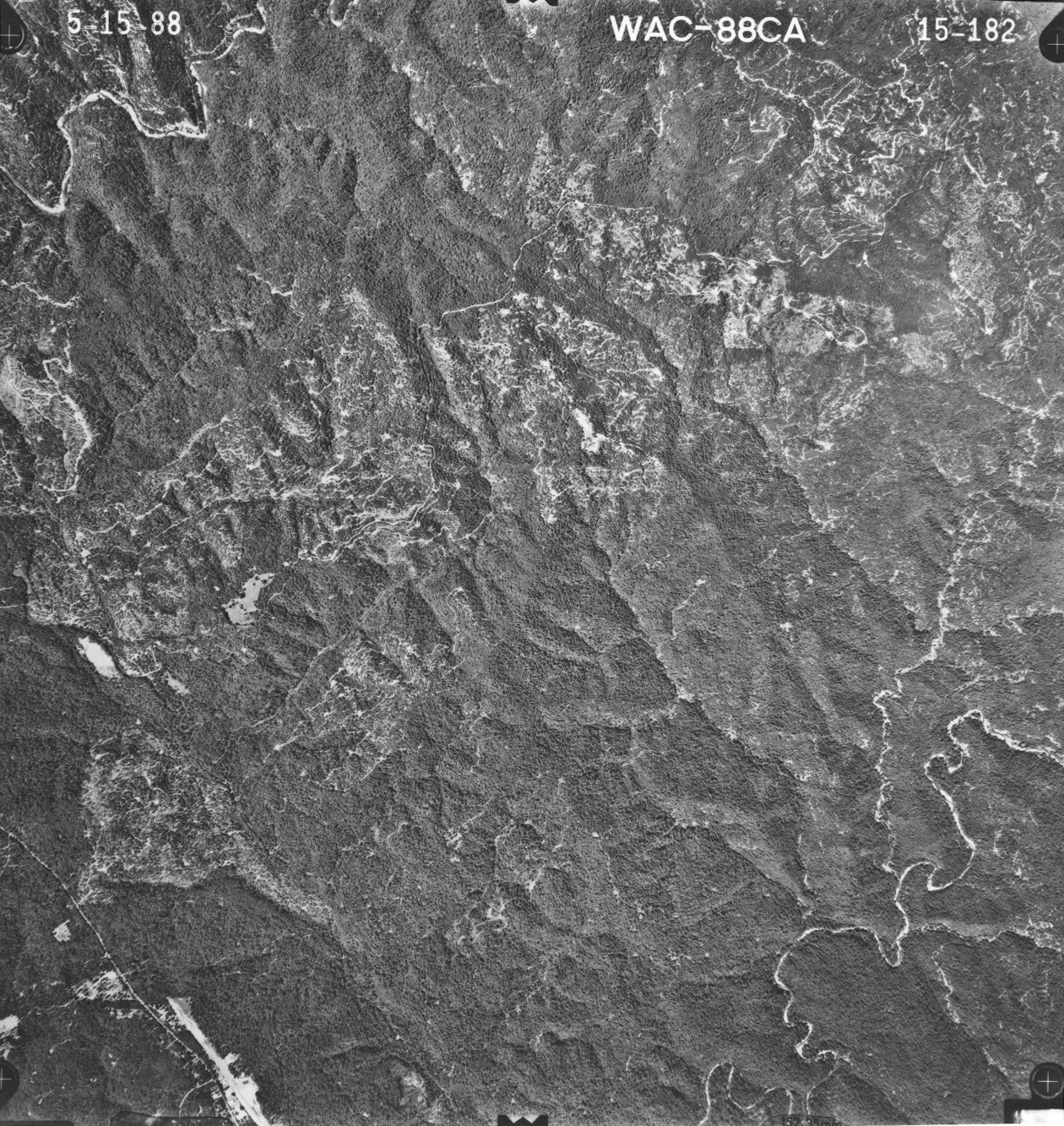
 Click on image to enlarge (149K). Click here to display a larger version (801K).
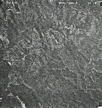
This aerial photo shows the Little North Fork Gualala watershed at lower left and the Garcia River at the top left of the photo. The North Fork winds through the lower right of the photo. The bed of Dry Creek is visible from lower right in the photo where it joins the North Fork upstream to its headwaters at upper right. Photo scanned from the collection of the Ukiah office of the U.S. Natural Resources Conservation Service (NRCS) and the Mendocino Resources Conservation District as part of Gualala River Literature Assimilation (Higgins, 1997).

 Click on image to enlarge (151K). Click here to display a larger version (870K).
 Click on image to enlarge (149K). Click here to display a larger version (801K).
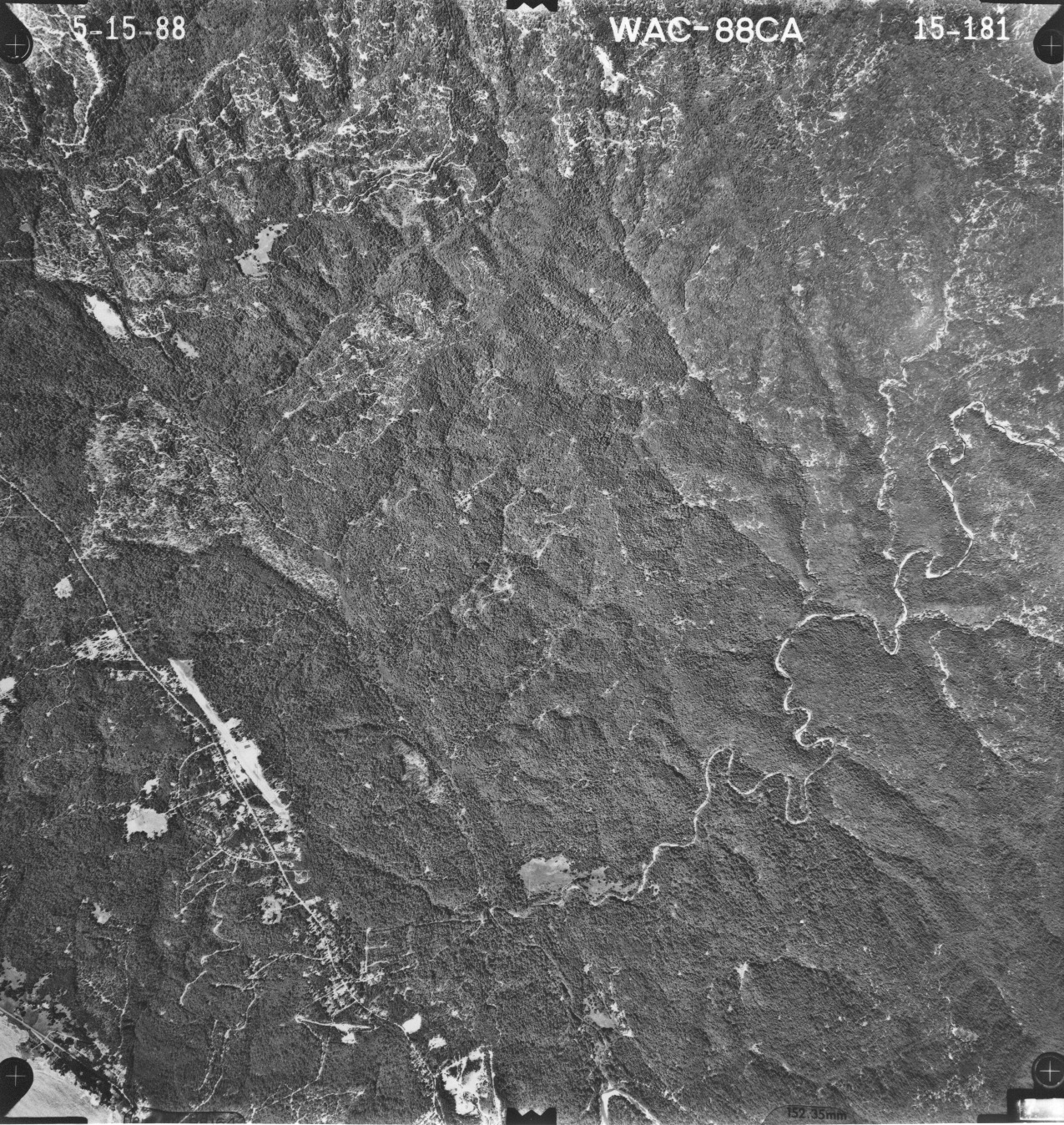