| Area |
North Fork |
| Topic |
Tour: CDFG NF Gualala Habitat Typing Photos 2001 |
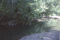
 Click on image to enlarge (59K).
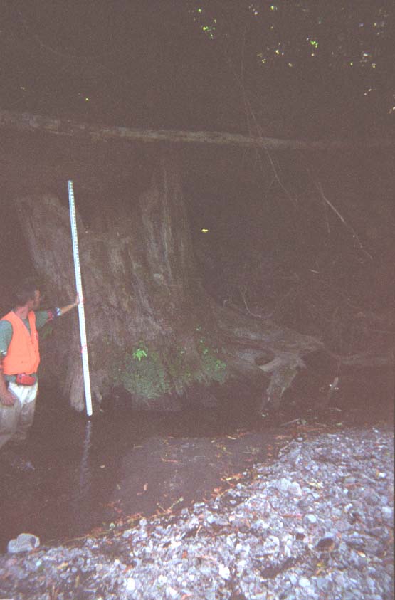
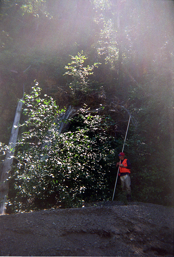
This picture shows a surveyor on the North Fork Gualala River during habitat typing in 2001. The information provided by CDFG is that this is a backwater pool formed by a root wad. The pool was formerly the main channel but a four-foot high gravel bar formed and isolated it from the main flow. Photo provided courtesy of the California Department of Fish and Game, North Coast Watershed Assessment Program. CDFG information below:
NF_HU.0103.01B
Photo #25
07.31.01
64oF
Backwater pool, root-wad formed [6.3]
Embeddedness=1
Substrate=A
Shelter value=3
Backwater pool was previously main channel. Pool is cut off from main channel by 4ft high gravel bar.
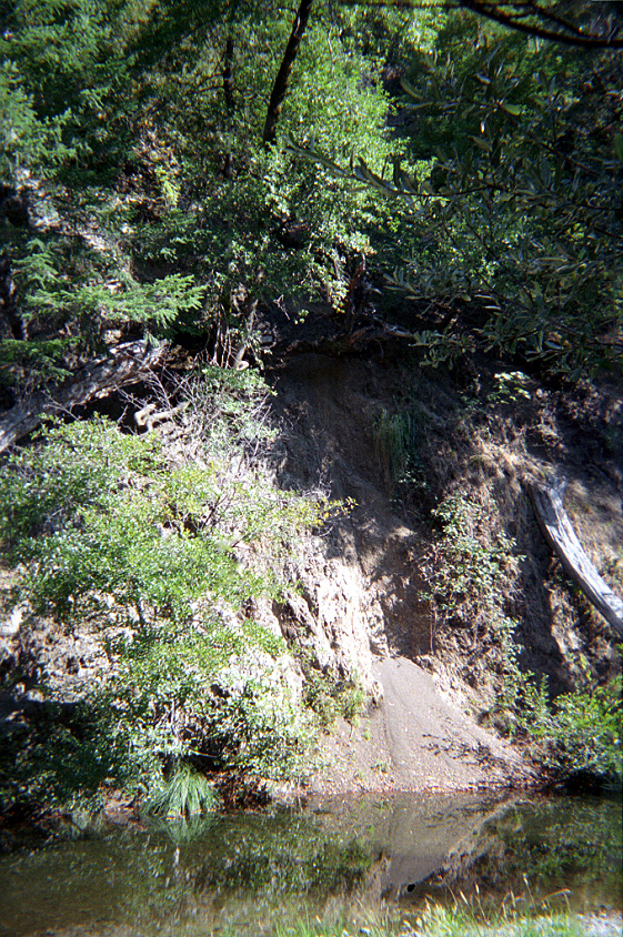
 Click on image to enlarge (90K). Click here to display a larger version (501K).
This picture shows a gravel bar on the North Fork Gualala River taken during habitat typing in 2001. The information provided by CDFG is that this is a low gradient riffle with a "sediment load on left bank." Small particle size distribution on the gravel bar suggests that it would be mobile on low frequency interval storms. Photo provided courtesy of the California Department of Fish and Game, North Coast Watershed Assessment Program. CDFG information below:
NF_HU.0104
Photo #23
HU #0104
08.01.01
62oF H2O
Low gradient riffle [1.1]
Sediment load on Left bank
N38o47.491' XW123o30.175'
 Click on image to enlarge (60K). Click here to display a larger version (349K).
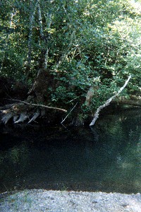
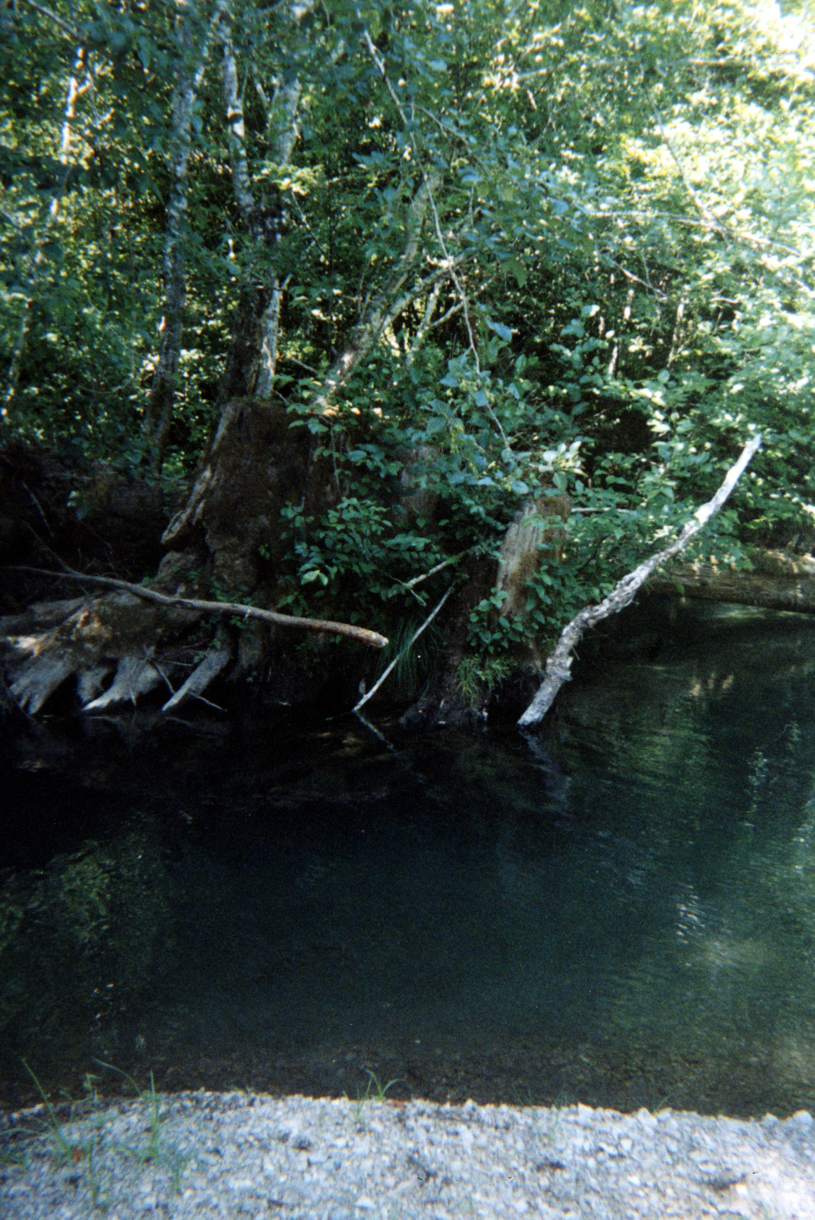
This picture shows a deep pool on the North Fork Gualala River taken during habitat typing in 2001. The information provided by CDFG is that this is a lateral scour pool formed by a root wad with a maximum depth of 4.6 feet and that gravel embeddedness in its pool tail was below 25%. Photo provided courtesy of the California Department of Fish and Game, North Coast Watershed Assessment Program. CDFG information below:
NF_HU.0124B
Photo #21
HU #0124B
08.01.01
61.9oF H2O
Lateral scour pool, root wad enhanced [5.3]
Embeddedness=1
Substrate=C
Shelter value=2
Root wad on Left bank 20ft X 12ft. Pool has 4.6 max
1.8ft mean
68ft long
21ft wide
 Click on image to enlarge (61K). Click here to display a larger version (412K).
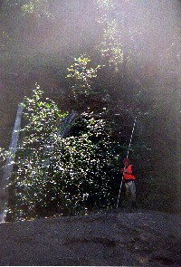
This picture shows surveyor on a high gravel bar on the North Fork Gualala River taken during habitat typing in 2001. The information provided by CDFG is that this is adjacent to a low gradient riffle with an "unstable bank, five feet high." Small particle size distribution on the gravel bar suggests that it would be mobile on low frequency interval storms. Photo provided courtesy of the California Department of Fish and Game, North Coast Watershed Assessment Program. CDFG information below:
NF_HU.0127.03
Photo #8
HU #0127
Unstable bank, 5oft high
08.11.01
63oF H2O
Low gradient riffle [1.1]
Shelter value=1
 Click on image to enlarge (101K). Click here to display a larger version (545K).
This picture shows small bank slip out adjacent to the North Fork Gualala River taken during habitat typing in 2001. The information provided by CDFG is that this is a mid channel pool with less than 25% embedded gravel at its pool tail. Photo provided courtesy of the California Department of Fish and Game, North Coast Watershed Assessment Program. CDFG information below:
NF_HU.0566A
Photo #16
HU #0566A
08.07.01
65oF H2O
Mid-channel pool [4.2]
Embeddedness=1
Substrate=D
Shelter value=2
Landslide on right bank
20ft wide X 200ft high, 90ft from tail of pool.
N38o49.611' X W123o28.121'
 Click on image to enlarge (122K). Click here to display a larger version (728K).
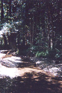
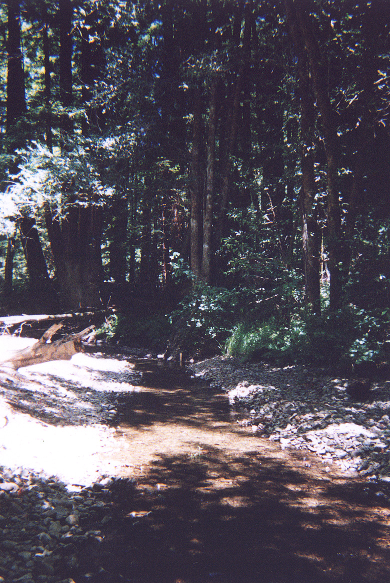
This picture shows a shallow riffle in the Little North Fork Gualala River taken during habitat typing surveys in 2001. Photo provided courtesy of the California Department of Fish and Game, North Coast Watershed Assessment Program. CDFG information below:
LNF_HU.0001
Photo#
HU #1
06.13.01
07.24.01 Metadata date
 Click on image to enlarge (111K). Click here to display a larger version (993K).
Close up of root wad in Picture #3. Photo courtesy of the California Department of Fish and Game North Coast Watershed Assessment Program.
NF_HU.0124B
Photo #21
HU #0124B
08.01.01
61.9oF H2O
Lateral scour pool, root wad enhanced [5.3]
Embeddedness=1
Substrate=C
Shelter value=2
Root wad on Left bank 20ft X 12ft. Pool has 4.6 max
1.8ft mean
68ft long
21ft wide

 Click on image to enlarge (59K).
 Click on image to enlarge (90K). Click here to display a larger version (501K).
 Click on image to enlarge (60K). Click here to display a larger version (349K).
 Click on image to enlarge (61K). Click here to display a larger version (412K).
 Click on image to enlarge (101K). Click here to display a larger version (545K).
 Click on image to enlarge (122K). Click here to display a larger version (728K).
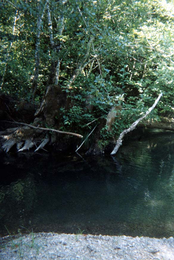 Click on image to enlarge (111K). Click here to display a larger version (993K).
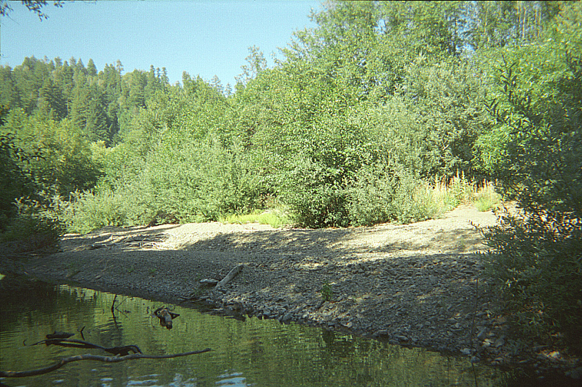