| Area |
North Fork |
| Topic |
Tour: Historical Aerial Pictures & Maps: NF Gualala Post WWII Logging |
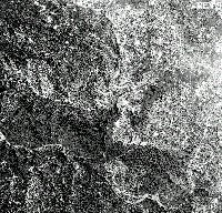 Click on image to enlarge (93K). Click here to display a larger version (633K).
This photo shows an unknown location in the North Fork Gualala watershed in 1963 during intensive post WW II logging. Note extensive road skid trail network, with haul roads often following stream courses. This widespread mechanized logging, just prior to the 1964 flood, set the stage for probably the largest human induced pulse of sediment to the Gualala. Photo courtesy of Don Morse, California Department of Forestry (FRAP), North Coast Watershed Assessment Program.
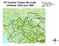 Click on image to enlarge (149K). Click here to display a larger version (267K).
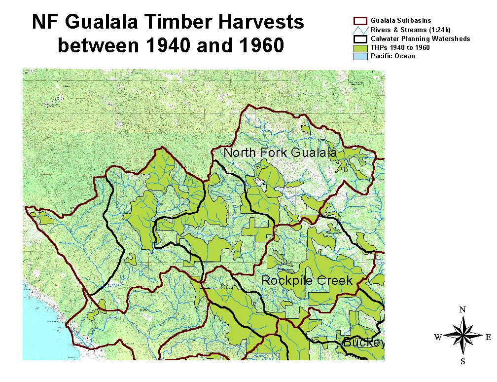
The map above shows logging that took place in the North Fork Gualala basin from 1940 to 1960 as digitized from aerial photos. Map courtesy of Don Morse, California Department of Forestry (FRAP), North Coast Watershed Assessment Program.
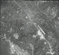 Click on image to enlarge (135K). Click here to display a larger version (685K).
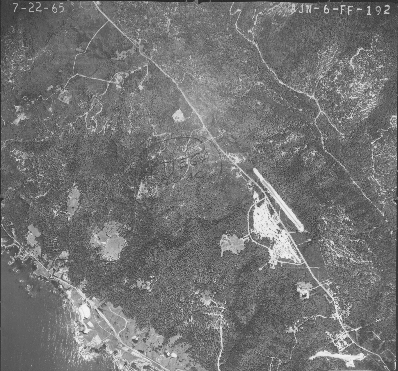
This aerial photo taken in July 1965 shows extensive logging damage to the upper Little North Fork Gualala, just east of the airstrip just to the right of center in the photo. The upper South Fork Garcia watershed is also visible at upper right and center. Photo scanned at the Mendocino County Resource Conservation District and NRCS Office in Ukiah.

 Click on image to enlarge (93K). Click here to display a larger version (633K).
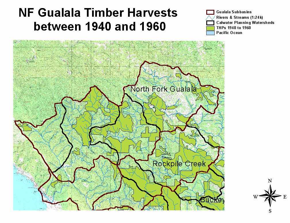 Click on image to enlarge (149K). Click here to display a larger version (267K).
 Click on image to enlarge (135K). Click here to display a larger version (685K).
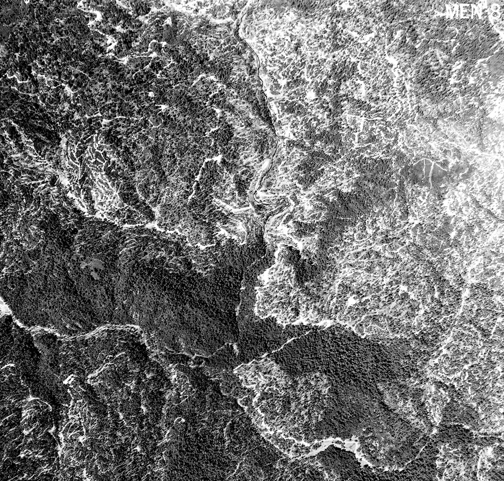