 Click on image to enlarge (64K).
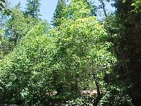
This photo shows the riparian zone of the North Fork Gualala River with the river just out of sight in the background. Note the floodwater marks on the riparian trees that appear to be fairly recent. Also notice the blue lines on trees, which indicates they are marked for logging. Photo provided by Dave Hope, North Coast Regional Water Quality Control Board.
 Click on image to enlarge (87K).
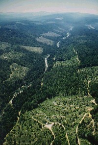
This photo shows the San Andreas Fault looking south with the lower North Fork Gualala in the foreground flowing along the rift zone. The South Fork Gualala is visible in the distance. The riparian zone widths here are probably 100 feet per the California Forest Practice Rules. Photo provided by Dave Hope, North Coast Regional Water Quality Control Board.
 Click on image to enlarge (141K).
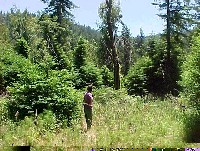
This photo shows the riparian zone of the North Fork Gualala River with the river just out of view to the left. Notice that the stream has shade from alders but that there are few conifers in the overstory to maintain a cool air microclimate. Also note that the GRI haul road is visible beyond the alders. This streamside location for haul roads, which is typical of the North Fork basin, causes contributions of surface erosion during winter, particularly if winter operations are carried out (Hope, 2001). Photo provided by Dave Hope, North Coast Regional Water Quality Control Board.
 Click on image to enlarge (144K).
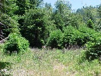
This photo shows the riparian zone of the North Fork Gualala River with the river just out of sight in the background. Creating clear-cut openings adjacent to 100-foot buffers, with the buffers also thinned, opens airflow along the North Fork and makes it more subject to warming (see Hypothesis #5). Photo provided by Dave Hope, North Coast Regional Water Quality Control Board.
 Click on image to enlarge (129K).
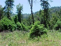
Similar shot to Picture #4 in the riparian zone of the North Fork Gualala River in a recent clearcut unit. Photo provided by Dave Hope, North Coast Regional Water Quality Control Board.
 Click on image to enlarge (117K).
Same as Pictures #4 and #5. North Fork Gualala River riparian zone with Saplings (trees less than 5" diameter) and grasses predominating. Photo provided by Dave Hope, North Coast Regional Water Quality Control Board.
 Click on image to enlarge (104K).
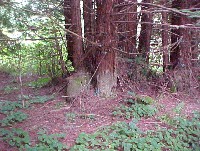
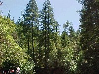
The photo above was taken during a pre-harvest inspection along the North Fork Gualala River with river bar cutoff in lower end of the photo. Note that the canopy is a mix of alder and small diameter redwood. In this view, there are no redwoods large enough to recruit as large woody debris and it will take several decades before small diameter trees present will be sufficiently large to fulfill that purpose. Photo provided by Dave Hope, North Coast Regional Water Quality Control Board.
 Click on image to enlarge (111K).
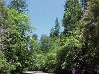
This picture was taken at virtually the same location as Picture #7 and also shows that alder and small diameter redwood dominate the North Fork riparian zone. Photo provided by Dave Hope, North Coast Regional Water Quality Control Board.

 Click on image to enlarge (64K).
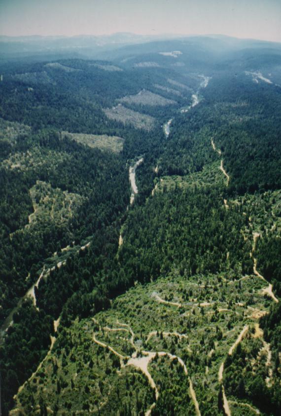 Click on image to enlarge (87K).
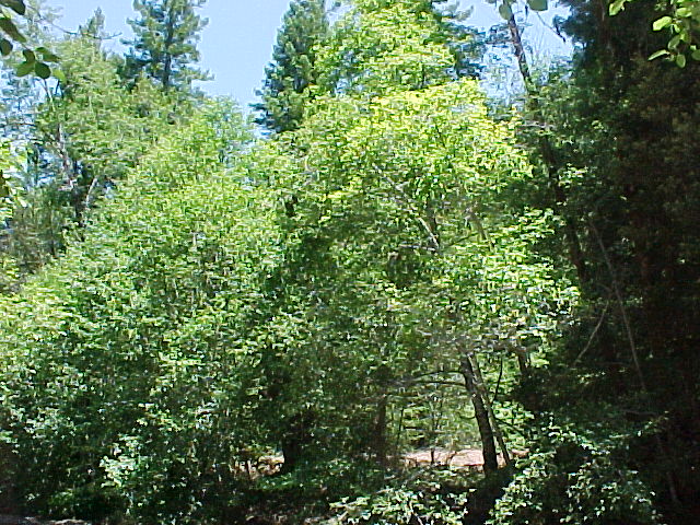 Click on image to enlarge (141K).
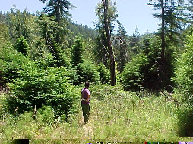 Click on image to enlarge (144K).
 Click on image to enlarge (129K).
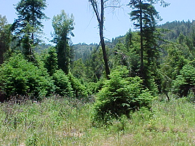 Click on image to enlarge (117K).
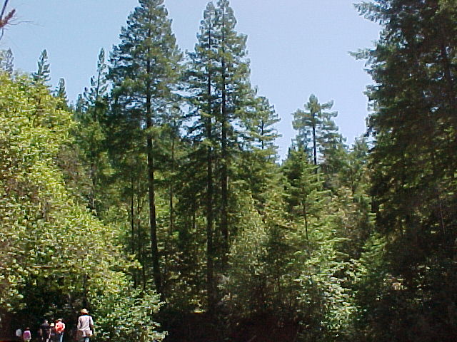 Click on image to enlarge (104K).
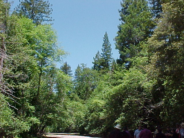 Click on image to enlarge (111K).