| Area |
North Fork |
| Topic |
Tour: North Fork Road Condition Field Picts from PHI Photos 2001 |
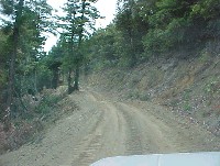 Click on image to enlarge (40K).
This photo shows a logging road in the North Fork Gualala watershed with a rolling dip to drain the in-board ditch. This road had been recently re-engineered and out-sloped. Photo provided courtesy of Dave Hope, North Coast Regional Water Quality Control Board. July 11, 2001.
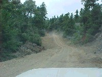 Click on image to enlarge (32K).
Photo taken at similar location to Picture #1 with another rolling dip. Photo provided courtesy of Dave Hope, North Coast Regional Water Quality Control Board.
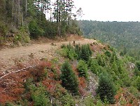 Click on image to enlarge (50K).
Photo taken of forest road in the North Fork Gualala basin with clear cut and young trees growing. Photo provided courtesy of Dave Hope, North Coast Regional Water Quality Control Board. July 11, 2001.
 Click on image to enlarge (47K).
Photo taken of forest road with scarp along road fill in the North Fork Gualala basin. Road fill failure was noted as a problem in the Gualala TSD. Photo provided courtesy of Dave Hope, North Coast Regional Water Quality Control Board.

 Click on image to enlarge (40K).
 Click on image to enlarge (32K).
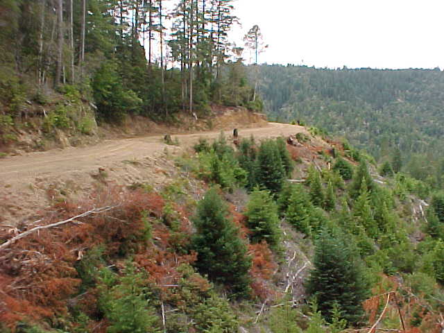 Click on image to enlarge (50K).
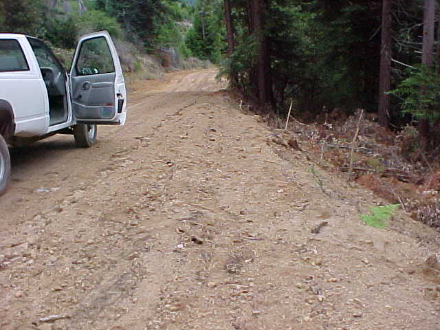 Click on image to enlarge (47K).